“Traveling – it leaves you speechless, then turns you into a storyteller.” – Ibn Battuta
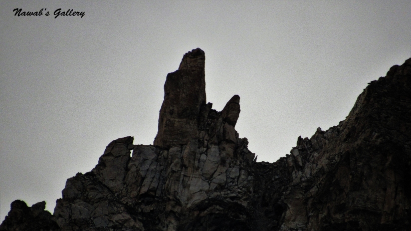
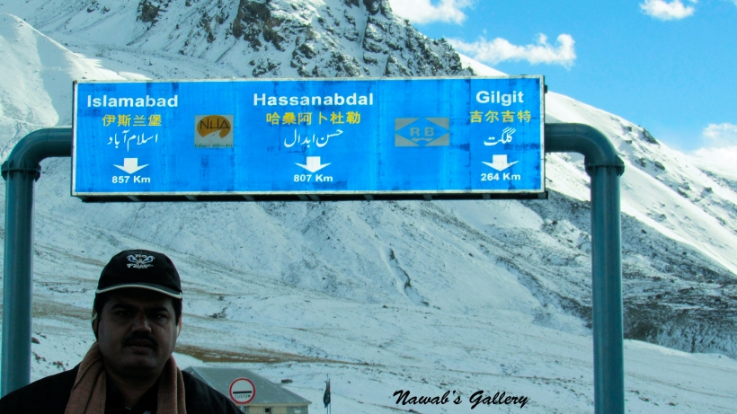
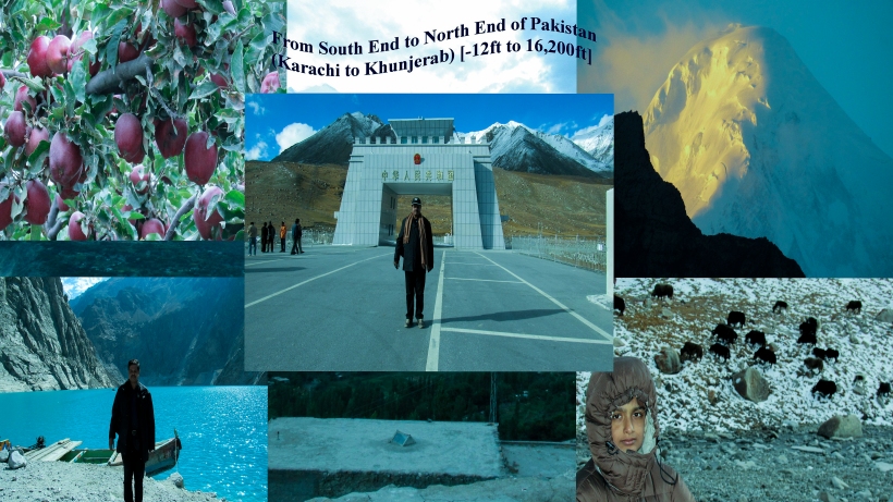
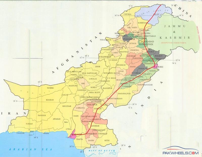
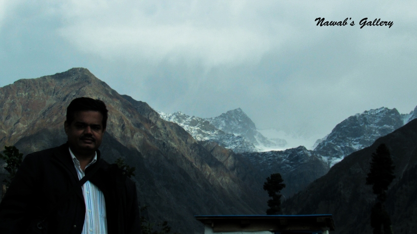
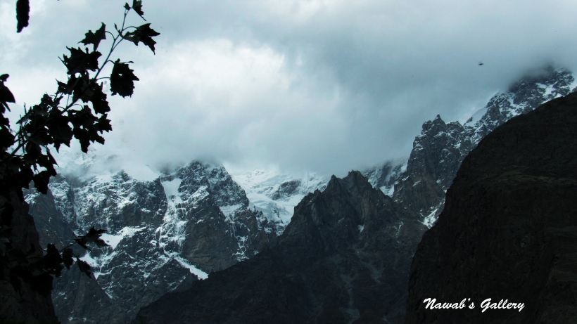
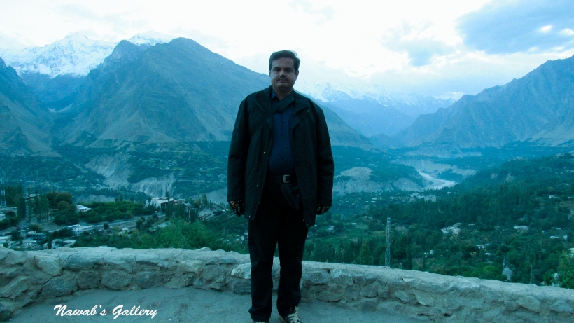
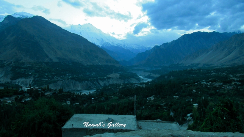
I and my family are frequent travelers, we have gone to numerous spots inside Pakistan, and also on various foreign tours. For the most part, we go to a new place each year, however infrequently we likewise revisit to the same area as well. This time, we plan to travel to the North End of Pakistan, Khunjerab Pass, the border area of Pakistan and China. Pakistan and China, the two friendly neighboring countries separated by the highest mountainous range of the world The Karakorum ranges. The only place connecting two countries together over this mountainous range is “The Khunjerab Pass”, at the height of 16,200 ft. Khunjerab Pass is the point where the Highest Paved international road “The Karakorum Highway” enters China, connecting Xinjiang Uyghur Region of China and Gilgit–Baltistan of Pakistan. For those who love natural beauty, lush green trees, snow covered mountains, glaciers and water streams this area worth a visit.
Following is a brief description of my visit:
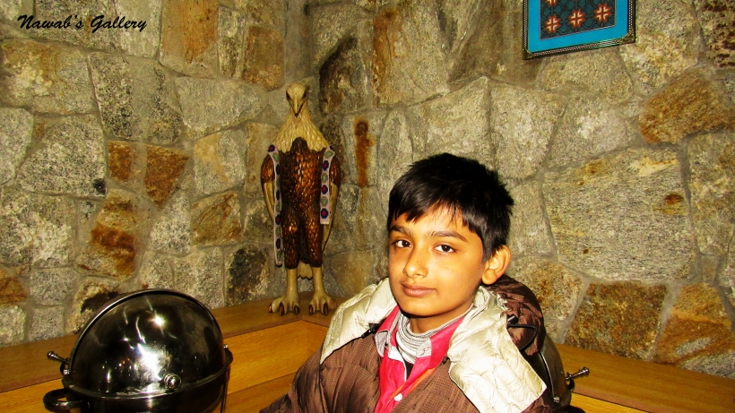
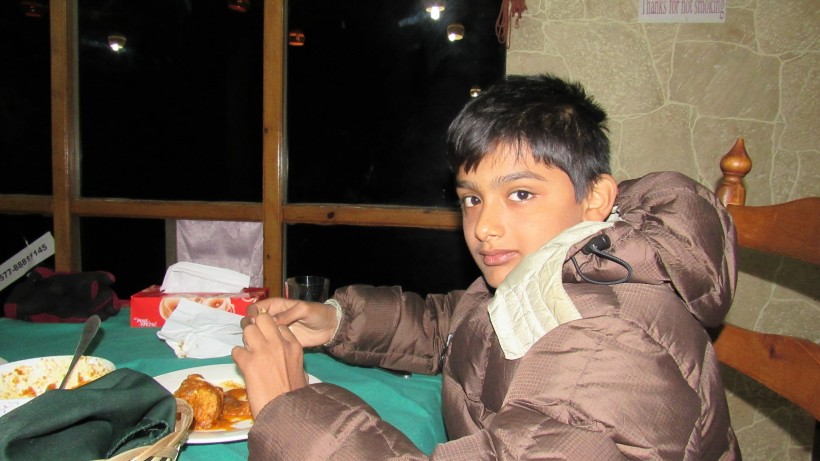
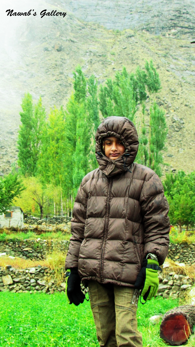
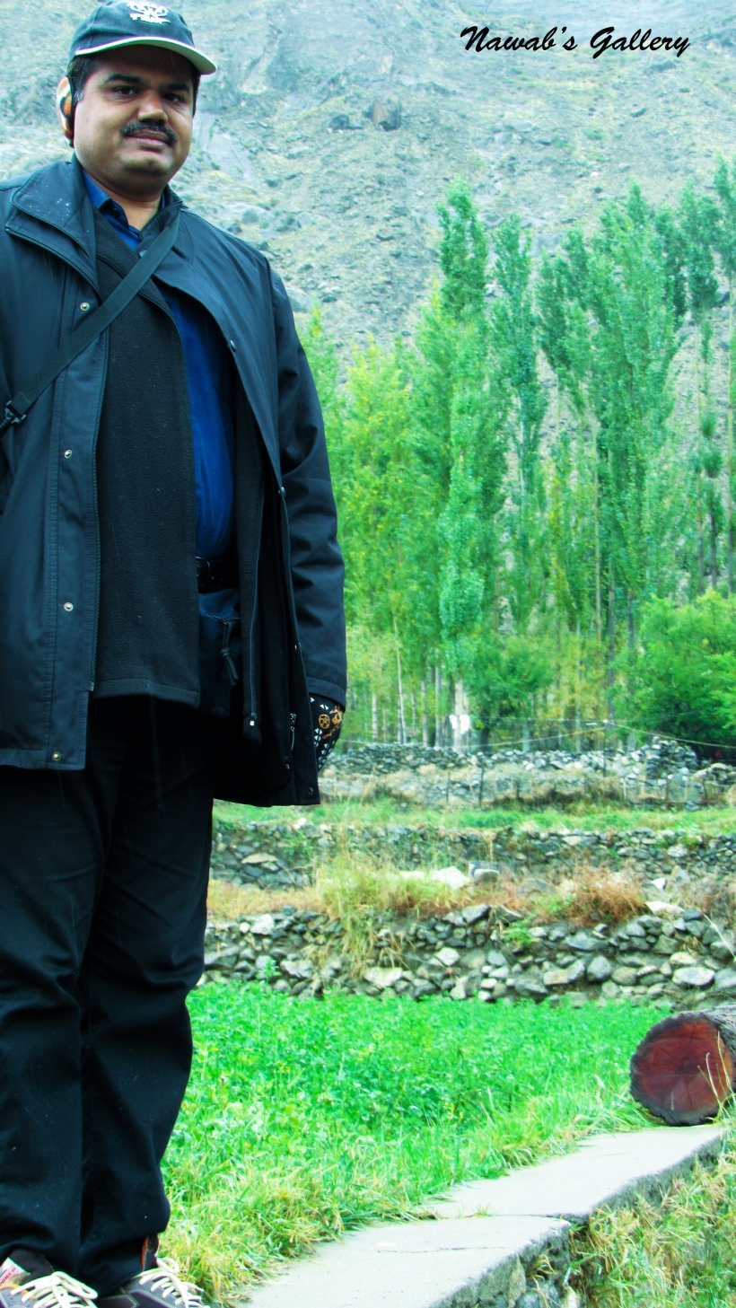
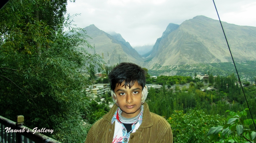
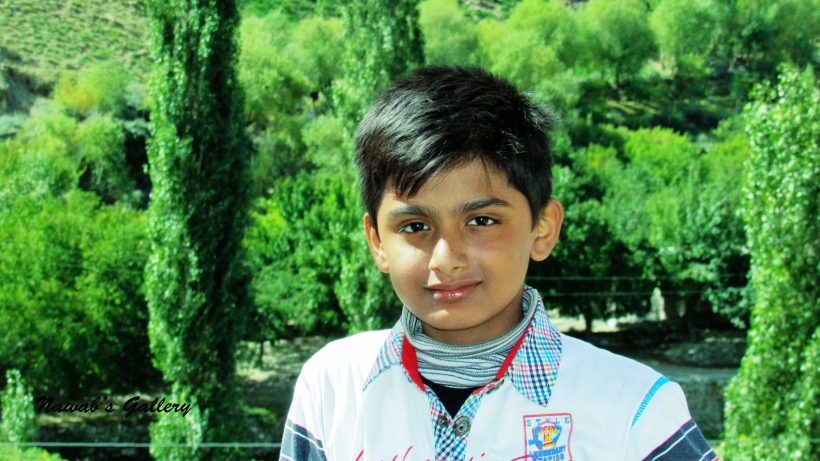
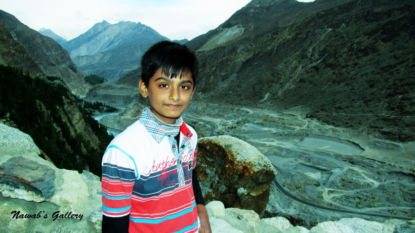
•Family Members: Me, my wife and 2 Kids (a 13 years old son and 8 years old daughter)
•Transport Used: Train, Coaster, Hi-roof Van (Hiace), Private Car (Taxi)
•Dates: From 12 September 2015 till 3 October 2015
The voyage began on 12th of September 2015 from Karachi to Rawalpindi via Train. By traveling on Taeezgam, a perfect budget train with AC coaches, we reached Rawalpindi on 13th September 2015. We stay at my sister’s home in Pindi on 13th and 14th of September. Our real adventure begins on 15th September 2015 from Rawalpindi.
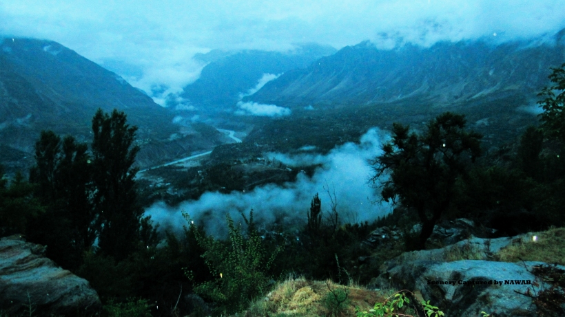
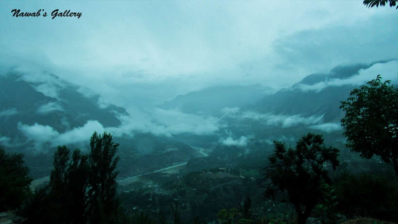
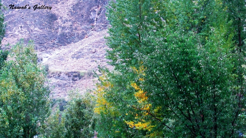
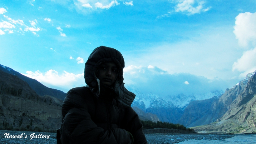
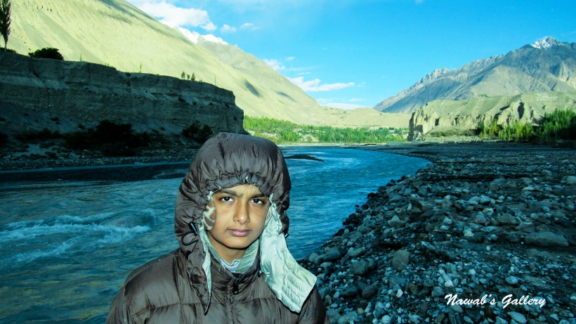
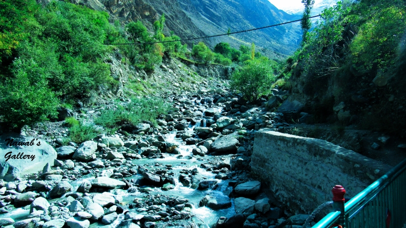
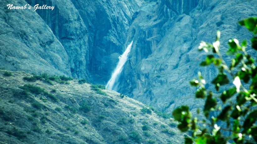
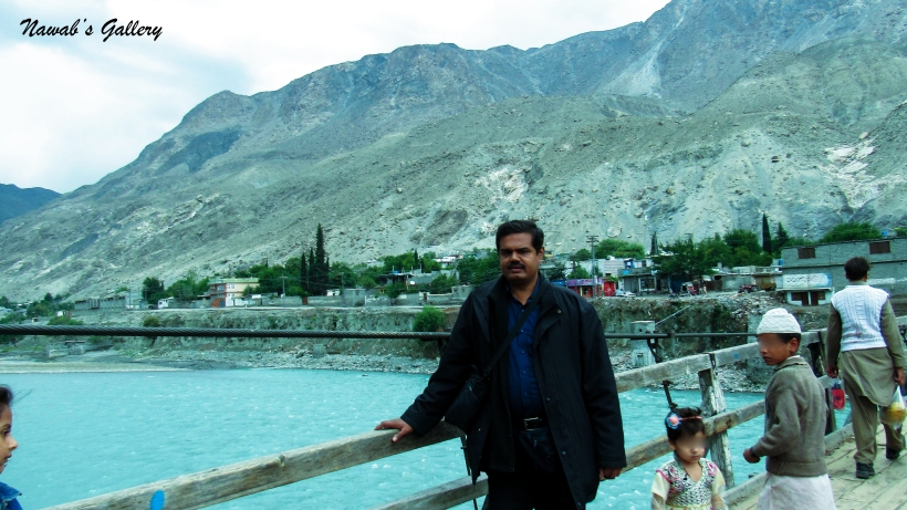
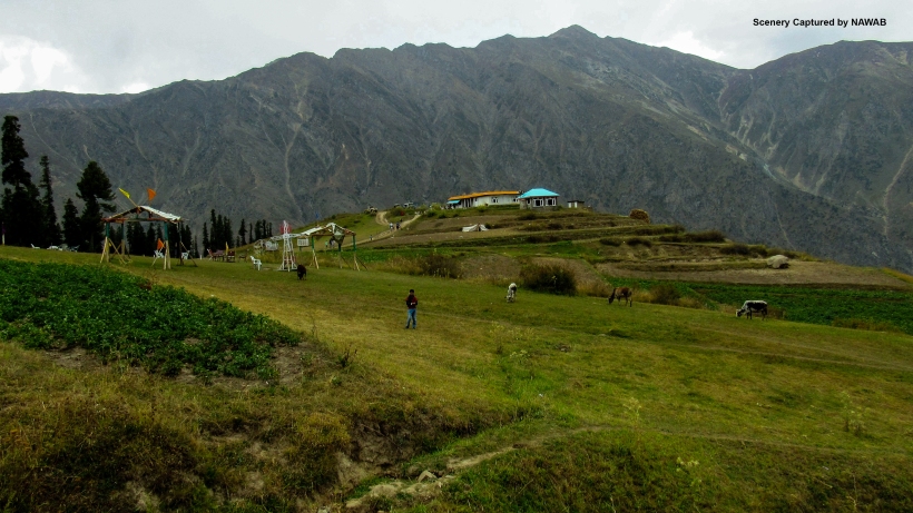
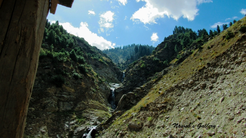
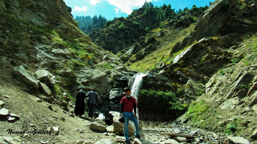
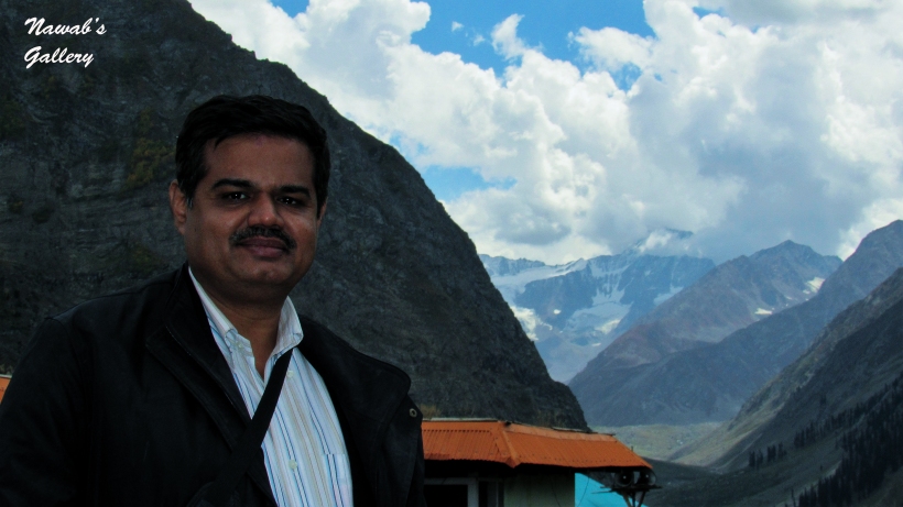
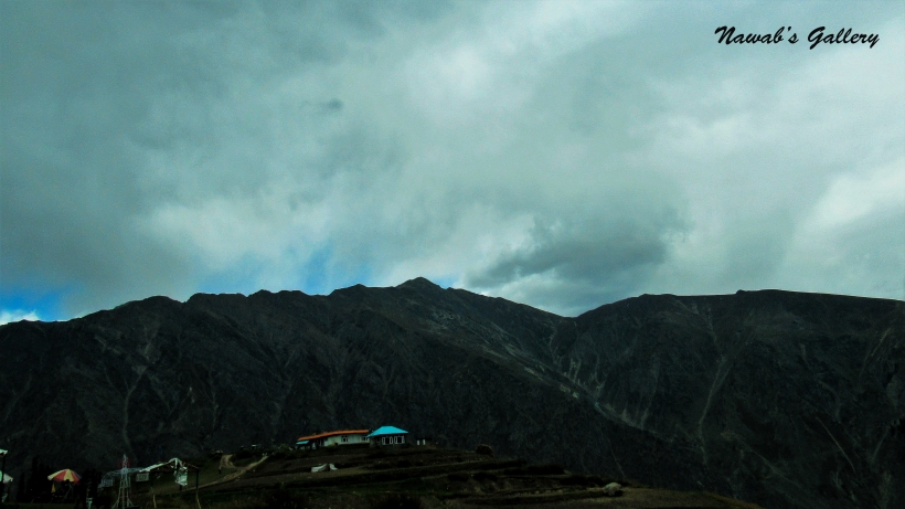
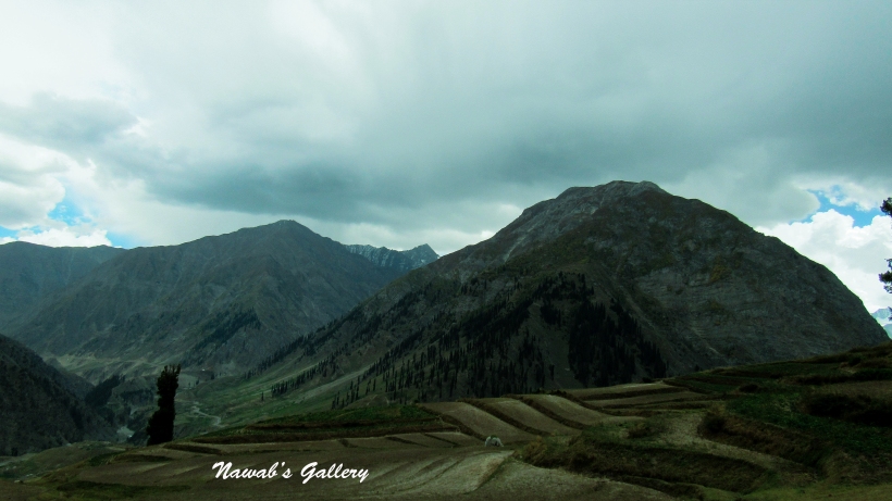
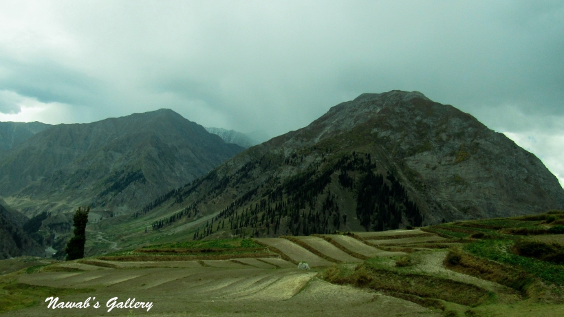
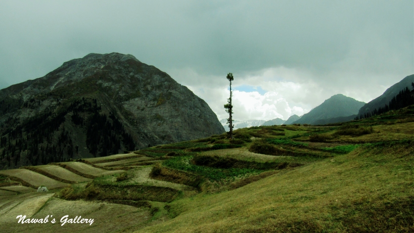
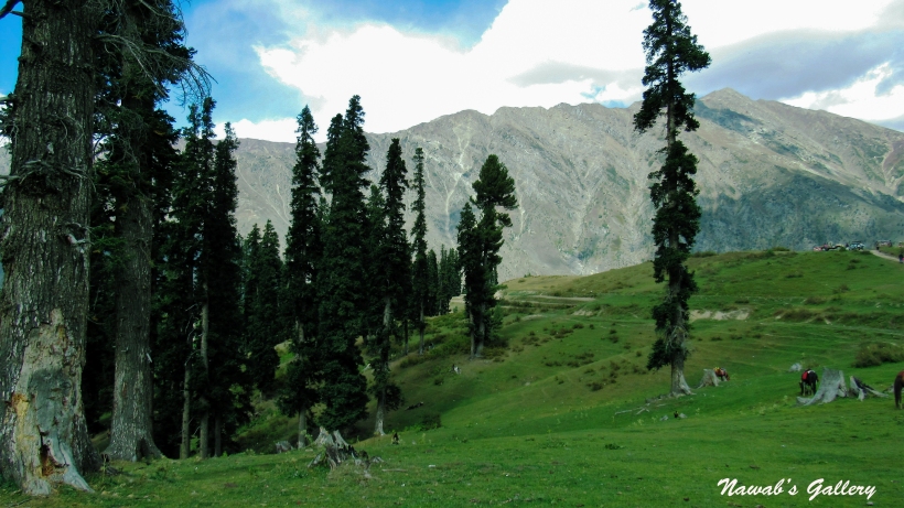
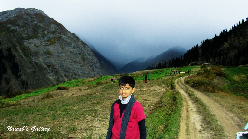
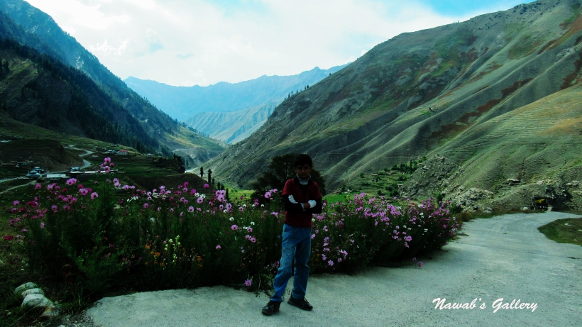
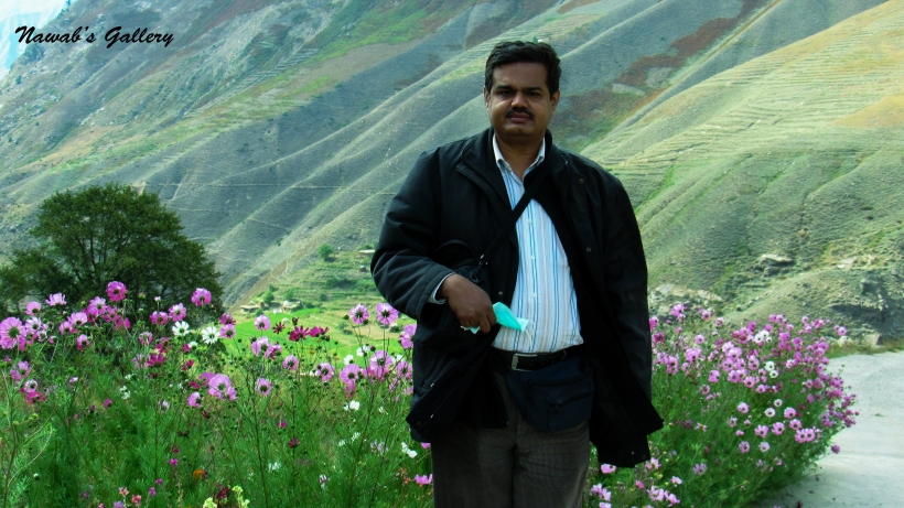
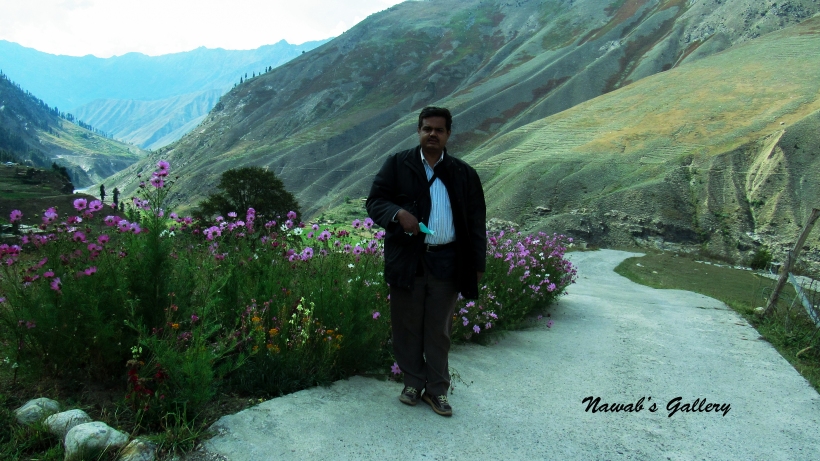
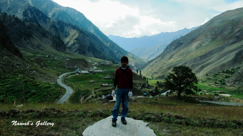
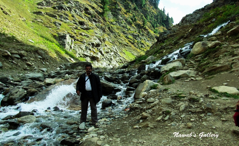
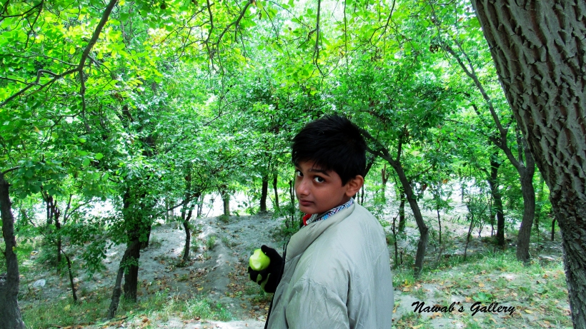
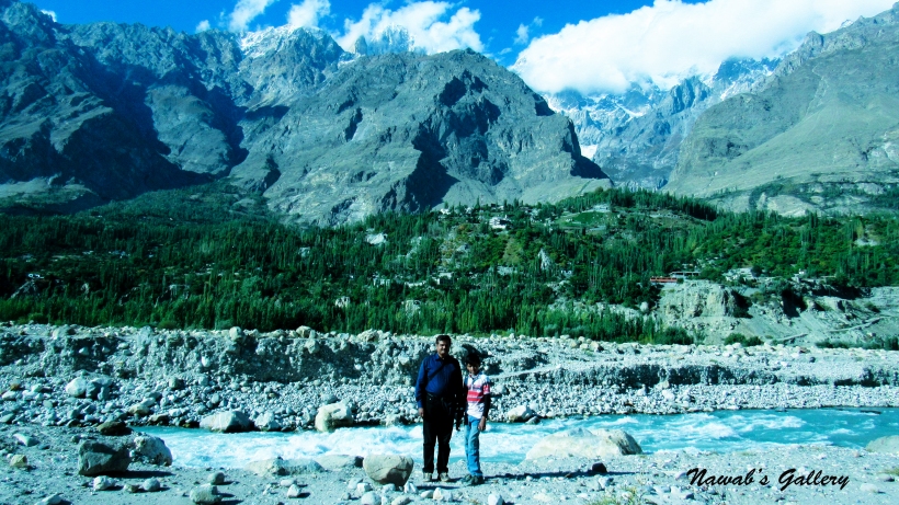
Yesterday we had a wonderful time at Sauful Muluk Lake and today our destination is Lalazar. At the height of 10,500 feet (3,200 meters), Lalazar is a green meadow situated 21 km from Naran. We wake up early in the morning and had the breakfast at the same restaurant where we had it yesterday. We have already booked the jeep for the Lalazar that is waiting for us on the road. As the surrounding areas of Naran are so beautiful we asked the driver to remove the leather roof that is covering the jeep so that we can fully enjoy the ride and the beauty of the surroundings. The drive started on the same Mansehra-Naran-Babusar-Chillas highway toward Babusar and crossed the Naran Town. The mesmerizing view of River Kunhar on the left and the mountain covered with Alpine Forest is unexplainable. We stopped for photography and video capturing at many stops and at stunning Waterfalls. Drink the fresh water from the fall, washed our face and hands and then continued our drive again. There are many waterfalls on the way toward Babusar, their source is up high on the mountain and falling into the river Kunhar after crossing the highway.
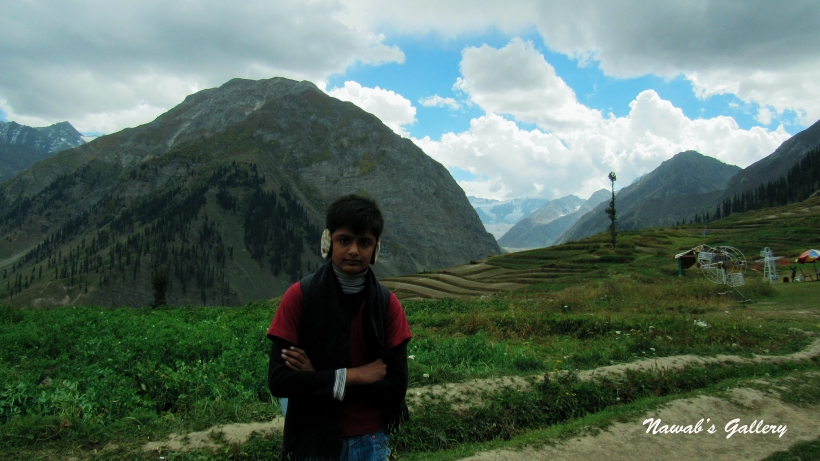
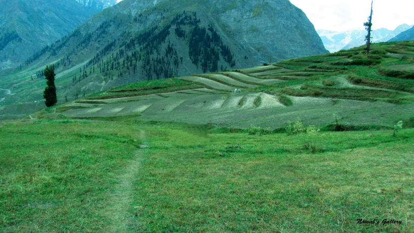
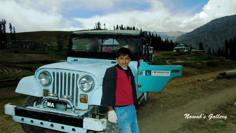
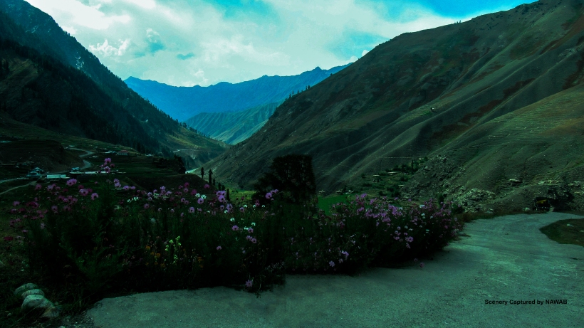
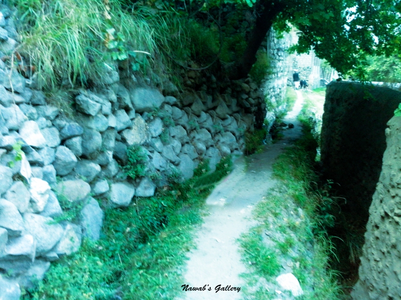
We were having a smooth and comfortable drive as the road is metalled and carpeted, but at Battakundi, our driver took a right turn and our jeep started climbing up on the mountain road, with hills on one side and a deep valley on the other side. This was a rough and dirt route and the only route going toward Lalazar. As we already have face masks with us in our backpacks, we immediately wore them to protect us from the dust. As said by Babs Hoffman “Stop worrying about the potholes in the road and enjoy the journey.” we continued our journey. As the zig zag road keeps on ascending the scenery started changing, at some place you can see the trees on one side and the river Kunhar below the valley on the other and at some places you can see corn and potato farms with the road passing in between the farms. After nearly a drive of 2 hours, we reached the most beautiful meadow of the Kaghan valley The Lalazar. We hopped out of the jeep pick our backpacks and moved toward the ground covered with grass and wildflowers. The Lalazar is surrounded by Fir and Pine Forest, the snow covered mountains and the River Kunhar flowing thousands of miles below in the valley.
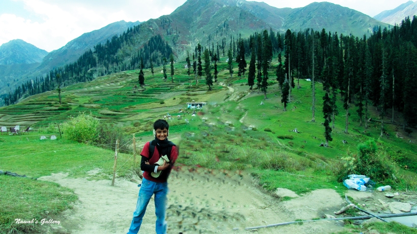
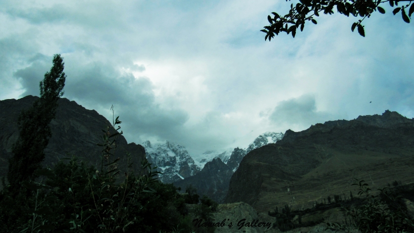
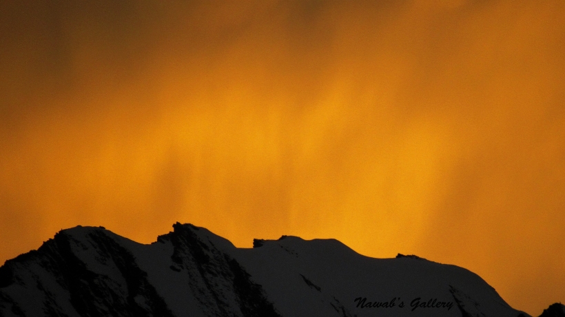
Walking some steps in the meadow, we spread out the sheet and sit there to enjoy the beauty of the surrounding. The unpolluted air, the refreshing smell from the surrounding, the quietness and the beauty of the place can make anyone fall in love with this place. While we were having some snacks and tea it starts drizzling, some people moved down the shelter, but my family decided to stay at our place and enjoy this sudden change in weather. At the time when we sit in this place, the sun was shining and the weather was less hot, but now this area is covered with clouds and the weather has become cold. On the nearby mountains we can see two different types of scene, on the mountains in front of us it was snowing and raining, we have seen the color of the rocks changing to white but on the mountains behind us, the sun was shining with full brightness. It was the first time in our life that we have seen such an amazing scene.
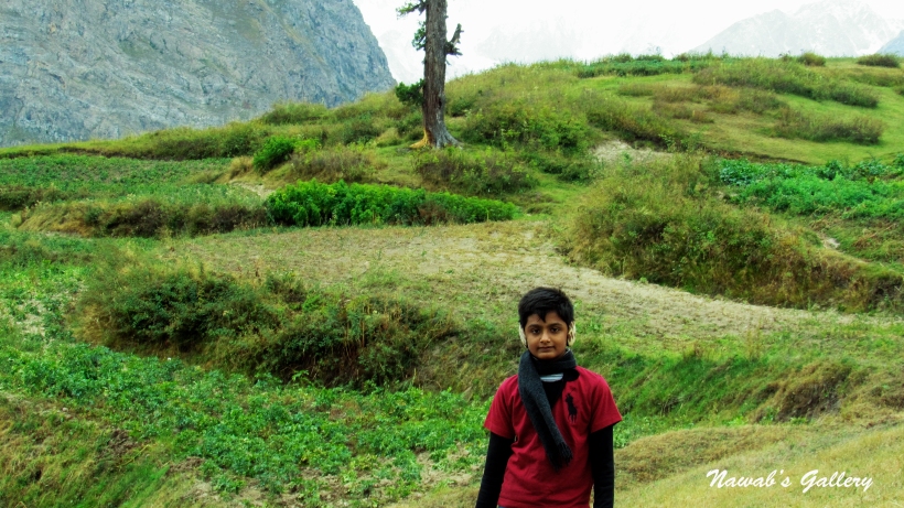
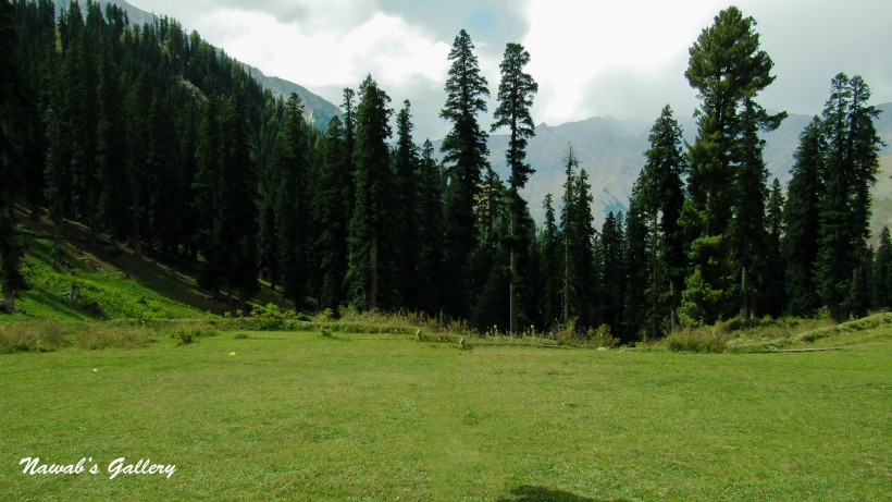
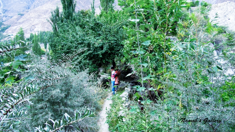
Lalazar is filled with attractiveness, not only it has green plains and valleys, but this place also has a forest, so we decided to move and sit some place near the forest. The forest is packed with pine trees, we sit near the forest and children started flowing the butterflies, smelling the flowers and running all around. It’s been more the 3 hours here, but the feel of the fresh air and the smell of the forest making us not to leave this place but we have to go.
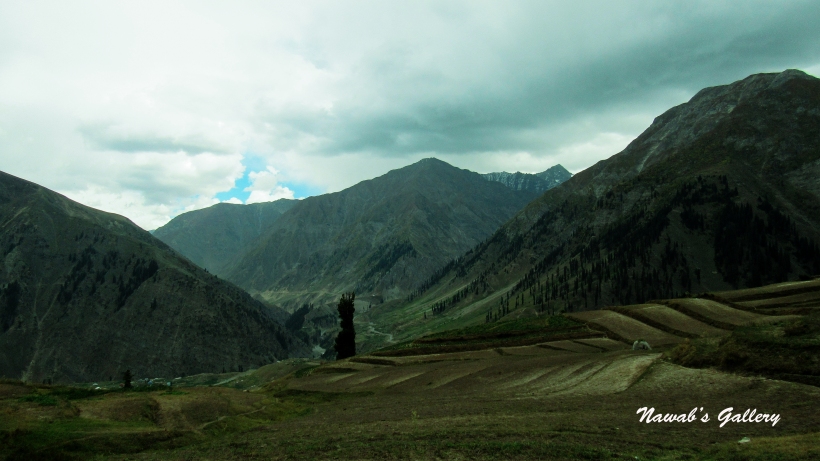
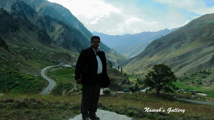
We sit back into our jeep again and our journey back to Naran started again on the same rough and dusty road, but we didn’t care about the dust just wore our face masks and started enjoying the beauty of the farms, the plains, the valley and the river and reached the main highway leading us toward Naran, The Mansehra-Naran-Babusar-Chillas highway. There is also a fascinating place “Batakundi” on the way to Naran, we stop there for a while, have some photographs, and then started moving toward Naran.
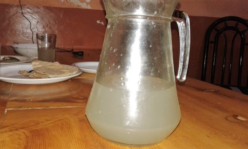
Before the beginning of the Naran city, there is a spot on the right side of the road where one can do Trout fishing activity along the Kunhar river bank. Fishing for brown and rainbow trout in the crystal clear water of the Kunhar River is the favorite pastime for locals and tourists. But a fishing permit is required that can be obtained easily from the nearby fisheries department and one can also rent the fishing equipment from the shops in Naran Bazaar.
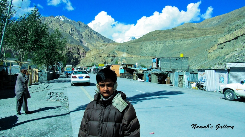
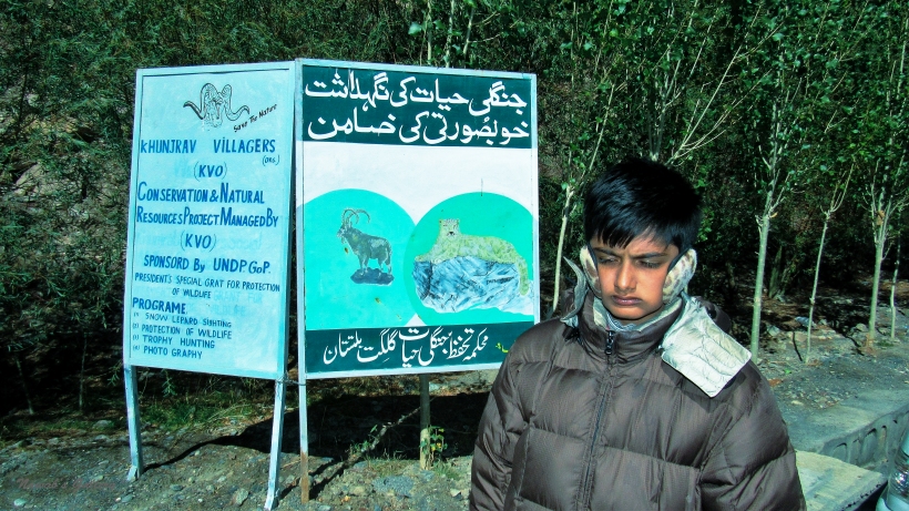
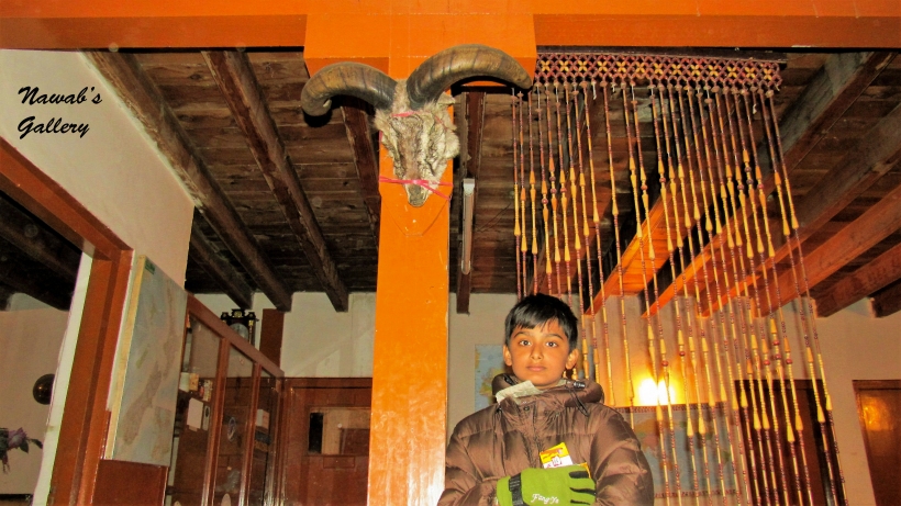
After six hours of an enthralling trip, we reached Naran and went to our room to take some rest. After a couple of hours, we went out to the Naran Bazaar again. My wife and daughter doing the shopping and me and my son having a chat with shopkeepers and locals. While talking with locals, we come to know that the surrounding mountains have different animals, one of which is a Markhoor that belongs to goat family and another animal that exists on these mountains is Leopard (Cheeta) but due to the population they live up high on the mountains and only come down during the winter season when these mountains get covered with snow.
We have been in Naran for two days and we have to leave for Gilgit tomorrow as our main objective of this trip is to reach the Khunjerab Pass (The Pakistan-China Border Crossing). After discussing with the locals and arranging for the jeep for tomorrow, we had dinner (Tikka & Naan) at the local restaurant. After this delectable dinner, we came back to our room, packed our bags for tomorrow’s journey and went to sleep.
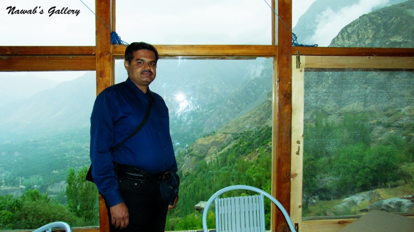
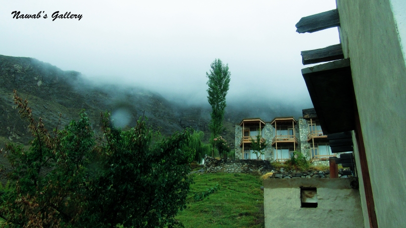
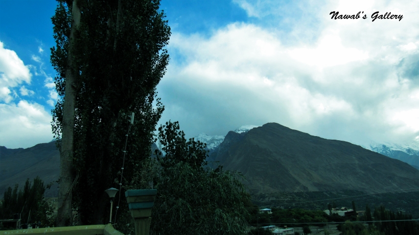
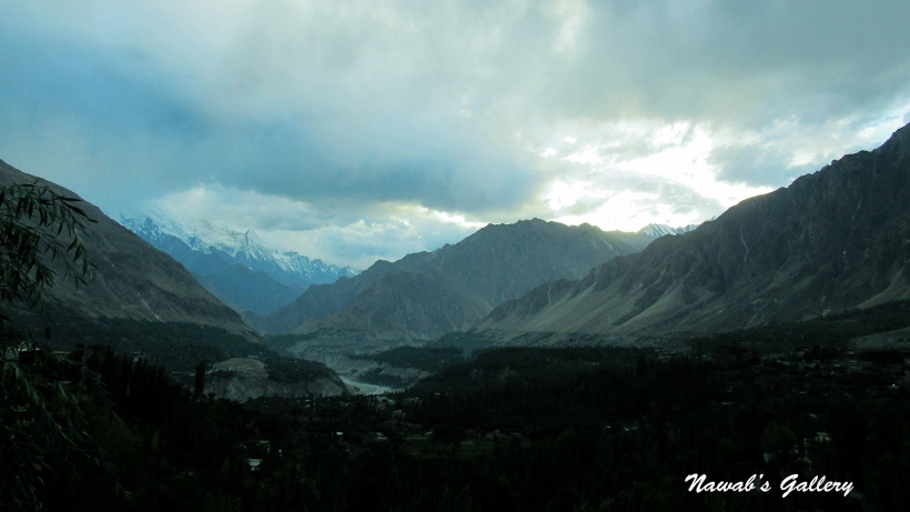
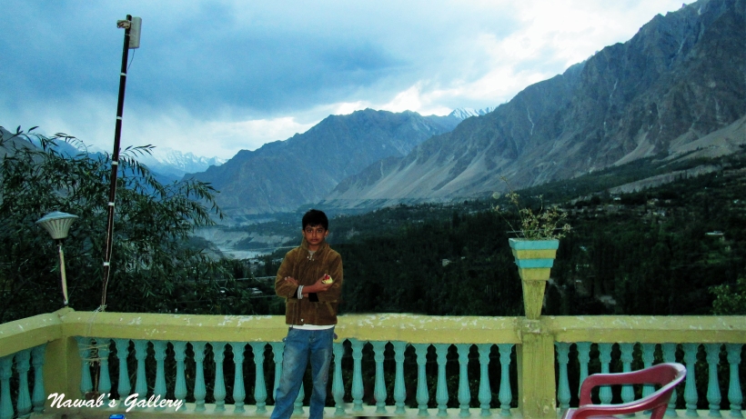
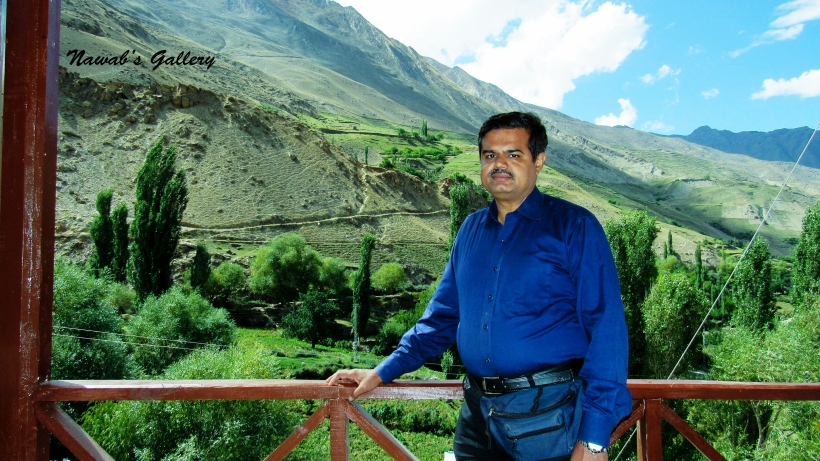
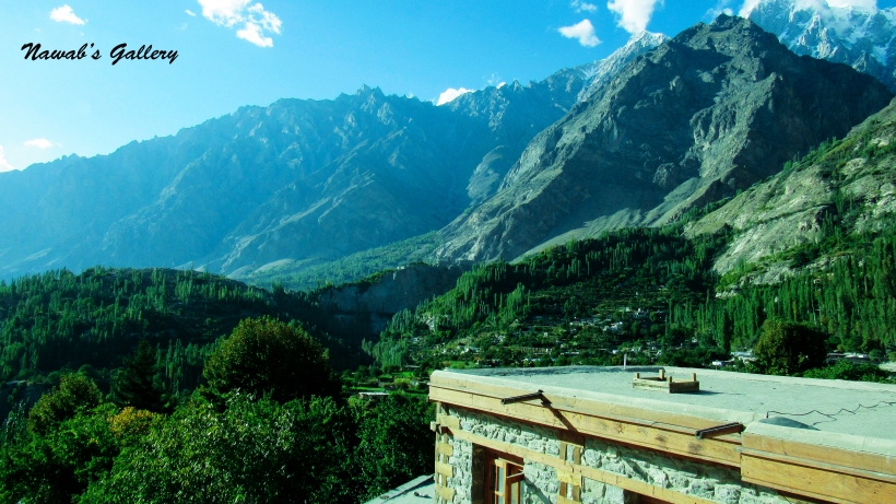
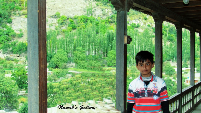
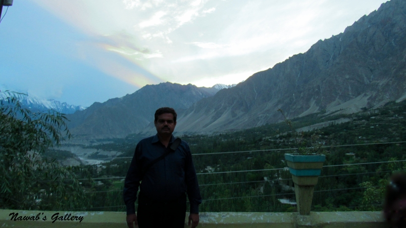
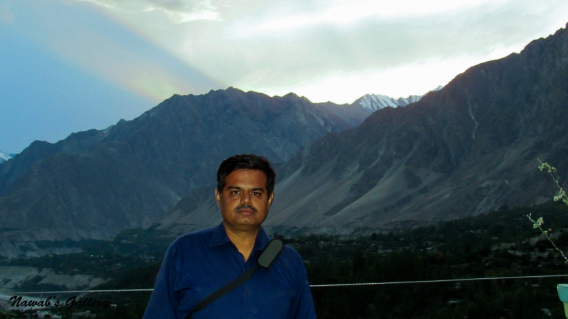
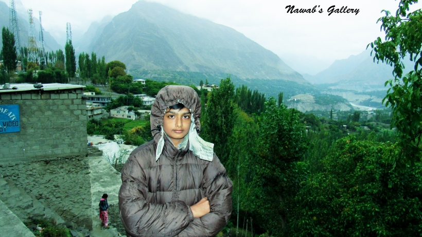
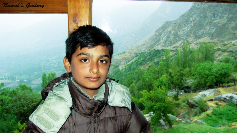
Agreeing to our itinerary, we only hold a night stay at Gilgit, but will be persisting for long on our return from Hunza. Today we have to reach Karimabad, a very beautiful town of Hunza. After having a hot bath, we went to the hotel restaurant for Breakfast. One thing to remember for the travelers is that in these budget hotels hot water is only available from 7 A.M. till 9 A.M. so wake up early to have a hot bath. The view of nearby mountains, especially from the roof of the hotel was awesome, you can also have this view from the balconies of the first floor.
To travel to our destination of Hunza, we went to a Bus Stand in Gilgit. The Bus Stand in Gilgit is on the outskirt of the city to protect the city from pollution, noise and traffic. From this Bus Stand transport for many cities of Pakistan is available, including Hunza, Skardu, Lahore, Rawalpindi, and even to Karachi. We decided to travel to Karimabad City (Hunza Valley) via Van. These vans travel seat by seat and move after all seats are occupied, hence we have to wait for some time before our journey starts toward Karimabad, Hunza.
We were traveling on Karakoram Highway toward Karimabad, Hunza. Since we are 4 people we have been allotted a complete seat of the van so we all sit together. In the front seats, there are all ladies sitting and behind us there are all gents. They are all local people in the van only we are from outside this neighborhood and can be clearly identified because of our look and speech. People in the region are very nice and friendly and they are treating us very nicely.
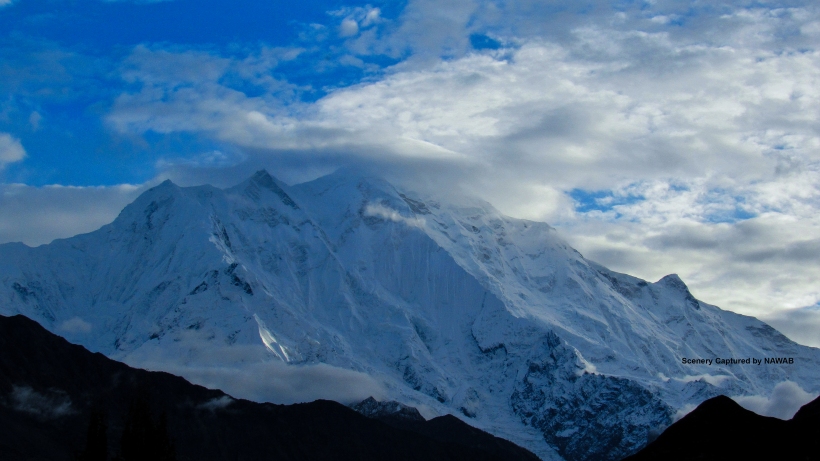
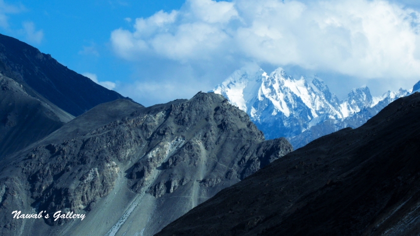
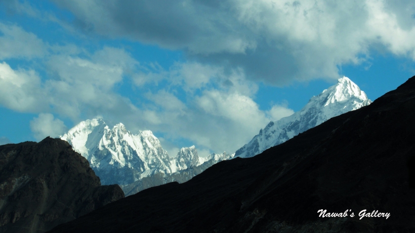
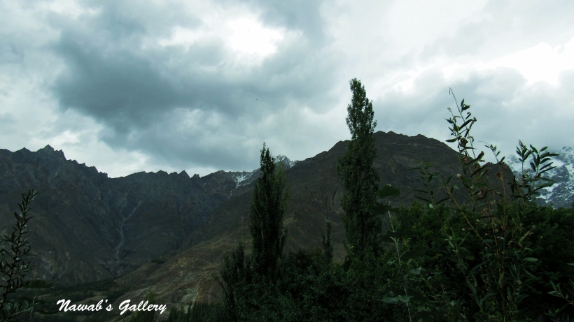
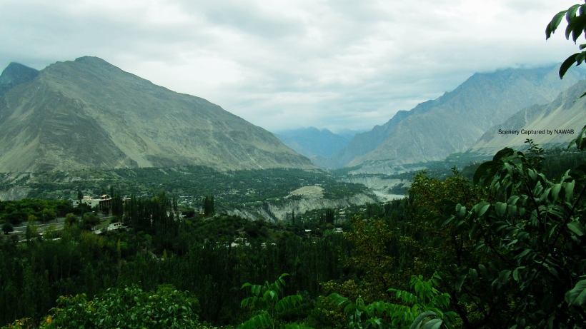
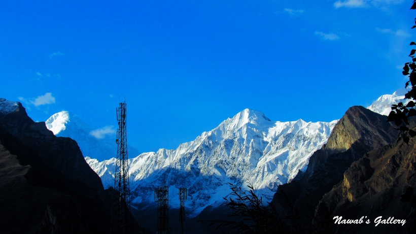
We are in the Kingdom of Himalaya and Karakoram with K2 (Godwin Austen), Nanga Parbat and other world’s highest mountains nearby, along both sides of Karakoram Highway there are green plains and valley surrounded by mountains with their summit covered with snow, these mountains are part of the Himalaya and Karakoram ranges.
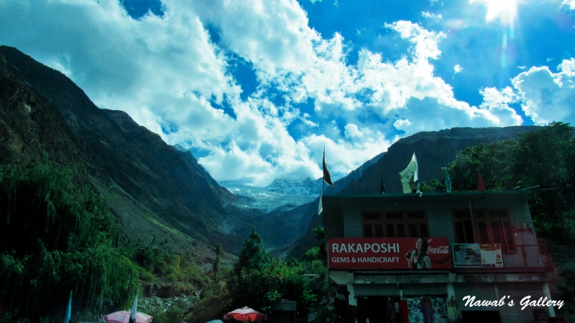
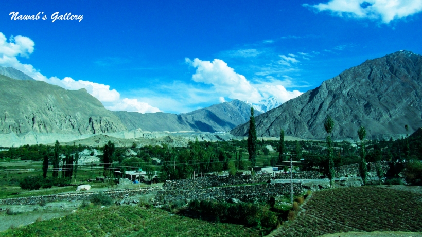
Considering the marvelous scenery and passing different cities like Sultan Abad, Rahim Abad, Chalt Valley, this valley is extremely beautiful and can be seen from the Karakoram Highway on the other side of the river, we were moving toward Karimabad. Crossing many cities, and also stopping at some cities to pick and drop passengers, we also crossed a point known as Rakaposhi View Point. This is the base of Rakaposhi Mountian and complete view of the mountain, along with its peak is clearly visible from this place. Since we were journeying on a public van we can’t reveal here, but we possess a plan for breaking off here on our return journey toward Gilgit.
Traveling on this beautiful route we reached Aliabad. Aliabad is a main & a business city in Hunza Valley with Banks, Hotels, Restaurant and Market. People belonging to Hunza have Business in this city and they also visit this city for monthly shopping. We stop there for 15 to 20 minutes as some of the passengers need to buy just about fruits from the store before proceeding to their home in Hunza Valley. Subsequently a couple of kilometers from Aliabad we left Karakoram Highway and struck a left turn on an ascending road, the road sign informs us that this road is leading to Karimabad City.
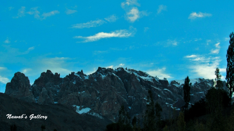
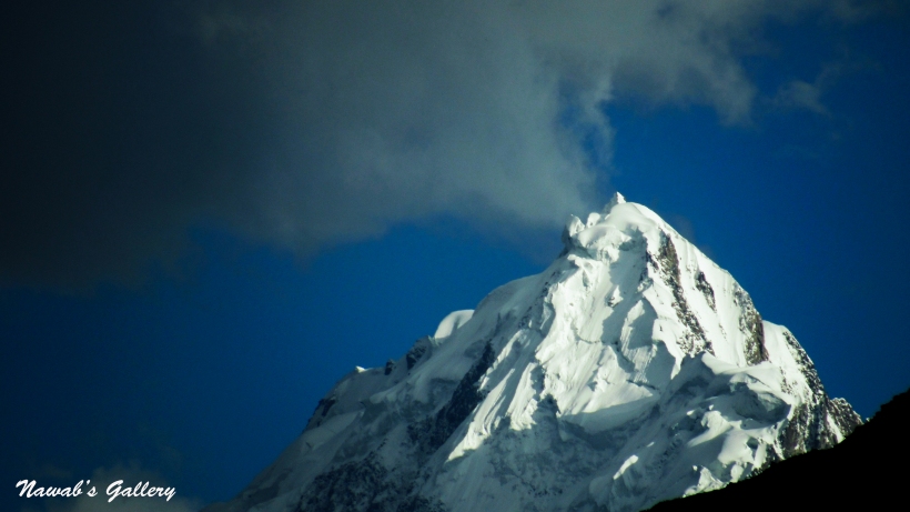
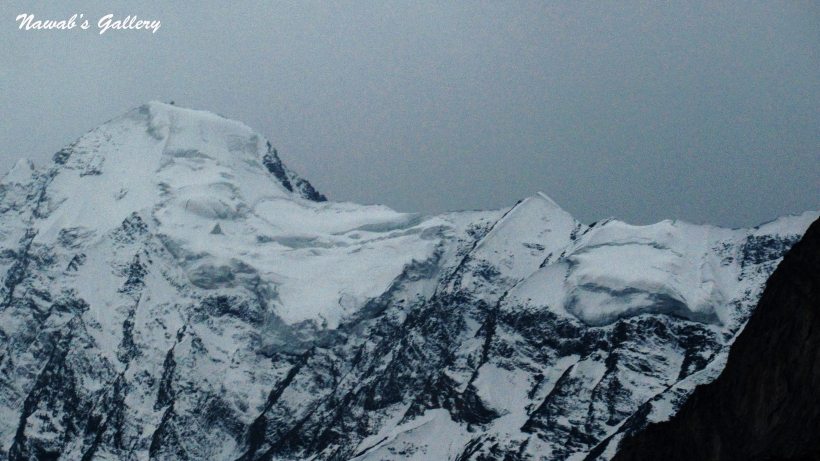
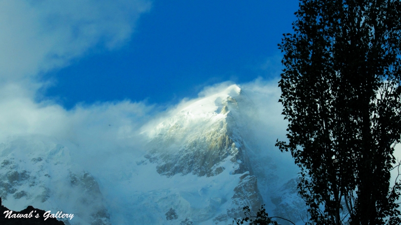
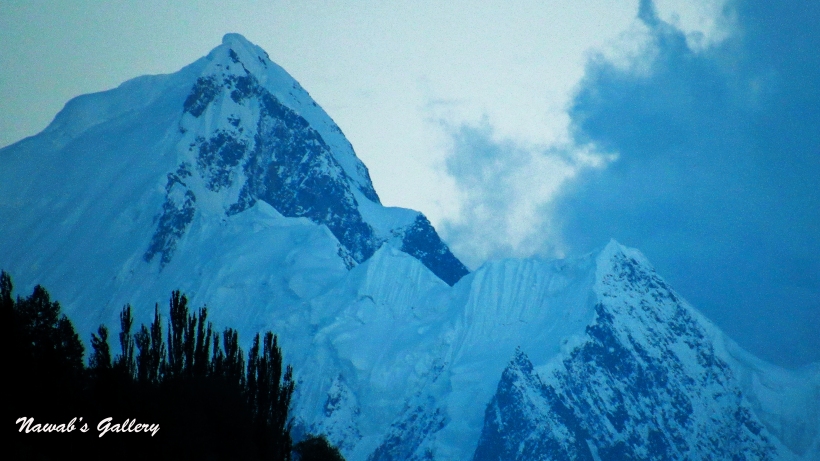
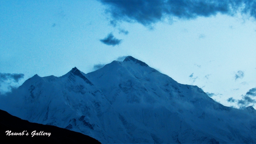
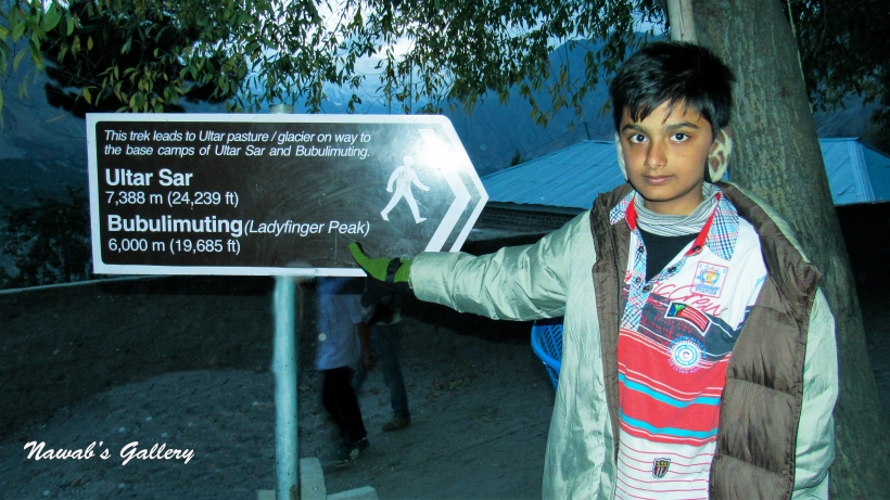
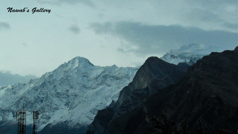
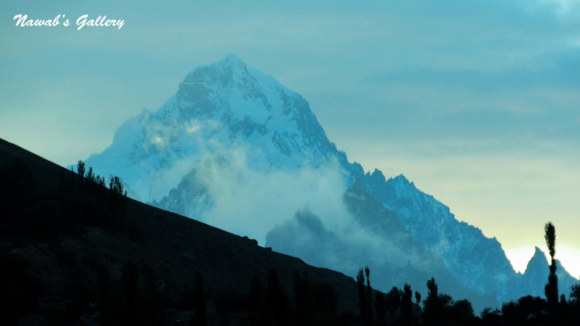
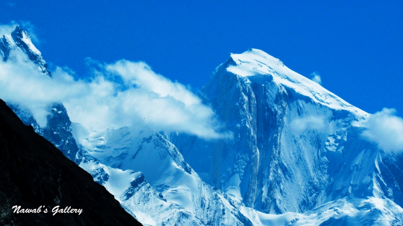
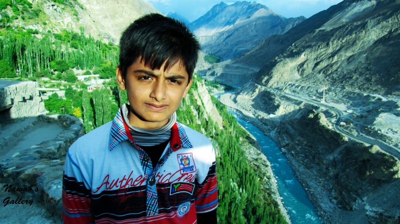
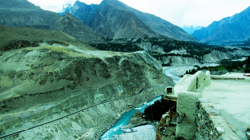
Hunza Valley is situated at an elevation of 2,438 meters and is one of the most exotic places in Pakistan. It is surrounded by several high peaks rise above 6,000m. Hunza Valley is divided into three regions, Upper Hunza, Centre Hunza and Lower Hunza. Karimabad is the capital of Hunza Valley and lay in Centre Hunza region. It is named after Prince Karim Aga Khan, the spiritual leader of the Aga Khan Community. The valley provides spectacular views of some of the most beautiful and magnificent mountains of the world which include: Rakaposhi 7,788 m (25,551 ft), Ultar Sar 7,388 m (24,239 ft), Bojahagur Duanasir II 7,329 m (24,045 ft), Ghenta Peak 7,090 m (15,631 ft), Hunza Peak 6,270 m (20,571 ft), Darmyani Peak 6,090 m (19,980 ft), and Bublimating (Ladyfinger Peak) 6,000 m (19,685 ft).
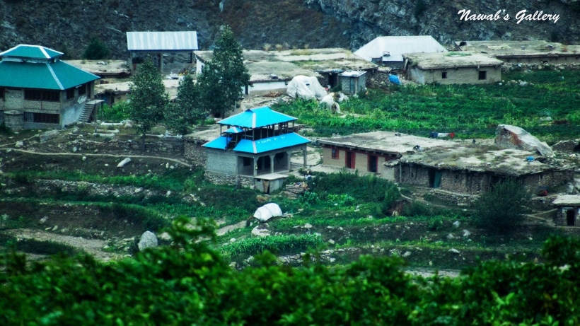
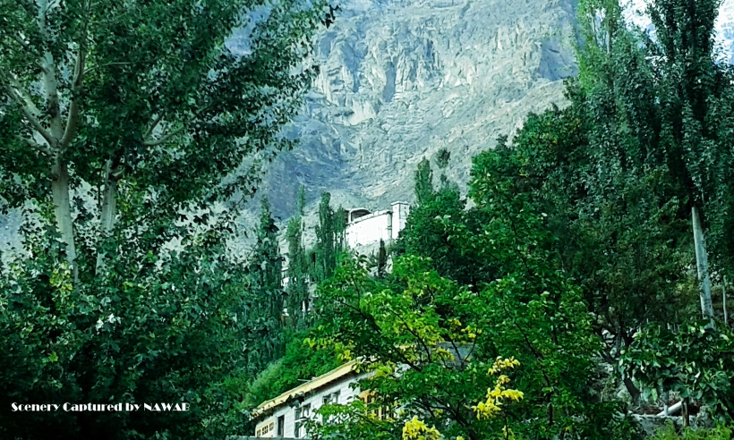
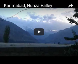
Dropping some passengers at different locations, our van driver told us that we are now in Karimabad and must mention a place where he can drop us. We need him to drop us at some nearby hotel. We didn’t have any advance reservation for a hotel so we have to look for the hotel. Thither are many hotels in Karimabad, infect there are all hotels along the main road of Karimabad since Karimabad is a tourist place. All around the year there is a number of tourists visiting this area, particularly in the summer season. In that respect are both luxury and budget hotels in Karimabad. After visiting different hotels, we decided to stay at Hotel Blue Moon situated near the main market in Karimabad city. On the ground level are the shops and climbing some steps is the reception and food court of the hotel. Rooms start from the foremost floor. The hotel is at an awesome location, in front there is the beautiful valley of Hunza, with the view of Rakaposhi Mountain and behind is the snow covered mountains of the Ultar Sar Peak and Ladyfinger Peak.
Ultar Sar is the southeastern most major peak of the Batura Muztagh, a subrange of the Karakoram range. It lies about 10km northeast of the Karimabad city and rises over 7,388m (24,239ft). The adjacent peaks are Shispare, Bojohagur Duanasir, Hunza Peak and Bablimotin.
Another popular peak at Karimabad is the Ladyfinger peak. It rests on the southwest ridge of the Ultar Sar massif, the most southeasterly of the major groups of the Batura Muztagh. The whole massif rises precipitously above the Hunza Valley to the southeast. The weather was cold and the sun was shining, the amazing thing is that if in this cold winter you stand in the sun you will start feeling hot.
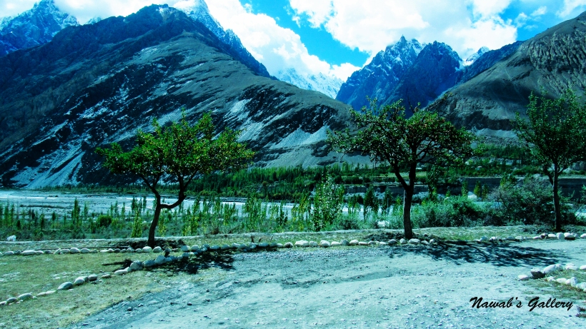
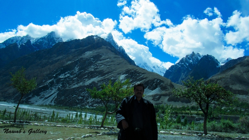
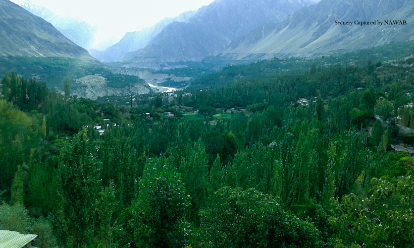
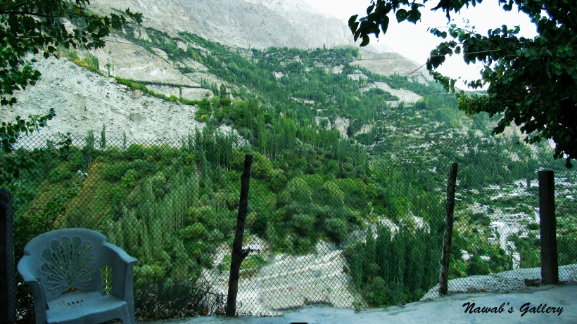
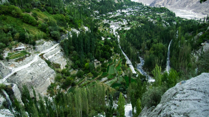
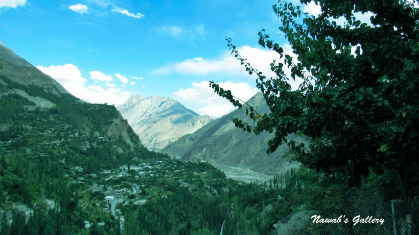
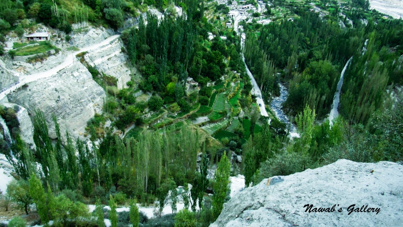
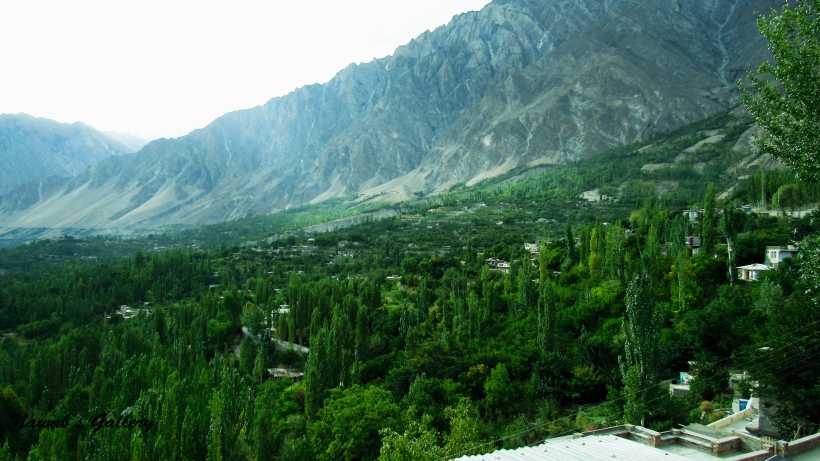
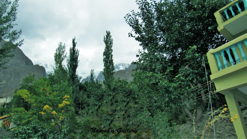
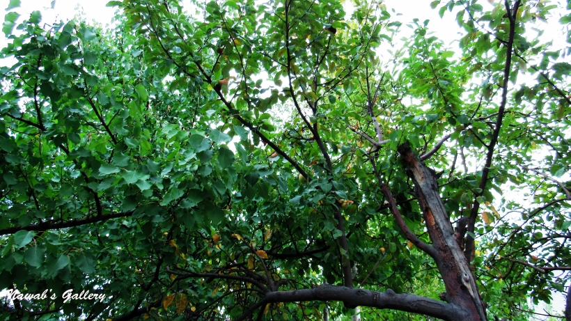
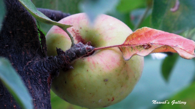
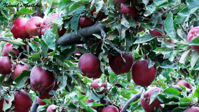
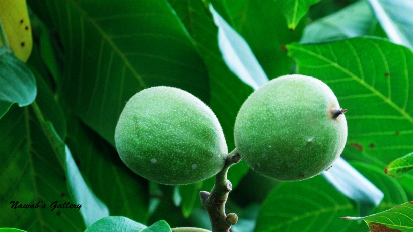
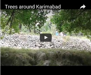
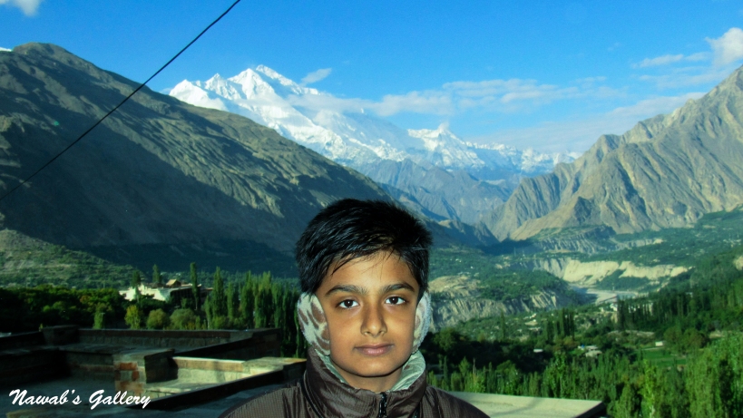
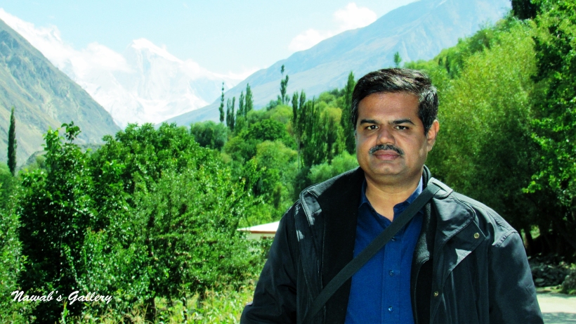
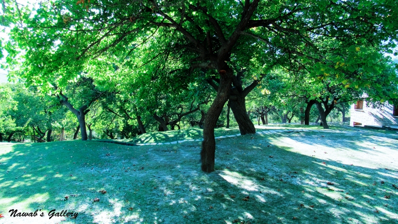
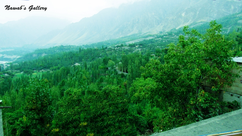
Settling ourselves at the hotel after this 4 hours of journey from Gilgit we decided to get some rest and extended into our room to have some nap. We wake up at evening, in front of our room, there is a large balcony with table and chairs positioned around for sitting. We sit in the balcony and placed an order for tea, in front of us is the most hypnotizing scenic view we ever witnessed in our life, The Hunza Valley. The valley in front of us is lush green with countless trees of Apple, Apricot, Walnut and many more, below in the valley we can abide the Hunza River flows in between these trees. Either you look in front, at the left, right or back there are trees all around surrounded by snow covered mountains.
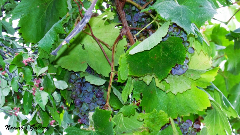
While we were having tasty tea the staff boy at the hotel told us that we will experience a marvelous view of the valley if we climb to the rooftop. Concluding the tea we move upward to the rooftop from where we discovered the valley behind the hotel. The view was alluring, from here we can see the valley of the Altit and Duikar. The green plains, the woods, the sights and the waterfall on the Altit side is magnificent, the historic Altit Fort and the Eagle’s Nest in Duikar can also be observed at a distance. There are apple trees, Walnut trees and grapes branches on the roof top of the hotel too, we picked more or less apples to try them and found them mouthwatering. All of my family members are too much happy on visiting such a heavenly place. The spectacular view makes us feels like we are on the roof of the world, surrounded by snow covered mountains. No wonder this place is called as the “Heaven on Earth”.
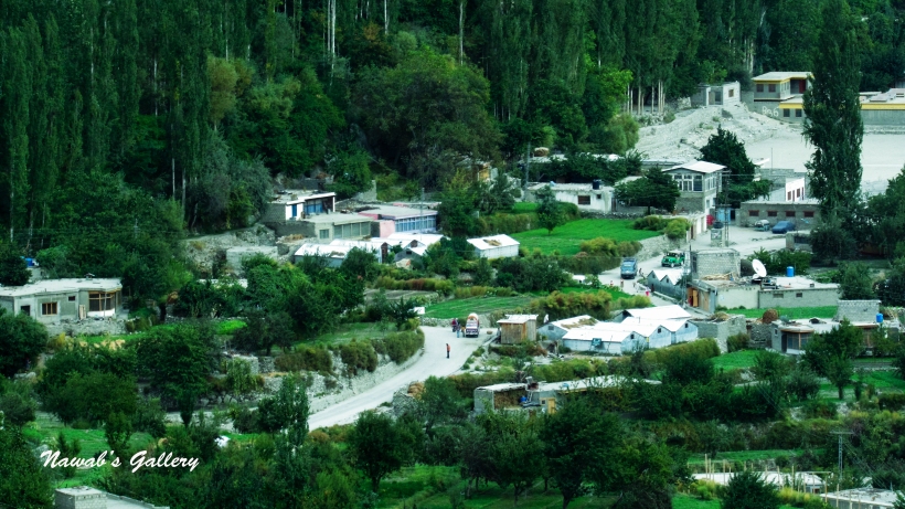
After spending some precious time on the rooftop, we went down stair on the main road, to visit the Karimabad city. Along both sides of the main road, there are stores and hotel constructions, the residential houses are either below in the valley or just little up on the mountain. We roam around the road for an hour or so, bought the Biryani for dinner and return back to our room. One thing to remember is that in these areas all stores and markets shuts down as soon as the sun sets. We had dinner in the beautiful ambiance of the balcony and sat there having chit-chat before going to bed. For tomorrow, we have plans to explore the Karimabad city and my wife had plans for lots of shopping. The night was too cold, but we were provided with sufficient blankets to keep ourselves warm, discussing our journey we all fell asleep.
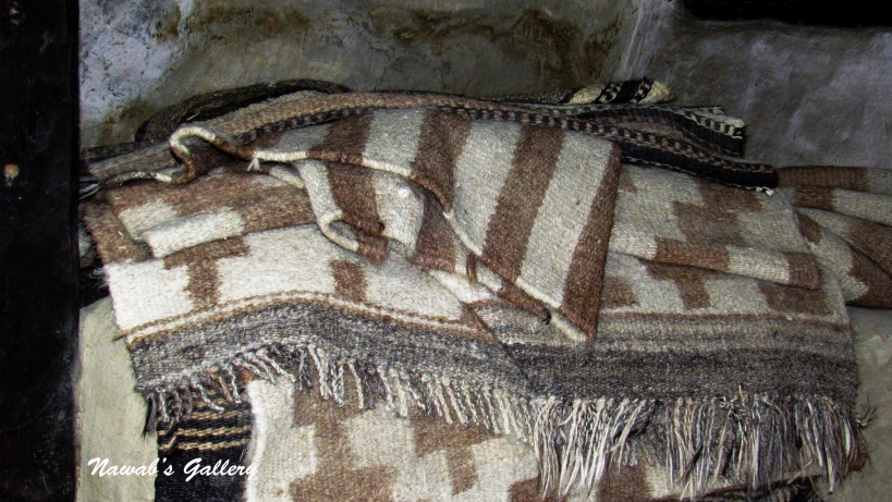
Yesterday we arrived at the most beautiful spot on the earth, Hunza Valley, “The Heaven on Earth”, and stay at its capital city ‘Karimabad’. Today we will be exploring this city. This city is built along the border of the mountain and is sloped upward to Ultar Sar starting from Karakoram Highway. The hotel at which we are staying is at the start of the market, after a hot bath and dressing up we moved downstairs to the main route and started proceed toward the marketplace. There are many shops along both positions of the main road, we went into the first shop that is on the left-hand side of the road directly after our hotel. This shop sells gems and jewelry and is led by local women. From the time we arrive in this area we found its people courteous and soft spoken, they steer us at every spot and quick to offer any sort of assistance. After visiting this shop we move toward another shop on the road this shop sells handmade rugs and carpets. These carpets are extremely beautiful and nicely woven by the local workers, there are also handmade jackets and shawls, and since my wife loves shopping she immediately started bargain and pick from the items.
The Hunza valley is popular for Camping, Swimming, Hunting, Hiking and Trekking, Mountaineering, Mountain Biking, Horse riding, Eco tours, Skiing, Safari tours, Fishing, Gliding and many other activities, for that there are many shops in Karimabad that sell equipment required for these activities. The equipment can either be bought or can be rented from these stores. Paper maps of these areas are also available in nearly every shop and one can also hire a local tour guide for hiking and trekking.
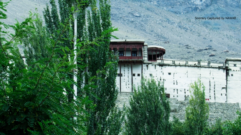
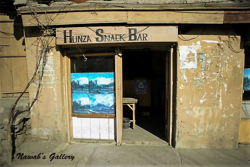
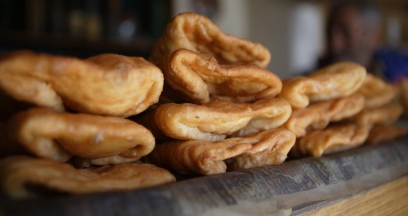
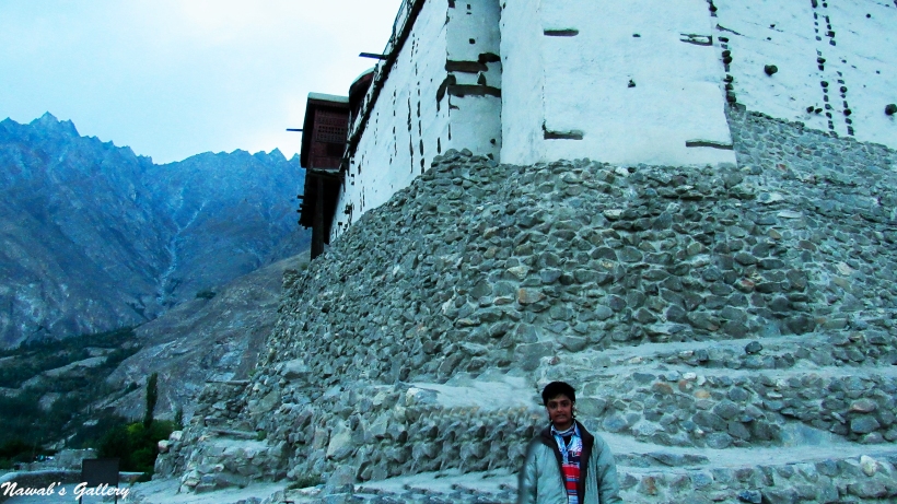
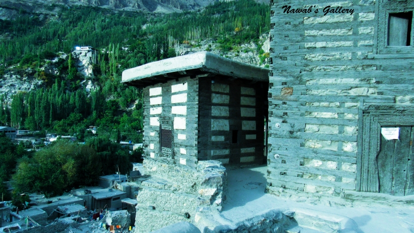
Going forward, there is a link road leading upward toward Baltit Fort this is a 700 year old fort and belongs to Mir of Hunza (but it is vacated by them in 1945) and is now considered as World Heritage by UNESCO. We have a program to visit Baltit Fort in the evening but not now, at this time we remain in Karimabad. Near this junction we found a small tea shop, it’s named as “Hunza Snack Bar”. It is a small local tea shop that server’s tea, coffee, omelet and a local bread called “Arzooq”. Originated from the Baltit, Arzooq is made with flour, eggs, butter and milk and finally cooked in oil, it is one of the most famous bread of Hunza. As shortly as we sat in the shop we placed an order for tea, my daughter spotted this bread and ask the shopkeeper regarding this bread, and after his explanation about the bread, we add this to our order. The shop owner is a very well-spoken and friendly person and we have a long chit-chat with him while waiting for our breakfast. After the food was served and we taste the Arzooq, we found it very delicious and from that day till we stay in Karimabad, we daily have our breakfast at “Hunza Snack Bar” with Arzooq also a part of it.
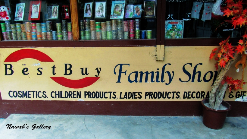
Finishing the breakfast we again proceed on the main route, travelled to different shops and take in the beauty of the area all around us, also surprise to catch the name of the shop as “Best Buy Family Shop”, the shop sells cosmetics, children products, ladies products, decoration and gift items, same as sell by the “BestBuy” in the United States.
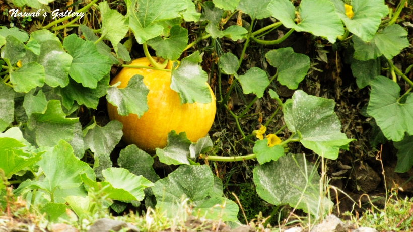
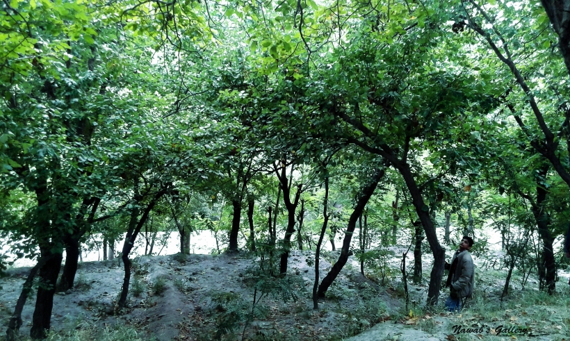
Enjoying the beautiful and long walk we settled to revert back to our hotel where we are sticking around. At a lower place in the valley there is a large number of Apple, Apricot, Walnut, and Fig and different other types of fruit trees, last night while having a chat with a local guy we were informed that there are no limitations on visiting their gardens and can deplete the fruit from these trees as much as we like, merely not to harm them. So today we have decided to hold a picnic in these gardens, we went down the valley and spread a sheet to sit among the trees, and the kids were thus happy and began running just about. Later on having tea that we purchased from the “Hunza Snack Bar” we began picking some apples, apricot, and walnuts from the tree. In that location there were some local kids also playing and picking walnuts, my kids wants to talk to them but due to language difference they were unsuccessful, but those children were so courteous that they gave the bag full of almond, grapes and apricot to my kids. We also collected a small bag full of apple and walnut and after spending such a splendid time at that place we started climbing back toward our hotel. On the way back my wife meets a local woman she was the mother of those kids playing in the woods when the woman learn that we are interested in eating walnut she assured my wife that she will arrange for the walnuts. The lady not only arranges for the walnuts but also send a bag full of walnuts for us to Gilgit city after we left Karimabad. We return back to our room and passed sometimes in the room as it was afternoon and the sun was shining too bright.
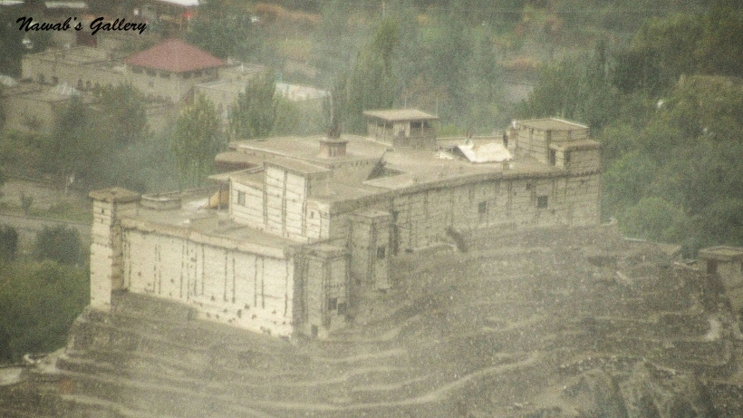
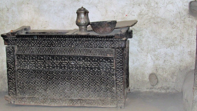
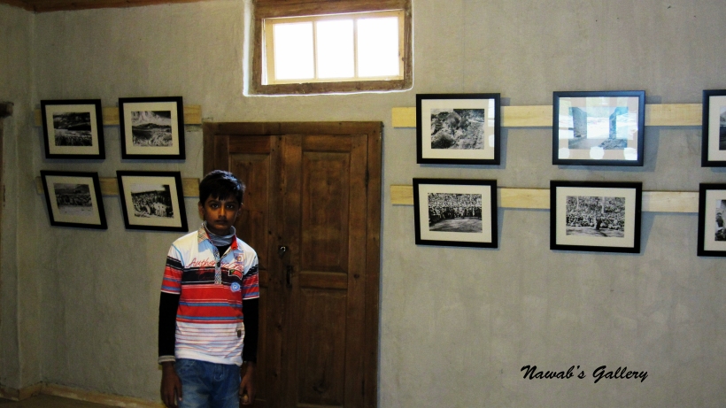
In the evening, our schedule includes a tour of “Baltit Fort”. Baltit is a 700 year old fort and belongs to Mir of Hunza and is counted as World Heritage by UNESCO. Fort is situated at the tip of a cliff and one need to climb up to the emplacement. The walkway to the fort was amazing itself, on the way we were greeted by the residents of ‘Baltit’ who were sitting alongside the street holding their daily tea and discussion. Many stores and houses exist on both sides of the route with people engaged in their everyday chores. Enjoying the walk we reached the Baltit Fort, we enter the Fort by paying a nominal fee, the well-trained and knowledgeable team of guides give us a well-planned tour of the facility. Built with bricks, mud and wood painted in red, the fort is also a museum that holds items belonging to the Mir of Hunza. The bird’s eye view of Hunza Valley and the spectacular view of Rakaposhi Peak can be observed in front of the Fort and the Lady Finger and Ultar Sar peak at the back. After having a circuit of the fort we started settling down toward the main Karimabad.
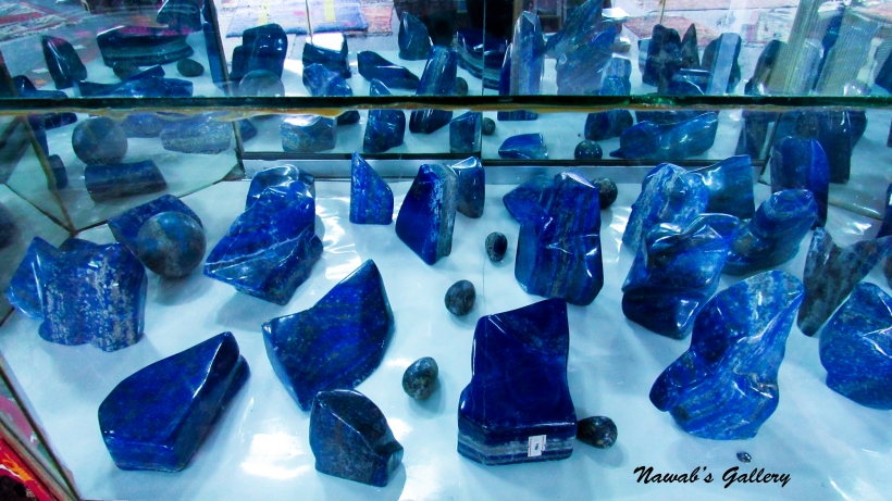
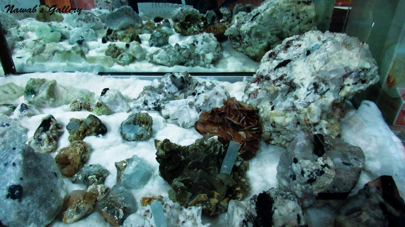
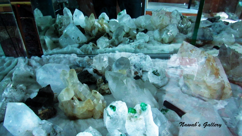
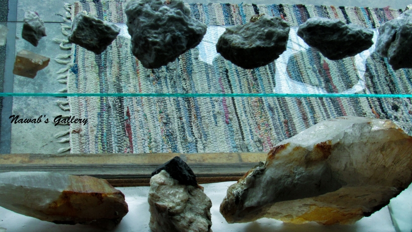
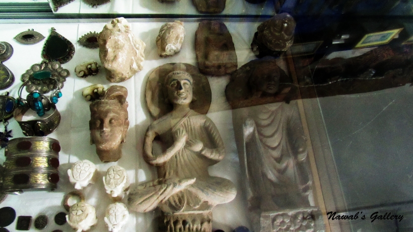
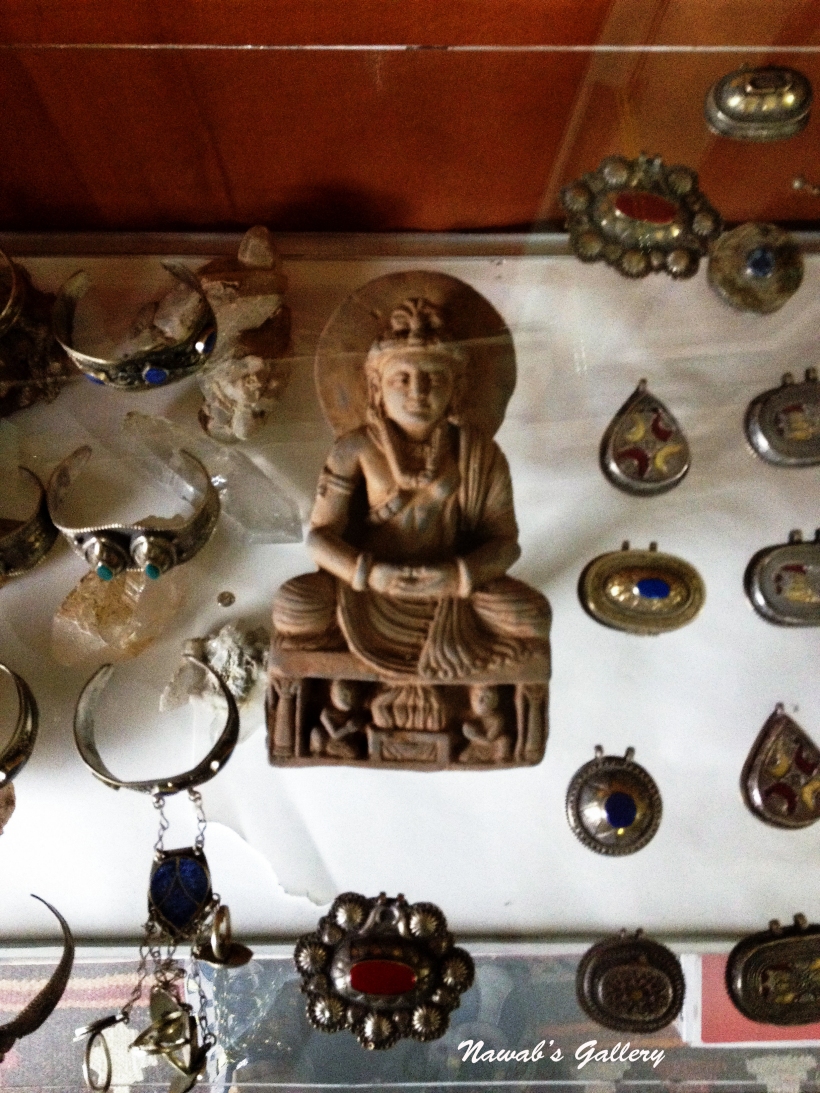
Hunza valley is rich in gems and precious stone there are many stores in Karimabad from where one can purchase these stones, suited according to their birth sign. Thither are many types of gems and stones available in Karimabad, some of them are stones like Ruby, Emerald, Aqua Marine, Sapphire, Tiger Eye, Quartz, Turquoise, Lapis Lazuli, Carnelian (Aqiq), Tourmaline and many others. On the route of Baltit, there is a store by the name “Mountain Art & Gems Gallery”, it is a store with the enormous collection of gems and stones, this shop’s proprietor is a respectful person with tons of knowledge related to gemstones. We purchased many different gemstones from that store, there were also wooden handicrafts in the store that we also bought on a succeeding day. Many statues of “Gautama Buddha” were also there in the store, but they are not for sale and are the collection of the shopkeeper, these are the statues set up during different expedition performed by the shopkeeper in search of the precious gemstones in the nearby mountains.
There were number foreign visitors around this place, they are from China, Korea, Britain, Germany, USA and many other countries. Roaming and shopping around the city and meeting different foreigners we arrive back to our room. We placed an order for the dinner that is of “White Lentils (Daal Mash)” and bread (Chapati) and watched television while waiting at the food court for the dinner to serve. After dinner, we return back to our room and fell asleep after such a fabulous day, with a plan in hand for the coming day.
Today is our 3rd day in the most beautiful valley on earth the Hunza Valley, for the last 2 days, we were exploring Karimabad, the capital of Hunza. We traveled to the marketplace, the Apple, Apricot and Walnut forest, the Baltit locality and the Baltit Fort, also tasted the local bread “Arzooq”. This area is extremely wonderful one can ramble here for hours or can merely sit and savor the beauty of its surrounding. My spouse even visited the local houses in the surrounding and made acquaintances with them and learn about their lives.
Today we hold a plan to explore the other nearby places, including Attabad Lake, Hopper Glacier, Nagar Valley, Confluence of River Hunza and Nagar, Rock Caving by Alexander the Great, Ganish Village and Altit Fort. Since this area is a pollution free with clean and fresh air all around, we always wake up early in the morning. The rising sun creates the surrounding mountains and the area the most spectacle place on land. After a hot bath, we packed our backpacks and went down for the breakfast. After the first experience, we consistently have our breakfast at “Hunza Snack Bar” with ‘Arzooq’ being the part of it. The Hunza Snack Bar is along the main road and the valley can be distinctly viewed from inside the snack bar, there were people walking toward their work on the main road and students to their school and colleges. People here have to walk long distances to reach their destinations as there is less and limited public transport in this area. And we were also walking too much from the time we are here, as we don’t have any sort of conveyance, but the thing we learn from walking is that you can view and observe more and can feel the surrounding and become part of it.
We roamed around for a couple of hours and then went to “Mountain Art & Gems Gallery”, as from there we have the plan to go on a trip around Hunza on the Jeep owned by the shopkeeper. We waited in the shop, the shop is loaded with precious gemstones, handmade wooden items, carpets, apparel and other handicraft items. As shortly as the shopkeeper handed over the shop to his brother we ride on the jeep and our journey toward our first spot the “Attabad Lake” has begun. After driving down from Karimabad we are now traveling on the Karakorum Highway toward China.
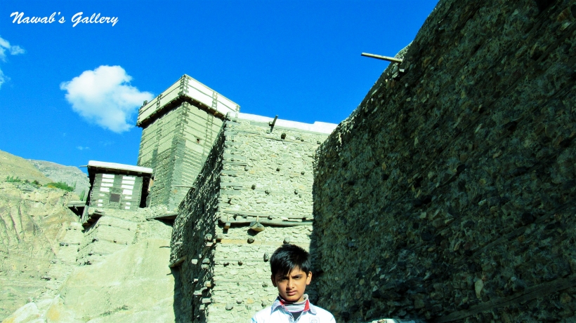
Driving a couple of kilometers we reached Ganish. Ganish is the oldest village in Hunza, with 800-year-old mosques, and is considered the first settlement along the ancient Silk Road. Situated approximately 6 kilometers from Aliabad it has been awarded the UNESCO Asia-Pacific Awards for Cultural Heritage. Ganish consists of sub-villages including Garelth, Chaboikushal, Shukunoshal, Khaii, Buldas and Chillganish. One of the most iconic things of Ganish is it Shikaris (watchtowers) made of wood and stone these towers were utilize in old times to keep watch on enemies.
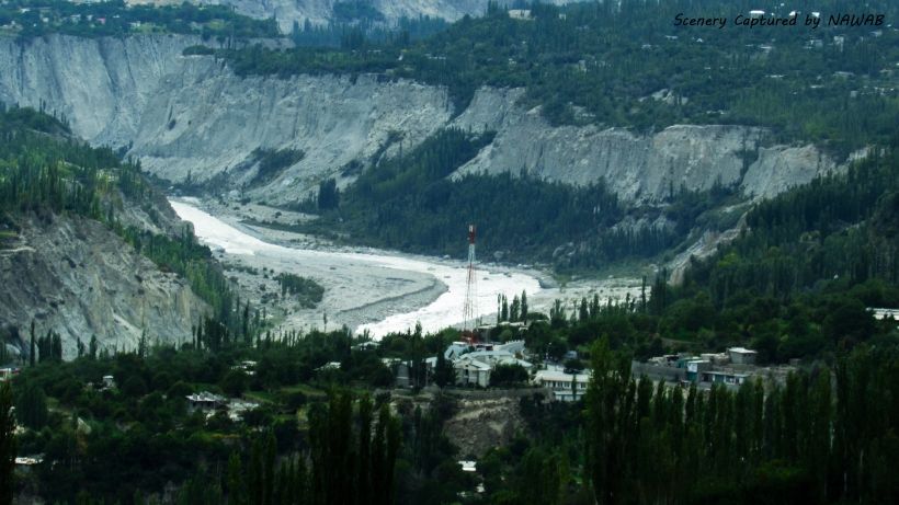
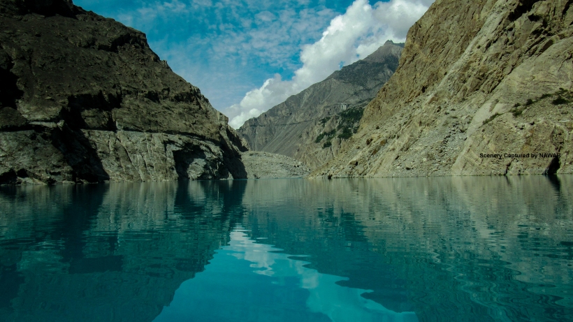
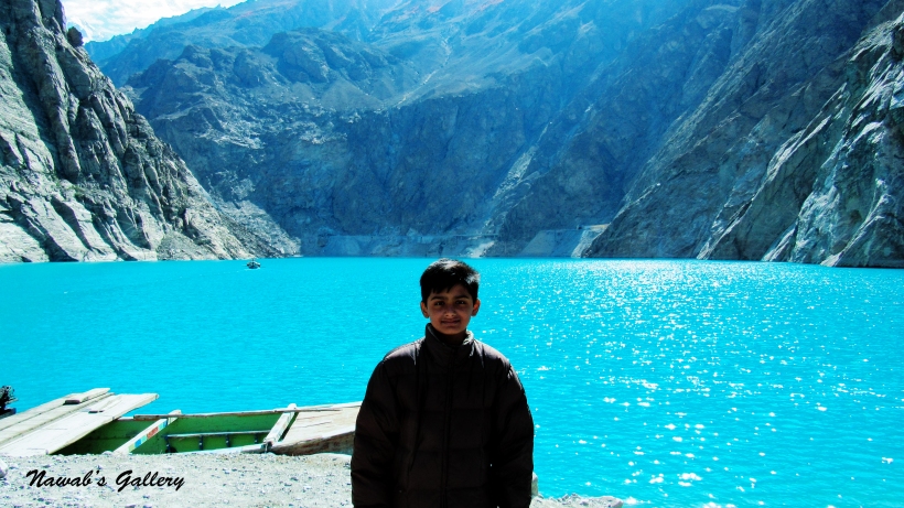
After passing a little time at Ganish we again embarked on our journey toward “Attabad Lake”. “Attabad Lake”, in the valley of Gojal, is created because of water blockage of river Hunza caused by massive land sliding in January 2010. More than 20 people were killed and part of Karakorum Highway was submerged due to this landslide and 6,000 people are displaced from upstream villages. The lake created in this result it is 24 km long, 100meters deep and is at an altitude of 2700 meters, surrounded on all sides by 6000-7000 meter high peaks and glaciers.
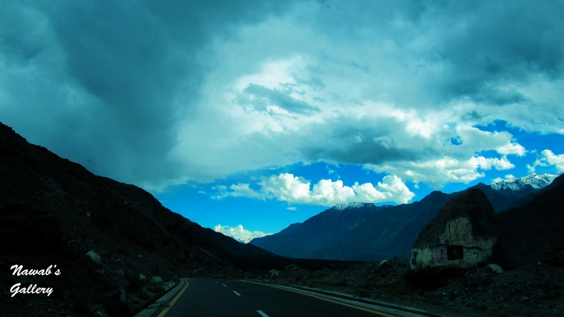
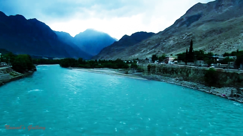
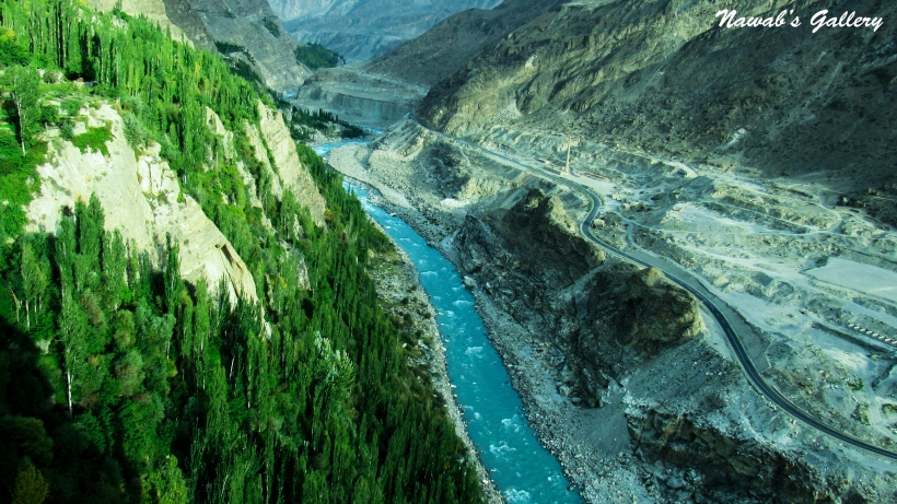
We were traveling on the well-built and well maintained Karakorum Highway with warning signs for expected land sliding at some places. Karakorum Highway is constructed in such a terrain that there are mountains on one side and deep valleys on the other side of the road and due to its high elevation and difficult conditions in which it was constructed, no wonder it is regarded as the Eighth Wonder of the World. And these mountains frequently cause land sliding and damaging the highway at different locations, but this highway is constantly monitored and is reconstructed on an immediate basis. Watching scenic views with Hunza River flowing in parallel along the left-side of the highway we reached Attabad Lake in nearly one and half hours.
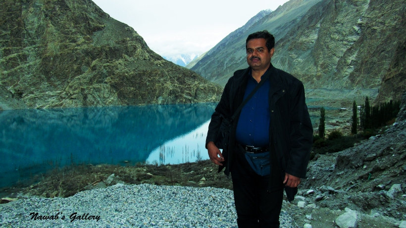
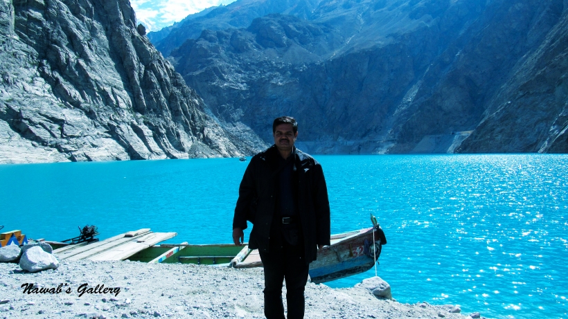
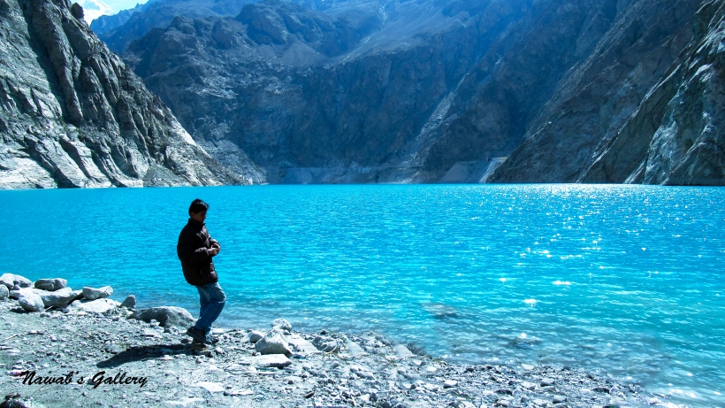
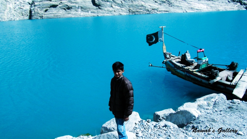
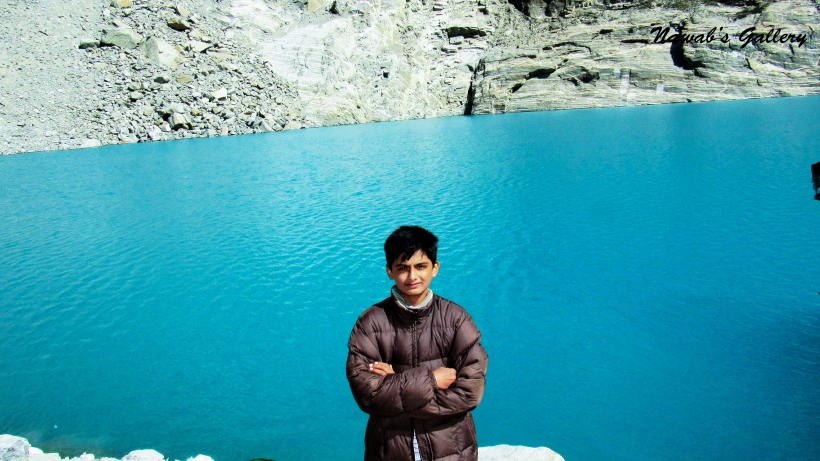
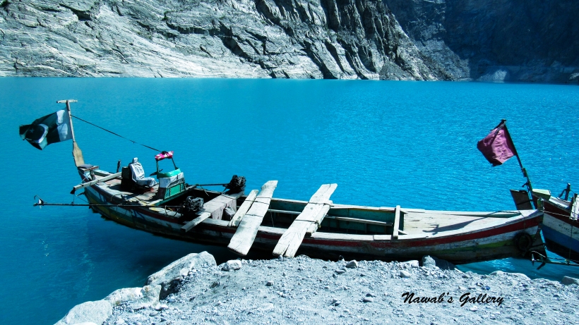
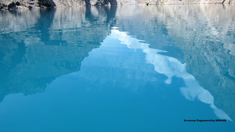
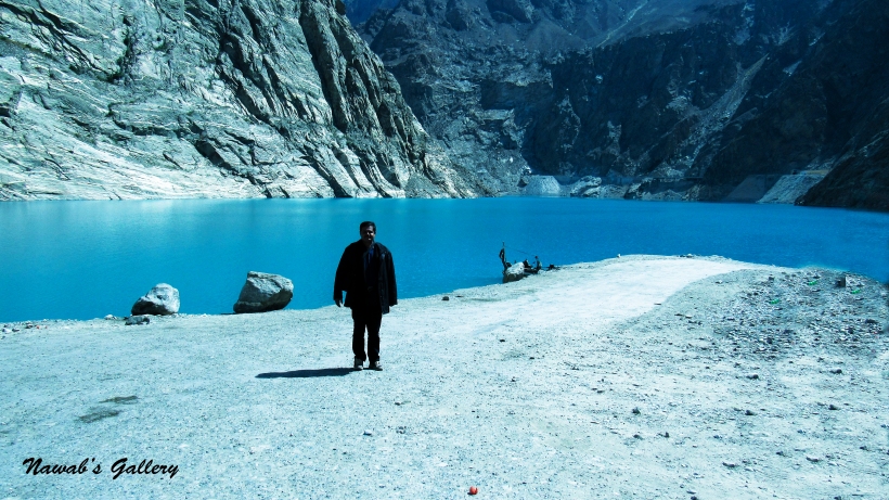
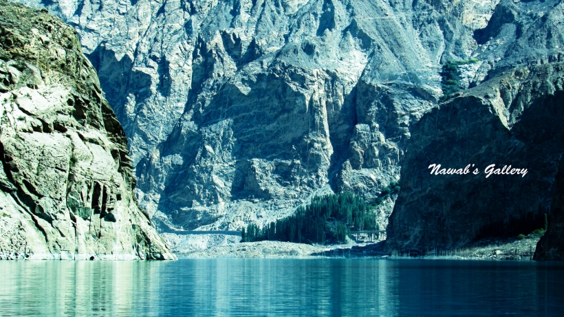
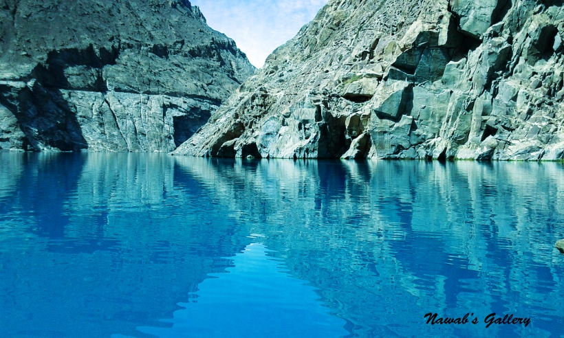
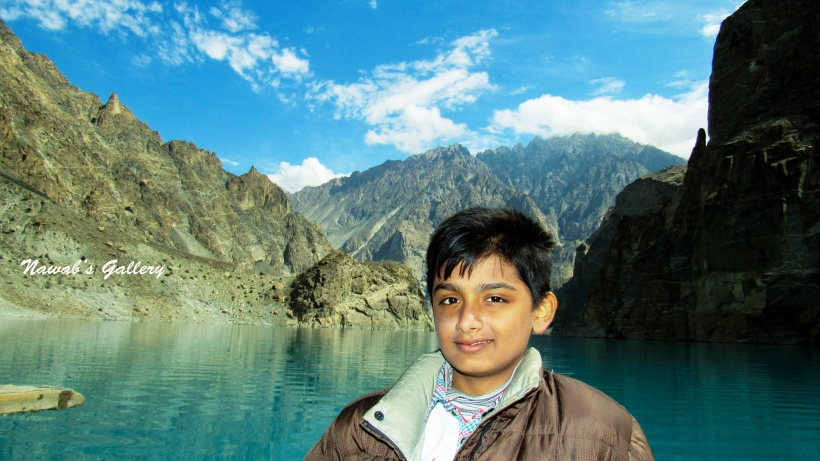
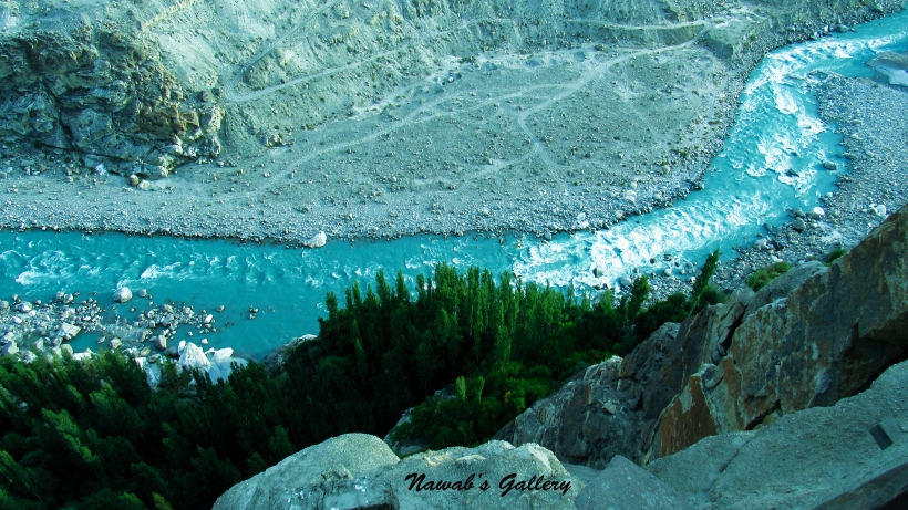
After traveling about 20 KM from Karimabad, on the left side of Karakorum Highway before the Attabad Tunnel, there is a rough and dirt road going down to the lake. Driving half a kilometer along this route we hit a terrific place with a vast lake filled with stunning blue color water, the color we have never witnessed in our life and mighty mountains surrounding the lake. We jumped out of the jeep and sit along the bank of lake dipping our hands and foot in the clear and cold water. The semblance of water is amazingly beautiful, the blue color of water we have never seen before, and so clear that for some distances the bed of the lake is clearly visible, this smoothness of water make it appear like a big mirror in which one can clearly see the reflection of the surrounding mountains.
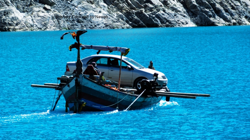
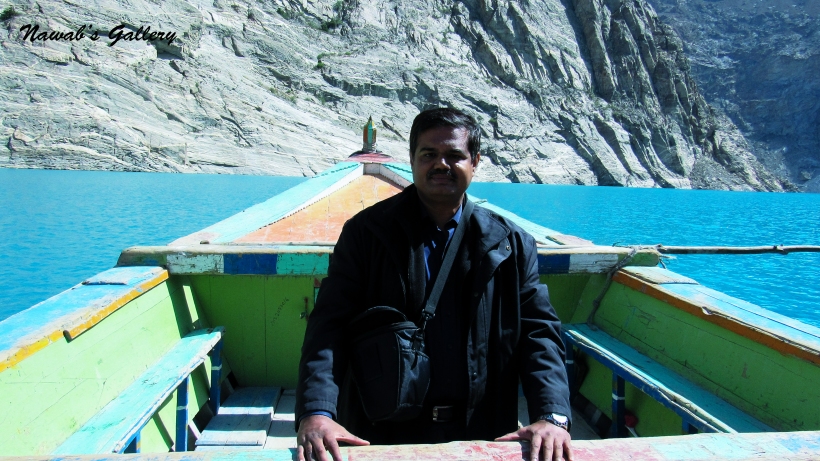
The calmness of the surrounding creates such a spiritual phenomenon that one will find his body so light that makes you feels like being adrift in the air. There were few boats moored up at the lakeside, these boats were used to transport goods and passengers from one side of the lake to the other side before the Attabad Tunnel was constructed few months back. We chose to have a ride on the boat and tour the lake. The boat was motor driven and the sailor was the expert, the tour began and our boat started moving toward Gulmit on the other side of the lake. We were completely excited and enjoying the ride, our boat was sailing along a most exquisite water and fenced by mighty mountains. At a distance we can see part of the Attabad tunnel up high on the mountain, some construction work was still going on in the tunnel and the huge machinery can be seen engaged.
After a spectacular boat ride of half an hour, we return back to the bank of the lake. Capturing the stunning vista of the area in our camera, we hopped back again into our jeep and started our journey toward our next destination “The Hoper Glacier”.
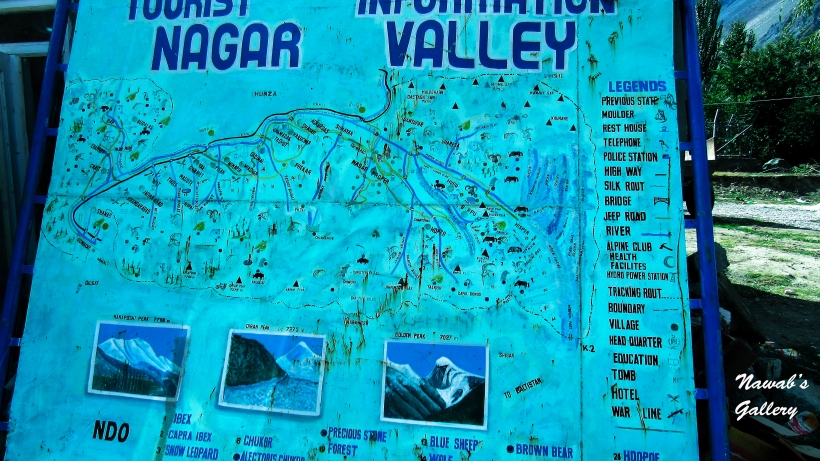
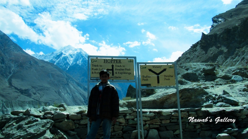
Hoper Valley is a part of Nagar Valley and is at nearly 10 KM from Nagar Khas, the capital of Nagar Valley. Nagar Valley is situated at an altitude of about 8000 feet (2,438m) and is also one of the most beautiful and scenic valleys of this region. Hopar Valley is the site of the Rush Lake, Bwaltar Peak, Kapldongs, Shaltar Peak, Hispar Muztagh, Spantik, Barpu, Bualtar and Hopar (Hopper) glaciers.
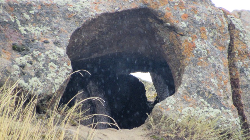
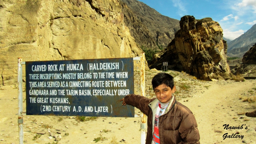
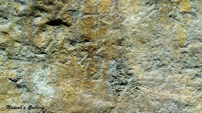
Driving on Karakorum Highway toward the direction of Karimabad, we stopped at the point to see the famous Rock Carving by the Brigade of Alexzander the Great when they traveled on the Silk Route for entering China. There are more than 50,000 pieces of rock art (petroglyphs) and inscriptions all along the Karakoram Highway in Gilgit-Baltistan, concentrated at ten major sites between Hunza and Shatial. These inscriptions, mostly belong to the time when this area served as a connecting route between Gandhara and the Tarim Basin, especially under the great Kushans (2nd Century AD and later). These carving shows single animals, triangular men and hunting scenes in which the animals are larger than the hunters. These carvings were pecked into the rock with stone tools and are covered with a thick patina that proves their age.
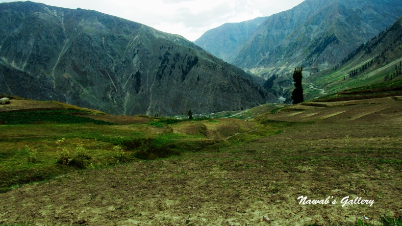
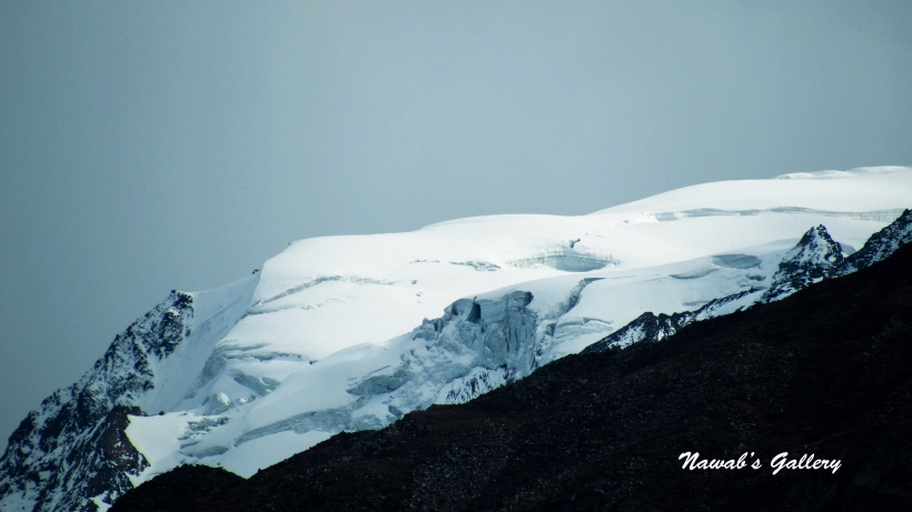
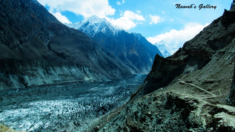
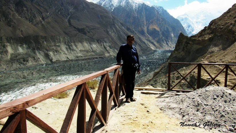
Before reaching the Hunza Bridge on left-side of Karakorum Highway there is another road going toward Nagar Valley. Now our drive is toward Nagar Valley with Hunza River flowing in parallel to the right side of the road. After a couple of kilometers, there is a spot where the Nagar River merges with Hunza River, we did not stop at this spot as we have to reach the Hoper as early as possible. The surrounding panorama of this route is magnificent, on one side is beautiful villages of Nagar and on the other side is the deep valley and snow-covered mountains can be seen at some distance.
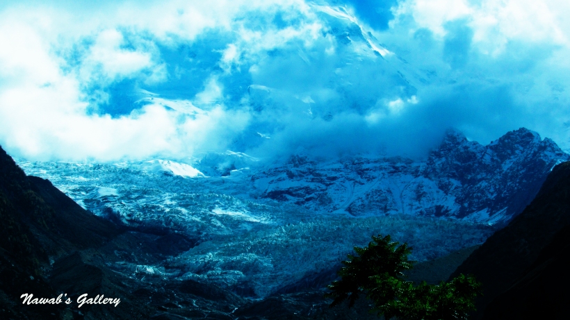
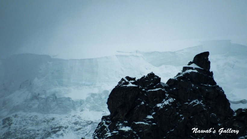
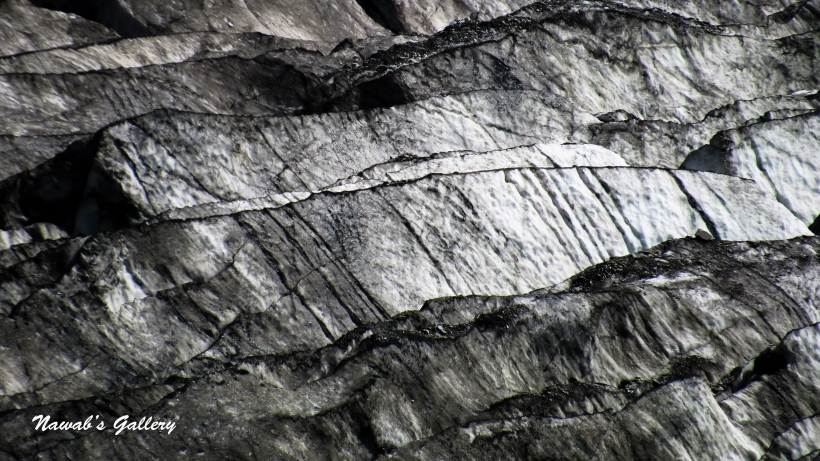
Stopping at Nagar Khas for a couple of minutes, we reached Hoper in 2 Hours. Hoper is a village with lush green plain surrounded by snow covered mountains. We stop at “The Hopar Hilton” hotel and restaurant and the Hoper Glacier can be seen below in a shape of slop coming down from the mountain. We have seen a little portion of a glacier in Naran, but this glacier is so huge. Only solid snow mixed with mud can be seen till miles, this glacier is far below in the valley from where we are sitting. Our jeep driver informed us that it will be of about one and half hour of trek if we wish to get to the glacier, but we choose not to chase down because it seems really tough and exhausting. Thus, we remain at the glacier view point and admire the beauty of the area. The glacier at the place we are sitting is mixed with mud and snow, therefore, look black but the part of the glacier that can be viewed on the mountain is white and neat.
At that place were many foreign tourists from Germany, USA, Australia, China, Korea and other countries who come to this place either to summit the highest peaks, reach the glaciers coming down from the mountains or to camp on the lush green plains along the beautiful lakes. The lakes that exist in between these mountains, like the famous Rush Lake, situated at an altitude of 4,694 meters, it is one of the highest alpine lakes in the world.
We have placed the order for the lunch as soon as we arrived here since we know it will take some time for food to be prepared. Spending about one hour at the glacier view point we return back to the restaurant, the restaurant itself is very beautiful with loads of trees and flowers. After finishing the lunch we simply sit there for half an hour more to admire the beauty of the spot and then began our journey back toward Karimabad.
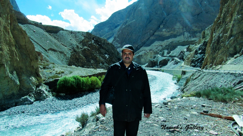
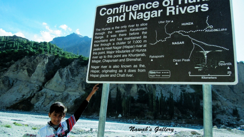
Going along the same route via Nagar by which we reached Hoper and taking some snaps on the way we again turn over at the “Confluence of Hunza & Nagar River” and this time, we stop at this spot to get some pictures. The Hunza is the only river to slice through the western Karakoram Range. It was there before the mountains and has maintained its flow through a cluster of 7,000m peaks to meet Nagar (Hispar) river at this point. Major tributaries of Hunza River up to this point are Khunjerab, Misgar, Chapursan and Shimshal. Nagar River is also known as the Hispar, originating as it does from Hispar glacier and Chalt River.
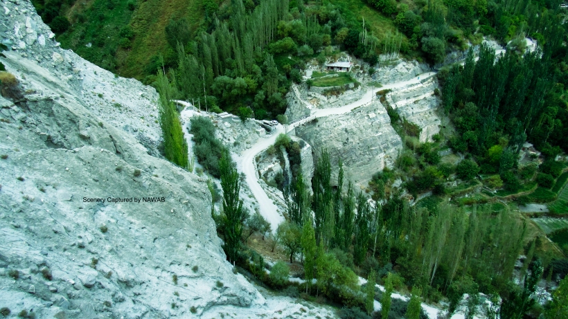
Joining back on Karakorum Highway and crossing the Hunza Bridge our next destination is Altit Fort. Altit Fort is an 1100-year-old Fort built and ruled by then Mir of Hunza in the town of Altit, later they moved to nearby Baltit Fort. Altit means “this side down” and the town is considered to be inhabited by Huns from the Persian Empire around 47 A.D. The fort is built on top of a high cliff and is over 1,000 feet above the Hunza River. The fort is at some 30 minutes’ walk or a 15 minutes’ drive from Karimabad city and is surround by the friendly and courteous population of Altit.
Riding up in the mountains we reach the Altit village in about 45 minutes. At the start of the Altit village, there is a small office where you can buy the ticket to enter the Altit Fort. From that point, we were assisted by a well-trained and knowledgeable guide who provide us the complete tour of the Altit Fort. Walking toward the fort there are many local houses and shops where the local population is busy in their daily tasks. At the entrance of the fort, there is a workshop run totally by the women of the Altit, where they craft and sell handicraft items made with wood. Outside the workshop is a large garden in front of the fort, that garden is planted with grass, pine trees, peach trees and many other types of trees that constitute the environment of the garden a marvelous spot to sit and enjoy the surroundings.
Crossing the garden we entered the fort made of rock, clay, and wood. The fort is well maintained by the Agha Khan Foundation and represents as a museum as well. The guide gives us the tour of every piece of the fort and explains in detail about the history and items present in the fort. The views of Hunza Valley, Karakorum Highway, Hunza River, snow covered mountains and of the other areas seen from the fort is extremely magnificent and breathtaking.
At Altit Fort there were many local and foreign tourists, in them there was a Japanese lady and she asked us to have a group photo with us. After touring the fort we came back to the garden of the fort, in the garden, there is a café that is also run by some really nice local ladies.
After today’s long and marvelous tour we return back to Karimabad. On the way back we bought some bakery items from a nearby bakery by the name “Café de Hunza”. It is a well maintained and nice restaurant in the area, serving a variety of cakes, coffee, and other bakery items. Their specialty Walnut Cake is excellent and must to eat. Very nice atmosphere and friendly staff.
One other fascinating thing in Karimabad is the availability of Pure Mineral Water everywhere. When asked from the locals we were told that this water is coming directly from the Ultar Sar Glacier and is distributed all over Karimabad through pipelines and is used as everyday tap water. The water is icy cold and extremely refreshing. We spend our rest of the day roaming around Karimabad before we got back to our room for dinner and the night’s sleep.
VIDEOs:
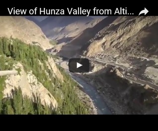
Attabad LakeNagar Valley & Hopper GlacierView of Hunza Valley from Altit Fort
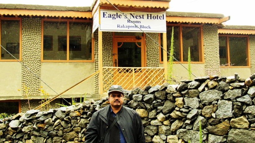
Duikar a village at an altitude of 9043.3 feet (2850 m) is the highest village in Hunza Valley and is above Altit village. It’s at a distance of nearly 11km from Karimabad, about 25 minutes’ drive by jeep or two and half hour walk. Situated in Duikar is famous Hotel & Restaurant by the name Eagle’s Nest and this is our today’s destination.
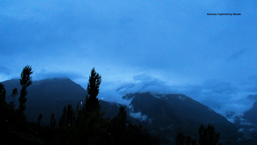
We wake up and went out for the breakfast at “Hunza Snack Bar”, last evening we also had a soup from this restaurant. It was Chicken Soup and was very delicious filled with chicken pieces and egg. We totally enjoy that soup, but in the breakfast, we eat Arzooq, tea, and omelet. The weather was excellent today as the valley is shrouded in clouds and it was dazzling since night. Since we own a rain cover with us, therefore, we didn’t suffer any problem roaming around in the city.
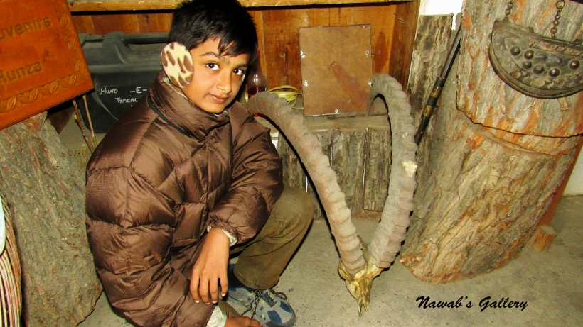
Traveling to different shops talking with the locals, we stop at a store where a carpenter is busy in designing a beautiful door, that door is made of walnut wood and crafting on the door is excellent. Letting the cat out of the bag with the carpenter we come to recognize that all the products placed in his shop, including door, wardrobe, chair, table and all other furniture items are constructed of virgin forest. Going forward, we entered another store by the name “Hunzo-e-Hayan” and this is also a wood craft shop where there are many decoration items as well as daily household use items made of Walnut and Apricot wood. There were also Taxidermy local animals in that store, we purchased some wooden items and proceed onward.
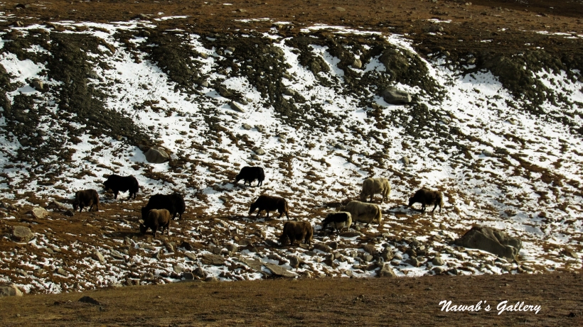
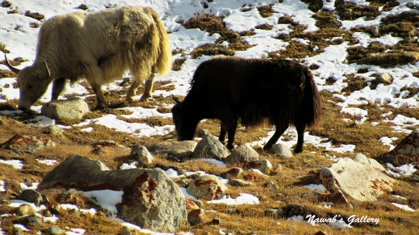
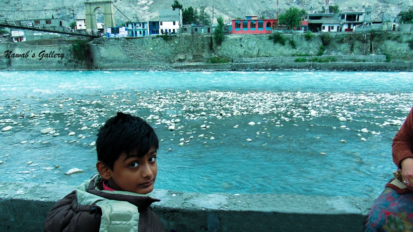
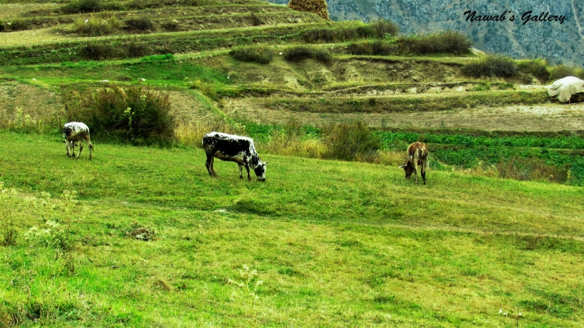
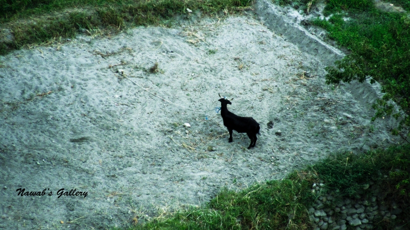
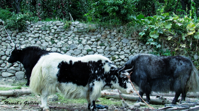
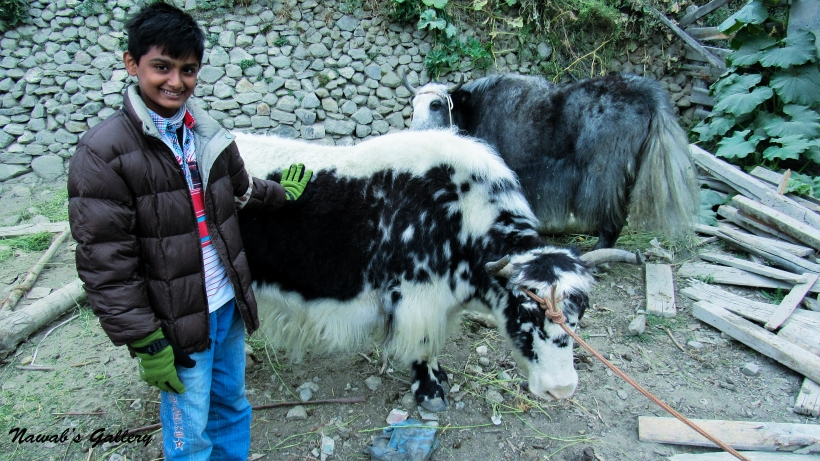
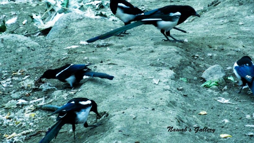
We have seen many different sorts of birds since we came here in Hunza, but the most special and a beautiful bird that we have seen for the first time is “Blue Whistling Thrush”. This bird is big in size with a fascinating blue color. At that place were many flocks of birds sitting all around, we got photographs of those before going along our walk about the city. In that location were also cows, goats, and sheep owned by the locals there, but most peculiar are the Yaks. The yak is a long-haired bull-like animal found throughout the Himalaya region of Southern Central Asia. People of Hunza bread these yaks for milk and essence.
Walking about on feet is the best way to explore the beauty of this region. After having a walk around in this area, we return back to our room. Since today is our last day in Karimabad, after three wonderful days, we packed all our luggage and make ourselves get up for another journey to Duikar, where we will be staying at the Eagle’s Nest Hotel. We already have booked a room at Eagle’s Nest in advance and Mr. Rehman from “Mountain Art & Gems Gallery” will drop us off at Eagle’s Nest in his jeep. After checking out at Hotel Blue Moon we shift all our luggage in the jeep and started our journey to Duikar.
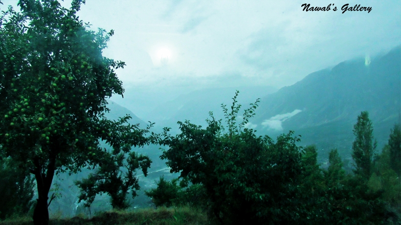
The route to Duikar is very beautiful with trees and water streams on the way and since it was still raining the surrounding looks marvelous. The road passes through the Altit village and is ascending up on the mountain. After about 30 minutes of a drive, we reached the Duikar village at 9043.3 feet above sea level. Our jeep stop at the entrance of the Eagle’s Nest Hotel and we immediately run into the hotel as it has started raining heavily. The hotel staff brought our luggage into the reception, the reception was a large well decorated and carpeted hall. The guy at reception asked us about our booking and handed over the keys to the room, he told us to wait in the hall until the rain ends and have a welcome tea. We decided to sit at the corner of the hall from where we can have the marvelous sight of the whole Hunza Valley below and the surrounding mountains above. The tea was tasty and the panorama of the valley was mesmerizing.
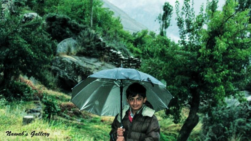
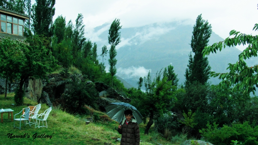
While waiting for the rain to stop, we roamed around the hotel hall and visited different rooms. Adjacent to the reception in the lobby is also store that sells different decoration items, handicraft products, and precious gemstones. We were experiencing a good time, then a staff boy handed us two umbrellas and ask us if we like to go into our room so that our luggage can be shifted. Unfortunately, they only have two umbrellas, but we have coped with it, so if anyone is traveling in a rainy season remember to carry an umbrella with them. We decided to go to the room and freshen up and get changed. The rooms we have booked are on Rakaposhi block, this block is in a marvelous location it is near the edge and there is a beautiful garden in front of the block from where the whole Hunza valley can be sighted below and the mighty mountains surrounding us.
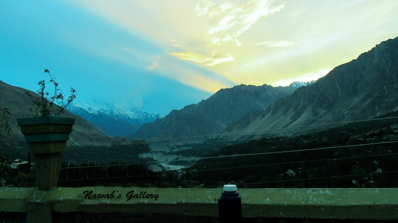
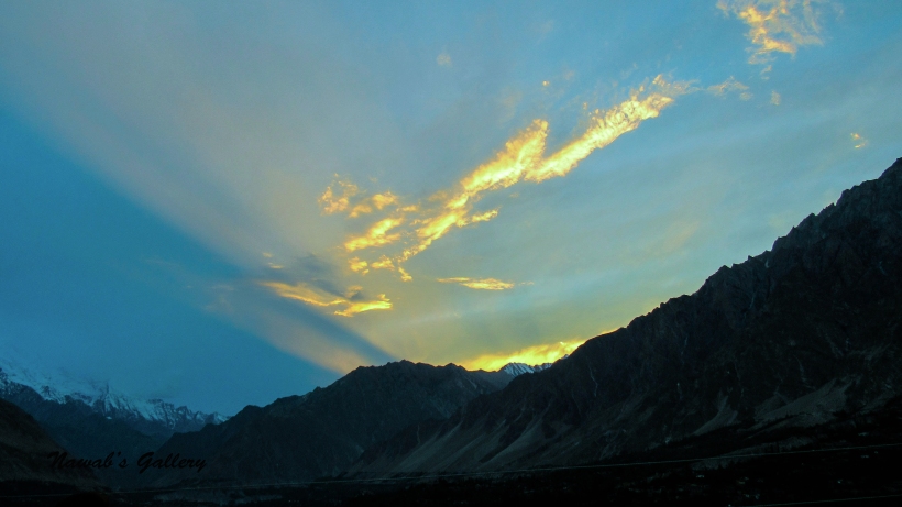
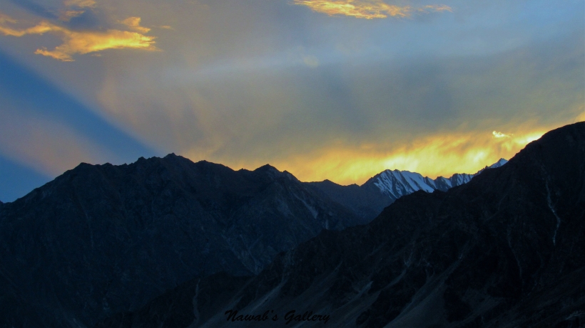
After settling up in our room we came out in the garden that is in front of our room. We can see the Hunza valley below covered with clouds and the Golden Peak, Lady Finger, Rakaposhi and other mountains covered with snow surrounding the valley. The air was fresh but cold, it is still dazzling and we were enjoying every moment of it. Whenever the rain starts heavy we return back to our block under the ceiling and see the stunning surrounding from inside and when it gets low we come out. The time just flies and after the stunning sunset, the surrounding area became dark, the mountains also hide in the dark, and from above here the lights in the Hunza valley can be seen at different places.
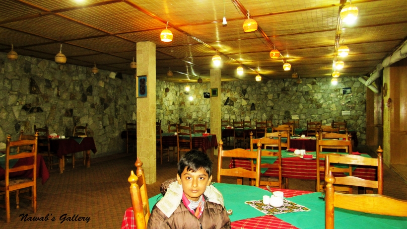
Now is the time for dinner so we went to the reception area and ordered the dinner, the cook told us that it will take some 20 minutes for the dinner to be served. So we sit in the lobby and surf the web, updating our Facebook and checking email. One thing to mention is that there is free Wi-Fi in nearly every hotel, you just have to ask for the password at the reception. At Eagle’s Nest there was some Japanese tourist too, and for them, the hotel offered the special seating arrangement along the floor with little tables for food.
After nearly 20 minutes the food was dished up in the dining area, it was ‘Chicken Karhai’ and ‘Naan’. The food was savored and we all liked it a lot. After dinner, we decided to return back to our room, but there was one problem that there were no lights on walkways between blocks and reception and it was still raining. But we have already prepared for such kind of situation and had a torch light with us that helps us while moving around the area.
We return back to our room the bed was very comfortable, but the night was really frigid. While we were at the reception we asked the staff if they can supply a heater for us, but we were surprised to know that they only have one heater in the hotel and it is already provided to the guests in another room. But they have provided us with sufficient blankets and comforters so that we can sleep with comfort. After discussing the today’s fabulous day and plan for tomorrow we all fell asleep.
Date: 23rd September 2015
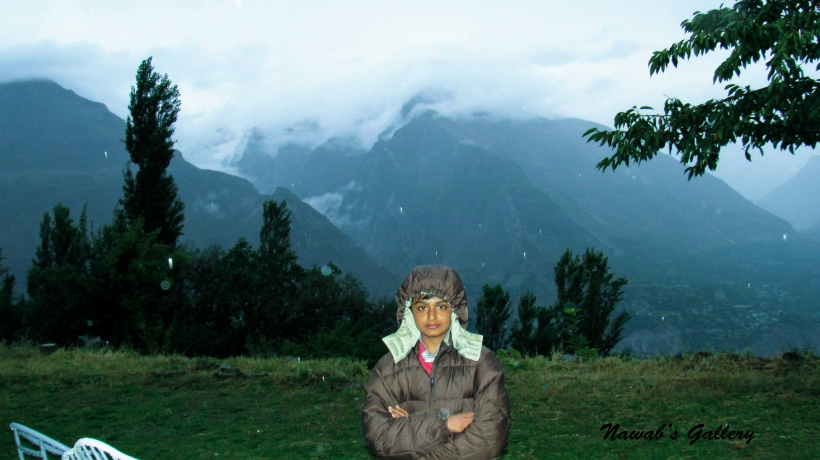
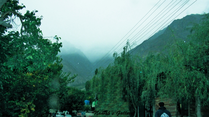
The morning at Eagle’s Nest Duikar was really frigid and it was raining outside. It was continuously raining since we got here in Duaikar and today is our 2nd day at Duikar. The outside view of the expanse from the window of our room was stunning. From there we can distinctly visualize the beautiful valley below in front and the mighty mountains in the skirting. It was the early morning with little sunlight spreading around the area. We got out to enjoy the beauty, fell the fascinating smell and inhale the sweet breeze. The area is surrounded by the clouds and the Hunza valley below is also covered by the clouds.
Spending some time outside and wandering around in the garden we went back to our room for a shower. After a shower and dressing up we went to the main hall at the reception area for the breakfast. Our today’s breakfast is “on the house” and needs to be provided by the hotel, but we were surprised to see that there was no one at the reception nor in the kitchen. We knocked at the door adjacent to the reception and also at the kitchen, but there was no answer, so we decided to sit in the lobby and waited for someone to come. After a while, another guest came out of his room and we started to have a conversation. He told us that he lives in Islamabad and frequently visit this place to admire the beauty and weather of this area. After experiencing that we are waiting for the breakfast, he went to the reception and banged on the door and called the receptionist with a loud voice, and to our surprise, a guy immediately came out of the room. He told the guy at the reception that we are waiting for breakfast and they should immediately serve us the breakfast. He told us that he is a regular visitor to this hotel and knows how to handle these type of situations.
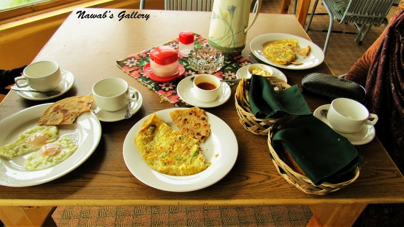
The breakfast was served after nearly 30 minutes, it was an excellent breakfast, it consists of omelet, paratha (a type of South Asian flat bread that is fried in a pan), and half fried eggs, bread slice, locally made butter and locally made apricot jam. The breakfast also included a delicious tea for all four of us. After this savor breakfast, we decided to go outside and visit the surroundings of Duikar. It is still raining and the surrounding was stunningly beautiful. One of the main attractions of Duikar is the viewpoint (2900 m) which is a 5-minute climb up behind the Eagle’s Nest Hotel, from here one can have the best views during sunrise and sunset but because of continuous rain we were unable to view this magnificent sunrise and sunset. We again try to go to the viewpoint, but the path was slippery and the visibility was very low too, so we just roamed around the village, enjoyed the beauty of the surround of the area and then return back to the hotel’s lobby.
I have read many bad things about the manager and the staff of the Eagle’s Nest on different blogs but we have a very good experience here, it is situated in an ideal location from where one can view the whole Hunza Valley below and the surrounding mountains, the Golden Peak, Lady Finger, Rakaposhi and other mountains covered with snow above. The sunset and sunrise are breathtaking. When we reached here it was raining and the hotel offered us with umbrellas but unfortunately, they only have two umbrellas and we are four, so if anyone is traveling in a rainy season do remember to bring an umbrella with him. They also have only one heater in this big hotel, but they have provided us with blankets so we sleep with comfort. One more problem that we face at Eagle’s Nest and the Eagle’s Nest management need to address it is that there were no lights on walkways between blocks and reception, which is making it very difficult to move around in the night. But luckily we have already prepared for such kind of situation and bear a torch with us that helps us while moving in the area. The breakfast and dinner were excellent and at a reasonable price. The staff is very courteous and cooperative, they even helped us to take our luggage to our room and back to the car. Our overall experience is very good, we enjoyed here a lot and my whole family was very happy by visiting this place and will be visiting here again in near future. I recommend everyone visiting Hunza valley to stay at least one night at Eagle’s Nest Hotel especially to catch the sunset.
As per our itinerary, we have to stay one more day at the Eagle’s Nest but because of the continuous rain and extremely cold weather we decided to move to Aliabad, a town near Karimabad. We asked the Eagle’s Nest management to arrange a transport for us so that we can go to Aliabad. In the meantime, we return back to our room and packed our luggage. At nearly 15 minutes our car arrived, we checked out of the hotel and started our journey toward Aliabad.
Travelling on the same beautiful road surrounded with trees and mountains we reached Aliabad in about 30 minutes. The weather in Aliabad is cloudy and pleasant, but it was not raining. We checked in at the hotel in Aliabad, we have a one day stay at Aliabad before we go to our desired endpoint of Khunjerab pass.
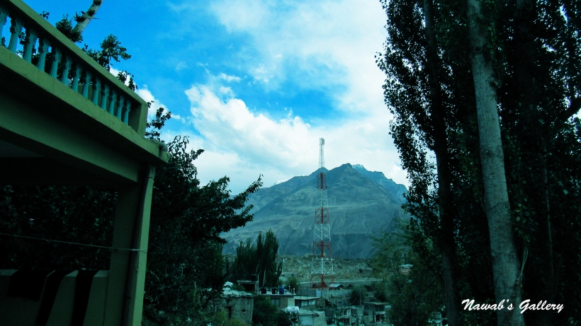
Aliabad is situated on the main Karakoram Highway and is a business and commercial hub of this area. There are many hotels, restaurant, shops, banks and markets in Aliabad. Being on the Karakoram Highway this city is very busy and somewhat more crowded than the other towns in this area. People travelling toward Passu, Gulmit, Gojal, Sust, Khujerab and China mostly break their journey at Aliabad for a rest and night stay. There are many transport companies operating in Aliabad. Many different types of transport like Buses, Coasters, Van and Taxies are easily available here to go to different places in Gilgit-Baltistan and even to Rawalpindi.
The hotel where we were staying is in the main market and we have whole day today to explore Aliabad. I and my son stay in the room for some rest but my wife and daughter immediately went out to the market for shopping. In the afternoon, we had Biryani from the local.
In the evening, we held our tea on the roof of the hotel and the vista of the area from there was marvelous with lush green valley and snow covered mountains surrounding the city and the busy Karakoram Highway below. The environment is not that much calm as in Karimabad and Duikar, cars and coaches moving along the road, people busy in their everyday chores, but it feels so wonderful by sitting on the roof watching the glorious sights and breathing the brisk air from the surrounding.
Finishing the tea we went down to explore the Aliabad city. Aliabad city is along both sides of the Karakorum Highway, adjacent the highway is shops, hotels and bus stops and the residential area is behind the market. Coming from Rawalpindi, we mostly tripped on the Karakoram Highway by jeeps, cars or buses but this is the first time we were walking on the magnificent Karakorum highway.
There was one problem in Aliabad, because of some failure, there was no power supply in the city but our hotel is providing the electricity with generators from 7 PM till 12 AM and we can charge our gadgets during this time. After dinner, we return back to our room and charged all our gadgets and packed our luggage for the big day tomorrow before going to sleep.
Today is a great day, today we have to reach our main aim and final destination of Khunjerab Pass, the Pakistan-China border. The break of the day was cold, we took our luggage and proceeded to the restaurant for breakfast. After the breakfast, we went on the roof of the hotel for the tea and enjoy the spectacular beauty of the surrounding. For our trip to Khunjerab, we hired the same jeep from “Mountain Gems & Jewels” by which we went to Attaabad Lake, Hoper and Altit.
The route to Khunjerab is via Attabad Lake. Attabad Lake is a lake in the Gojal Valley of Gilgit-Baltistan and was formed due a massive landslide at the Attabad Village in January 2010. The landslide created a large dam and blocked the flow of the Hunza River resulting in a formation of 24KM long and 100 meters deep lake, at an altitude of about 2700m surrounded by 6000m-7000m peaks and glaciers. The 19KM (12 miles) part of Karakorum Highway, linking Pakistan and China, was also buried and inundated due to this landslide. The area behind Attabad including Gojal, Passu, Gulmit, Sust, and Khunjerab are totally cut off from rest of Pakistan. The only method to go to the other side is by boats operating at Attabad Lake. And due to this, all goods have to be unloaded and loaded on each side of the lake as there is no other means through the mountains, adding additional cost to the trader’s goods.
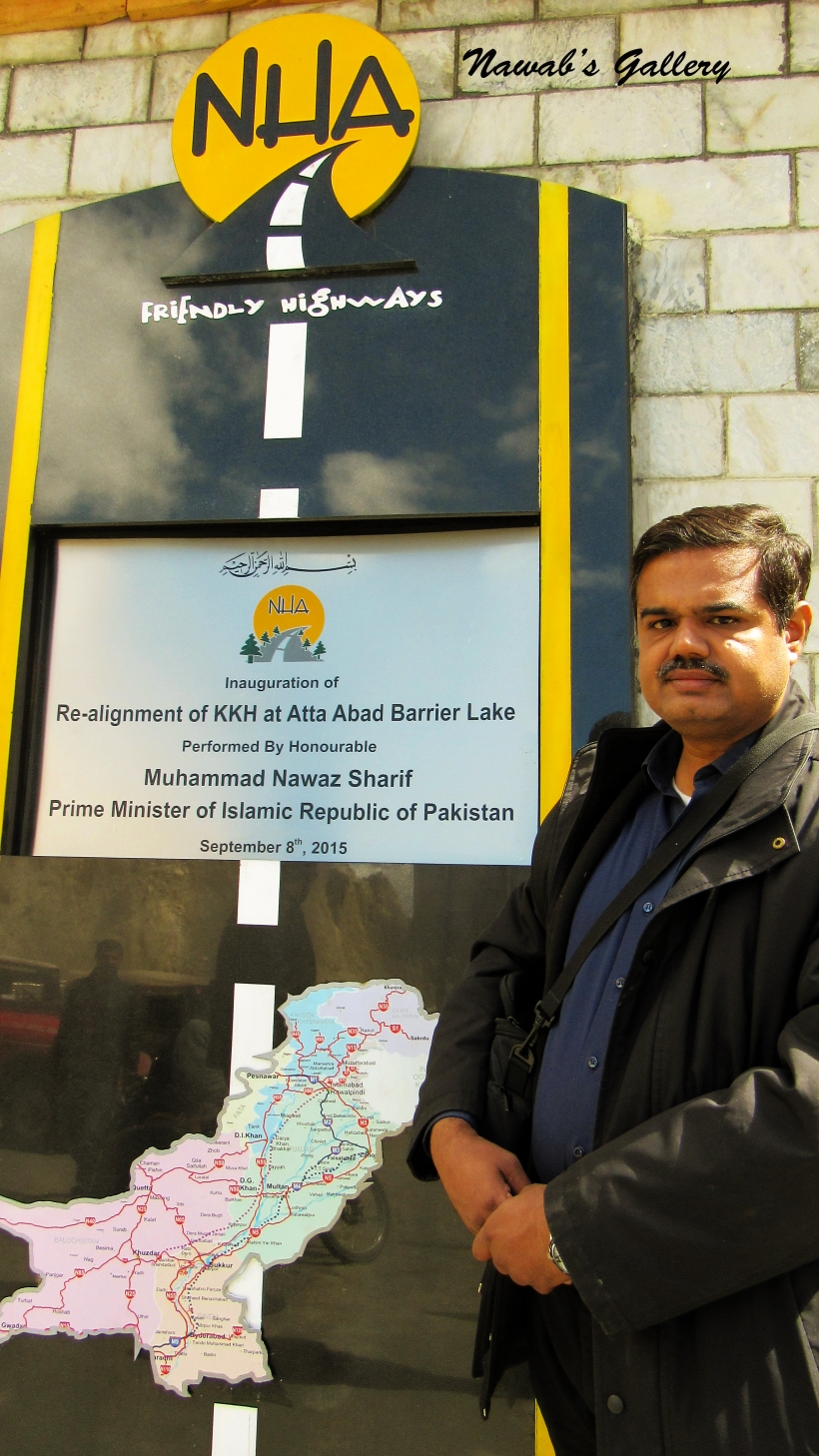
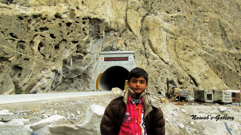
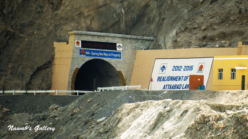
The Government of Pakistan in collaboration with the Government of China started work on the realignment of 24 KM long patch of the Karakoram Highway and was open for the transportation on 14th September 2015. The realignment project is a construction masterpiece consisting of five tunnels with a total length of seven kilometers, two bridges, and 78 culverts. The project restored the road link between Pakistan and China and have been named as Pakistan-China Friendship Tunnels.
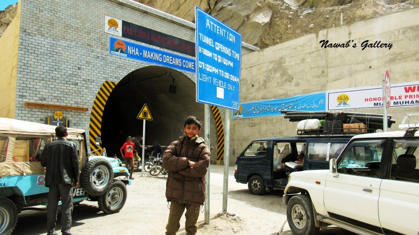
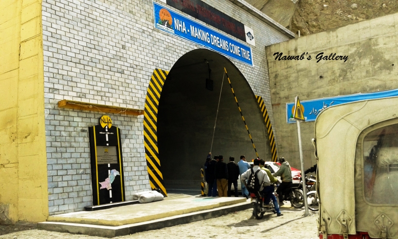
At the time we were visiting that area the realignment project was in its final stages and the tunnels are operational only during the specific period of time for the traffic. To reach Khunjerab it is necessary that we have to pass through Attabad Tunnel and for that we have to wait for the tunnel opening time.
Our jeep arrived at about 10:00 AM to pick us up for the journey. Breaking off at different locations we reached Attabad Tunnel after nearly 40 minutes. The tunnel is still closed for the traffic as we had arrived before the tunnel opening time. During that time, we wandered around in the area and capture some photographs. We have to wait longer for the tunnel to open as there was some clearance work still in progress and instead of 11:00 AM the tunnel opens at 11:30 AM. Our journey begins again and we move in the first tunnel, the tunnel was dark as lighting work still needs to be installed in the tunnel, and to furnish the electricity for lighting in the tunnel a solar farm is built near the tunnel.
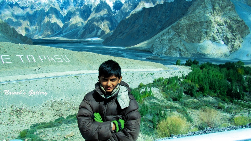
Passing five tunnels with a total distance of seven kilometers and two bridges we come into the Gojal Valley. Spreading over an area of about 8,500 sq.km Gojal is the largest tehsil of Gilgit-Baltistan and is a series of small and large valleys sharing a border with Hunza, China, and Afghanistan. Gojal comprises of nearly 25 villages and Gulmit is the largest settlement and also, a tehsil headquarter. Some of the popular settlements of Gojal include Gulmit, Passu, Khyber, Nazimabad, Sost (Aminabad) Khudabad, Misgar, Shimshal. Except for the Shimshal, Misgar and Chipursan valleys, all the villages of Gojal can be viewed from the Karakorum Highway (KKH) and are easily accessible.
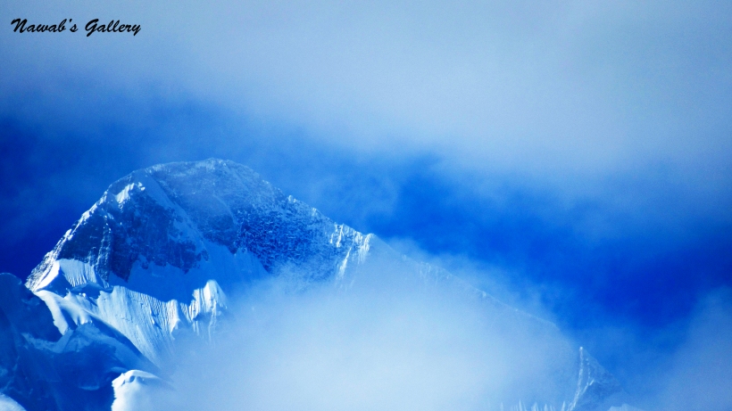
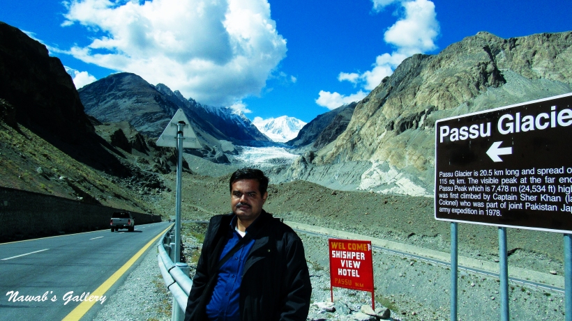
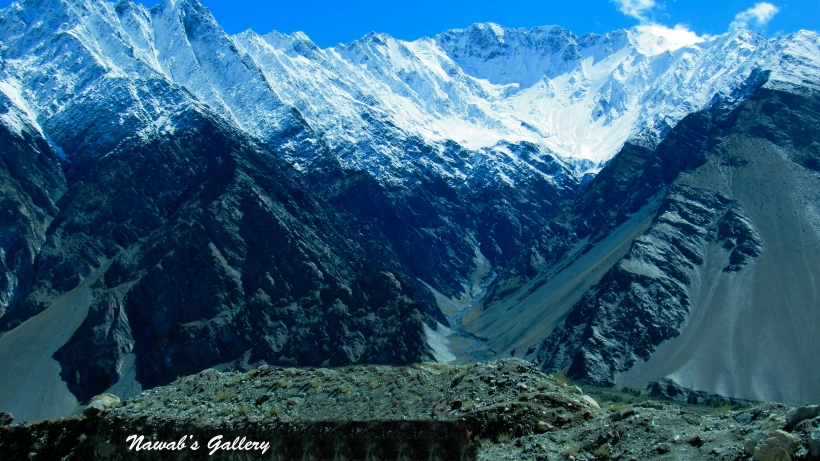
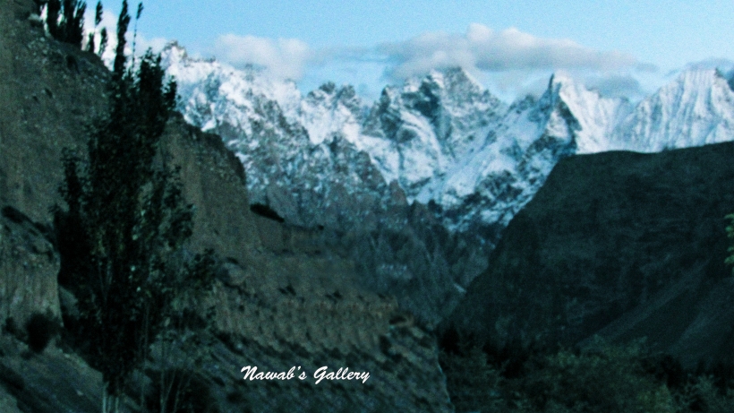
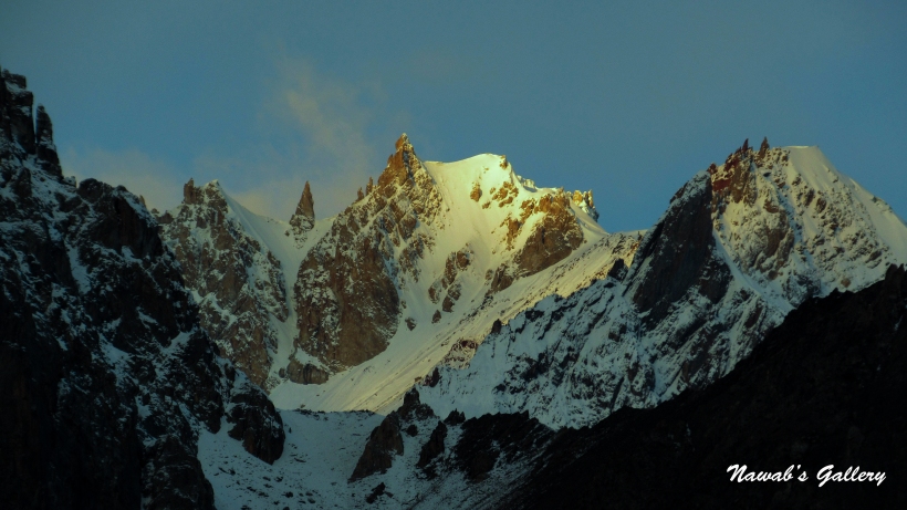
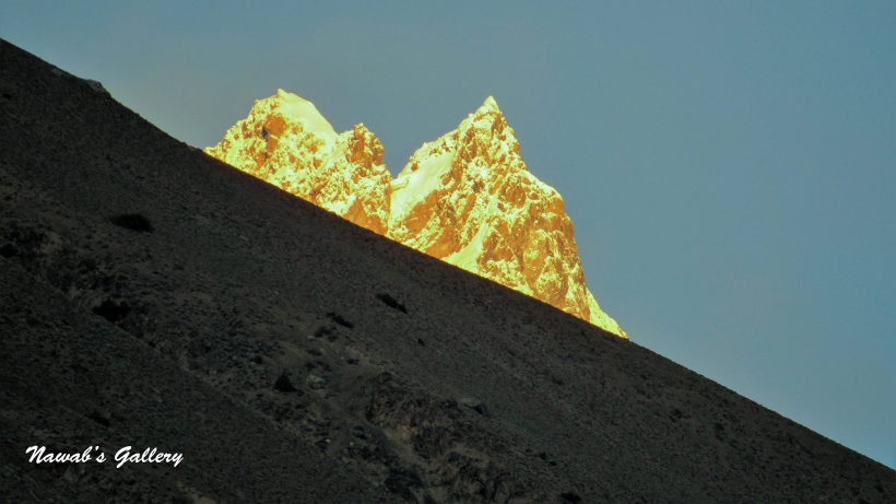
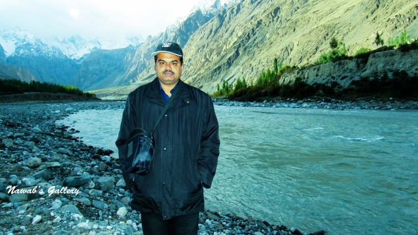
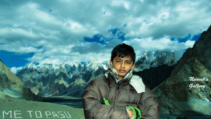
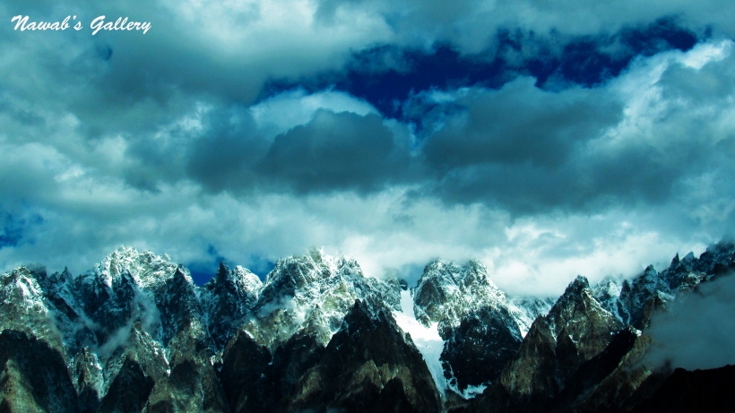
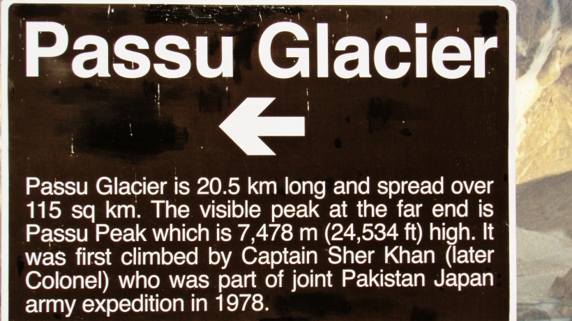
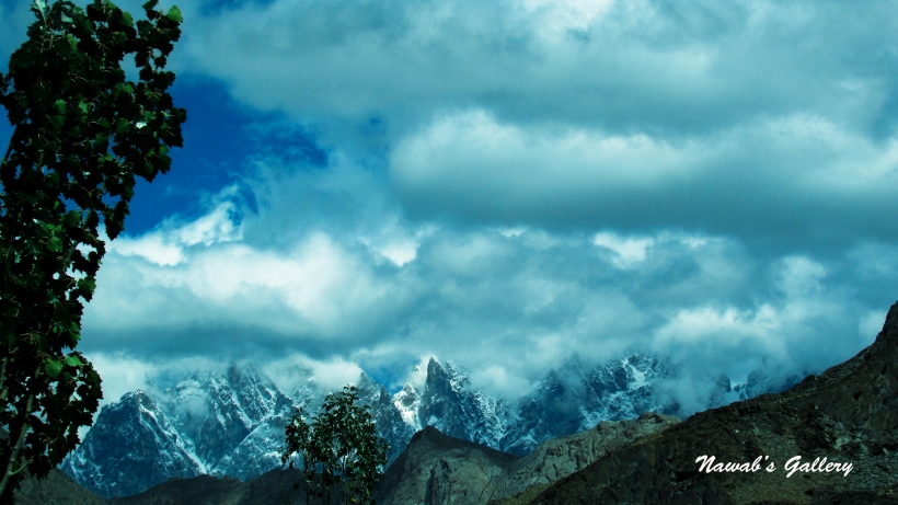
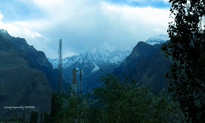
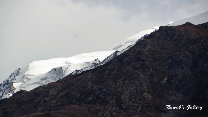
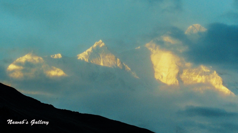
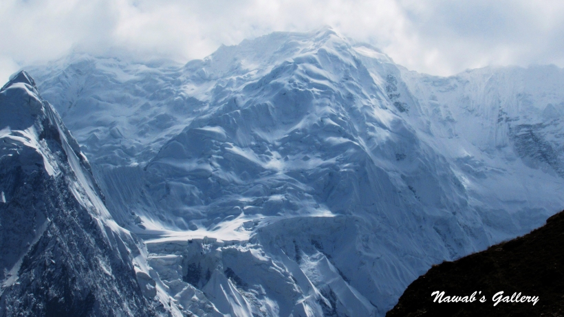
We were travelling on smooth and outstanding highway, with magnificent mountains on one side, the splendid river on the other and the stunningly beautiful area in front. Travelling in between this unspoiled natural beauty and the pollution free environment we reached Passu. Passu is a small village some 15KM from Gulmit. We stop at the Passu viewpoint for the magnificient view of Passu Peaks and the Glacier. Passu Peaks are also known as Passu Cones or Passu Cathedral and is 6,106 meters (20,033 ft.) high. Also nearby are the high peaks of Passu Sar, Shispare Sar, and Bature. Batura also known as Batura Sar at the height of 7,795 metres (25,574 ft) is the 10th highest mountain in Pakistan and 25th highest on Earth, and the 57 kilometres (35 miles) long Batura Glacier is considered as the 5th largest and longest glacier outside the polar region.
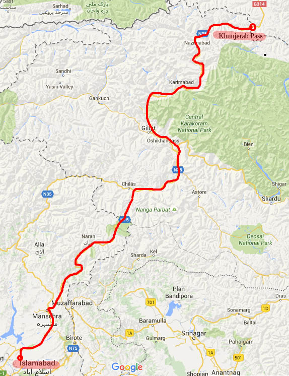
Getting hold of some photographs we took up our journey again toward Sust. We are all extremely excited as we are now moving toward our main target of the whole journey, the Khunjerab Pass, for which we have travelled this far, an approximate distance of nearly 3000KM.
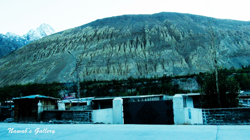
After about 2 Hours and covering 38KM from Pasu we reached the town of Sust, this is the last town on Karakoram Highway before Pak-China Boarder. At 10,000 ft high-altitude, Sust is a custom and immigration point for passenger and cargo transport because all traffic crossing the Pakistan-China border passes through this town. Sust also acts as a dry port between Pakistan and China, facilitating customs clearance and other formalities for goods moving from the Chinese regions of Kasghar and Sinkyang to the commercial centers of Pakistan. A passenger bus service offered by The Northern Areas Transport Corporation (NATCO) operates daily between Pakistan and China. However, the border crossing is open only between May 1 and October 15. During wintertime, the roads are choked up by snowfall.
At Sust there are many shops, hotels and restaurant on both side of the Karakoram Highway, the actual village of Sust is up above the mountains. People travelling between Pakistan and China stop at this place for food and rest, they even stay here a night before going toward their destination. We likewise hold a cup of tea and some refreshment at Sust before starting our journey toward Khunjerab again.
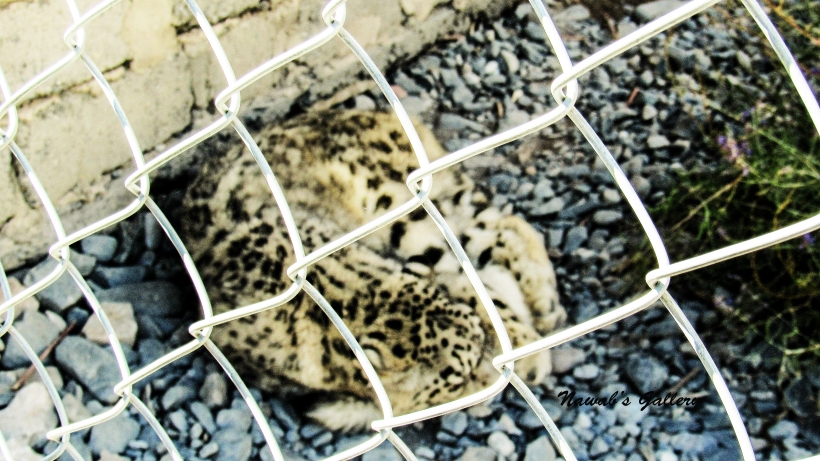
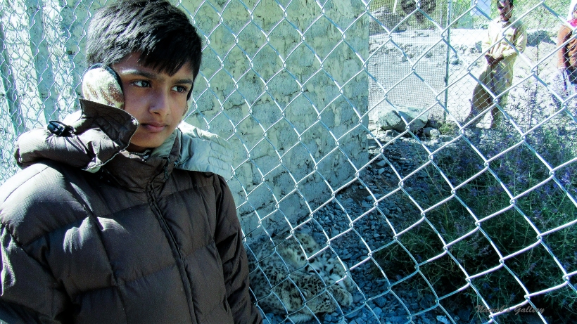
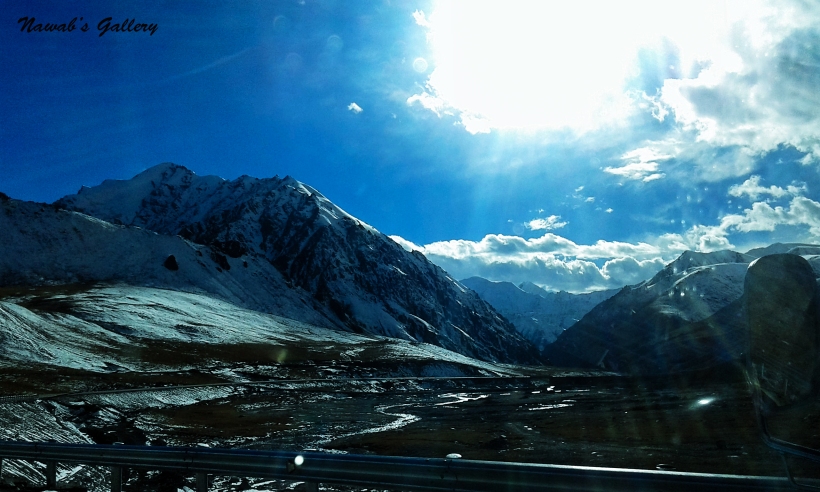
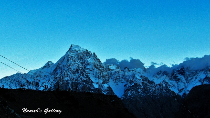
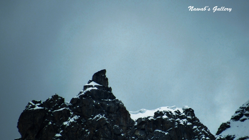
It is the autumn season and the trees are changing colors and creating a brilliant panorama of the valley. Travelling some kilometers along the marvelous surrounding we reached the Khun-zerav National Park (wrongly known as Khunjerab National Park). This park was established in April 1979 primarily as a mean to protect the Marco Polo sheep, which is only found in this area in Pakistan. The other animals inhabit this area are Siberian Ibex, Brown Bear, Tibetan Red Fox, Tibetan Wolf, Golden Marmot, Yak, Markhor and Snow Leopard. Encompassing a total field of 226,913 hectares this park is contiguous to the Taxkorgan Nature Reserve in China. Setting off at an altitude of above 4,000m and going up in the mountains till 4,934m at Khunjerab Pass, this park is considered one of the highest altitude parks in the world. It is likewise one of the most important alpine biodiversity regions within Pakistan.
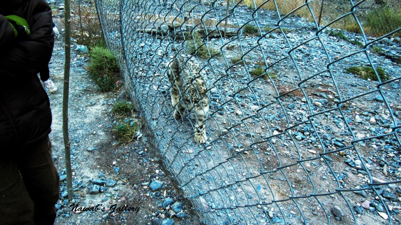
We stop at the ingress of the park to pay a token fee. There they hold a baby Markhor which is being treated for the injuries. Moving around a little we also noticed a snow leopard in a coop. The security person stationed at the park told us that they have rescued this leopard cub from the icy river water from drowning, as it was separated from its herd. And today they are taking good care of him and will leave him back on the mountain as soon as it reached a young age.
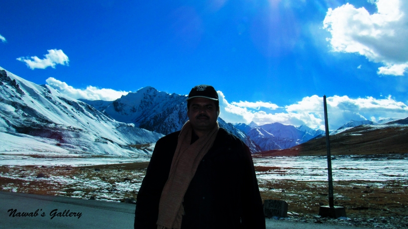
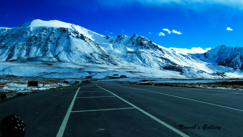
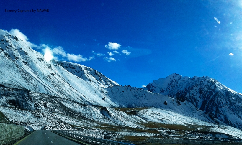
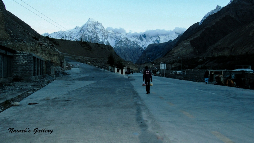
The journey toward Khunjerab Pass again started after grabbing some pictures of the area. We are going along a very scenic route with many streams flowing from the surrounding mountains into the Khunjerab River, the beautiful trees that we have witnessed the first time in our life, snow covered mountains and many tunnels on the highway to protect it from land sliding. As we move forward we were climbing up on the mountains and the snow started to appear on the side of the road. Along the path to the Khunjerab Pass, there was a check post were a security officer told us that it will be very much colder up on the mountains and we should get into warmer clothes, then we immediately doubled our wearing. Khunjerab Pass is nearly 83 KM from Sust and it took us nearly 2 hours to arrive at the Khunjerab Pass.
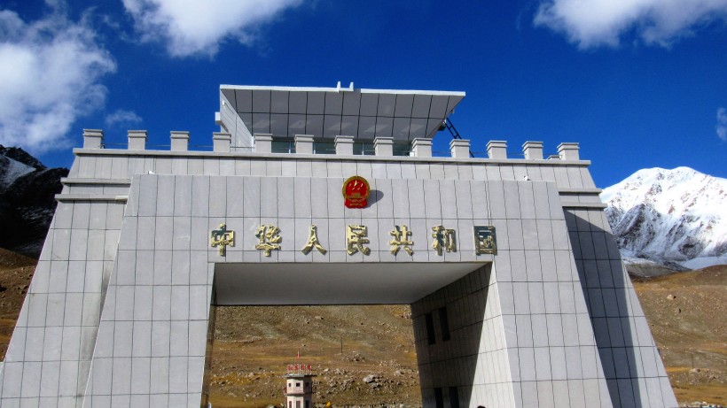
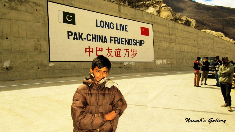
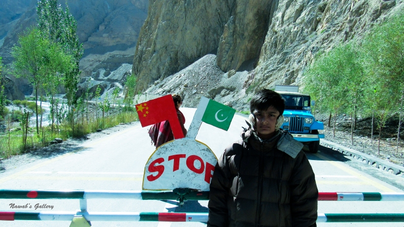
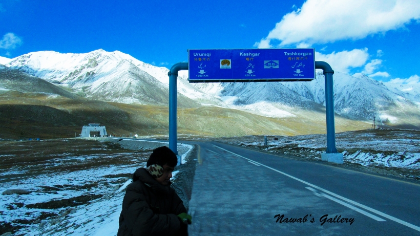
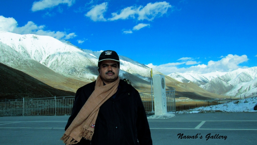
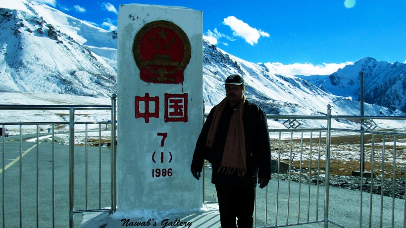
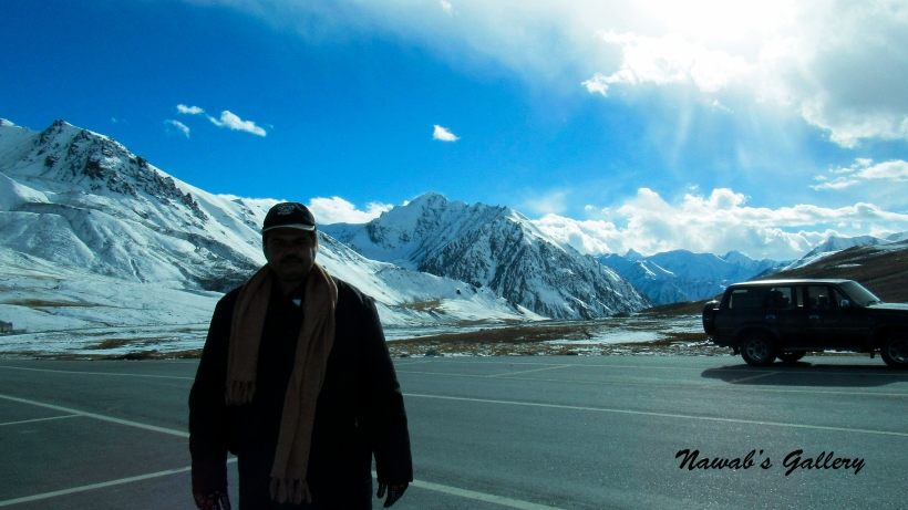
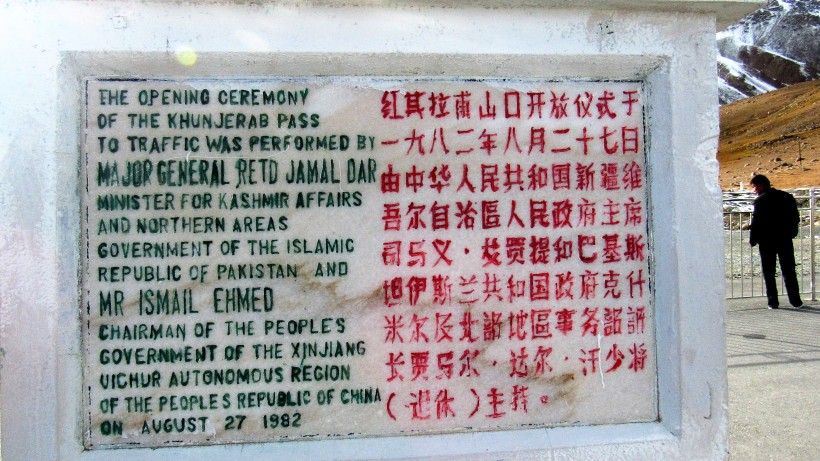
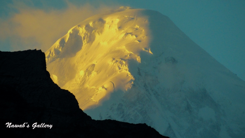
Pakistan and China, the two friendly neighboring countries separated by the highest mountainous range of the world The Karakorum ranges. The only place connecting two countries together over this mountainous range is The Khunjerab Pass, at the altitude of 16,200 foot. Khunjerab Pass is the spot where the Highest Paved international road The Karakorum Highway enters China connects Xinjiang Uyghur Autonomous Region of China and Gilgit–Baltistan of Pakistan. Since this place is at such high altitude, after November the crossing might be closed because of heavy snow. But after April, the pass is again open and can be visited at any time.
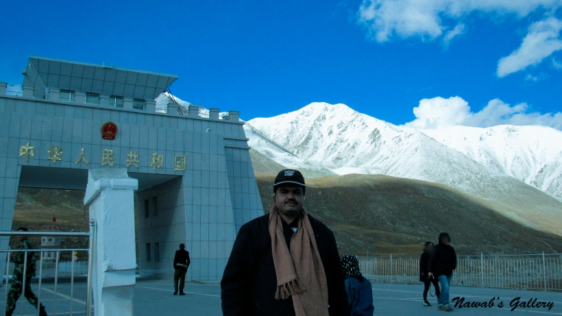
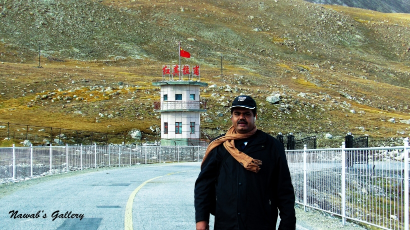
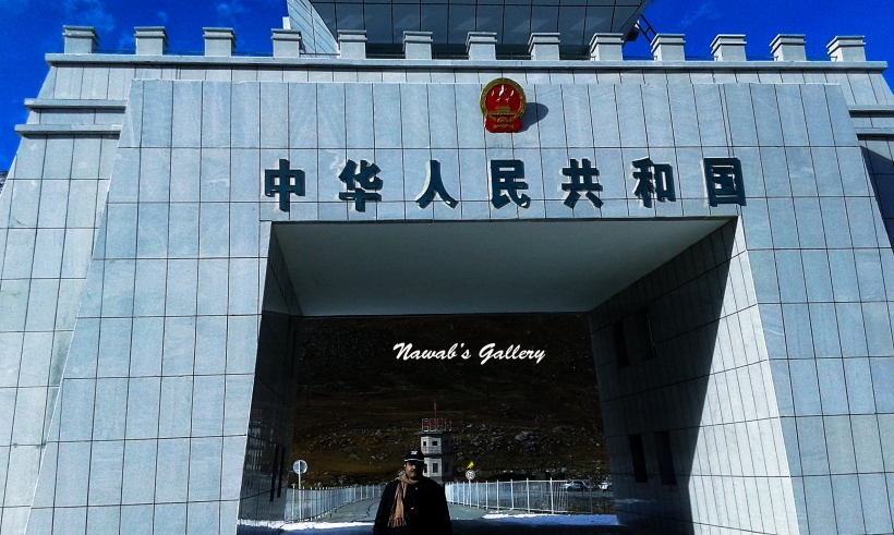
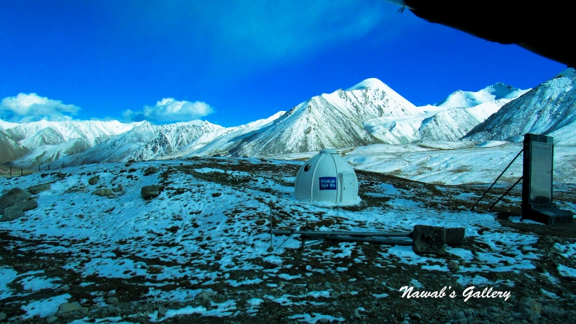
We started out of the jeep and went toward the zero point, this is the place where Karakoram Highway enter the China. As Khunjerab Pass is at 16,200 ft. above one can experience difficulty in breathing at that altitude but we have been eating lots of apricot on our way as apricot provide oxygen to the blood. We are walking on the Karakoram Highway toward zero-point and there is snow on both sides of the highway. Children immediately jumped in the snow and start playing with it. There is a very beautiful monument construct at the zero point between Pakistan and China border, enjoying the cold weather, scenic beauty of the surrounding and awesome panorama of the snow covered mountains we reached the monument. At the monument, there are security persons posted from both sides of the countries and also tourist visiting from both sides of Pakistan and China. We had the photo session with tourist from China as well as with the security officers.
While roaming around and taking photographs we asked the security officer from China if we can just visit the other side of the border, inside china for a few minutes, they allow us for just 5 minutes to go on the other side. We were so pleased, we thanked the officers, and with a brisk walk, we move toward the Khunjerab Zero Point and then entered into the China. With this, our domestic trip has now become foreign tripJ. We walked inside the China till their check post, grab some photographs, children pick up the snow and started playing with it and saying that this is Chinese Snow. With this adventure, we return back to Pakistan side and thanked the officers again for allowing us to enter into China.
As we were relishing the sensational beauty of the surrounding the snow fall suddenly started and the temperature dropped very rapidly with the high breeze. We return back to our jeep and had some snacks and a cup of tea that we have taken with us from Sost. One matter to remember while visiting Khunjerab is that there are no restaurants or shops at the Khunjerab Pass so you have to bring eatables and tea or coffee with you if you desire to hold a picnic at that place.
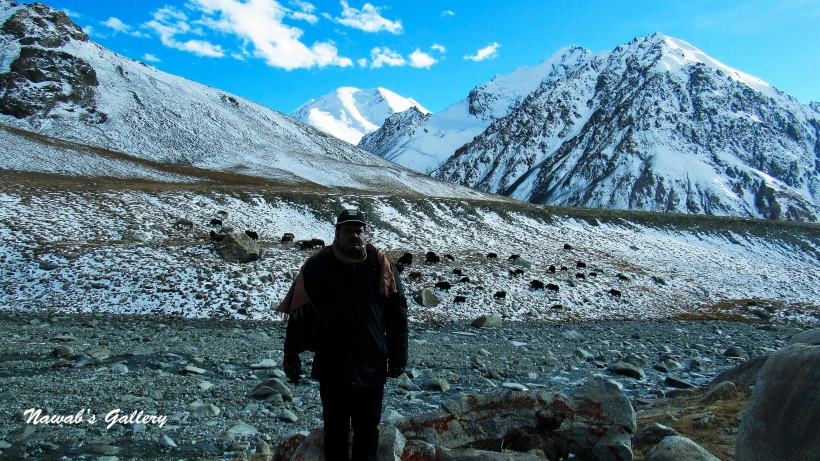
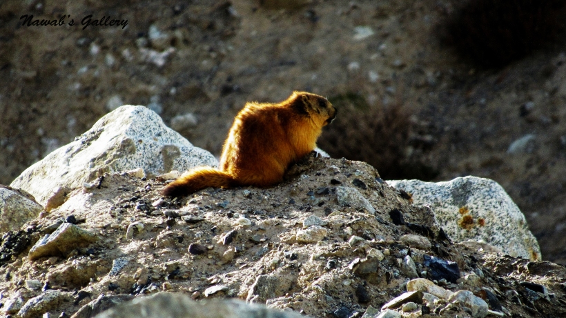
After finishing tea, we embarked our downhill journey back toward Sost from 16,200 feet. Along the way back we stop at many places to occupy in the scenic beauty. At one spot there were many Yaks grazing on the ground along the Khunjerab River and at another spot, there was a Golden marmot sitting on the rock at the side of Karakoram Highway, we also stop to watch Markhors and Ibex grazing high up on the mountain. Many herds of sheep and goats were also moving along the Karakoram Highway these herds belong to the locals living in nearby villages between Sost and Khunjerab.
Travelling along the magnificent Karakoram Highway we reach Sost before sunset. We roamed around Sost market for a while and then we went into our hotel, we opt to stay at Khunjerab Hotel, it is a good hotel situated on a small hill alongside the Karakoram Highway but a little outside the Sost main area.
Yesterday we experience a great day at Khunjerab (Pakistan-China Border) as it was our goal and reason for traveling this far, and now our return journey back to Karachi is started. We spend our night at the Khunjerab Hotel in Sust, it is a decent hotel with courteous staff. One thing we were missing there was Wi-Fi and there were no mobile signals on that point as well.
Me and my son wake up at dawn and got out of our room to admire the beauty of the surrounding. While wandering around in the front garden we can observe the Hunza River flowing at a little distance down the hill, so I and my son decided to walk to the bank of the river. Crossing Karakoram Highway we walked toward the river, the path to the river is very rocky and making it difficult to walk. But we walk slowly and manage to get to the river bank, the sound of the running water makes it feel very pleasant. The water was really icy, so we decided to stay away from it. Getting hold of some photographs we return back to our hotel again after about an hour.
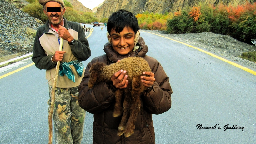
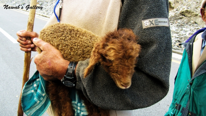
As my wife and daughter were awakeed too, we proceeded to the hotel food court for the breakfast. Completing our breakfast we packed our luggage and started our journey back toward Hunza. Our journey again started on marvelous Karakoram Highway along with the Hunza River. Today is a great day for residents of Pakistan and also for this area of Gilgit-Baltistan as today is Eid-ul-Adha, the animal sacrificial day, followed in the tradition of the Prophet Ibrahim.
It is a day here at Hunza when people wearing colorful dresses visits mosques (Prayer House) and community halls. Children were also playing and running around as there is a public holiday. Some people were taking their animals to the sacrificial ground. In this area, animals can only be sacrificed in a designated area and the meat is distributed among the people of this area. We saw that all the animals that are being taken for the sacrifices must be covered with white cloth. Upon asking our driver told us that this is a tradition that all animals dedicated for scarifying must be covered with white cloth as a symbol of the coffin.
The weather was tremendous, the cold wind was blowing but as we were descending from the high altitude the temperature is also getting better and it’s not as frigid as it was in Khunjerab and Sust. Continuing along this route between Khunjerab and Hunza, there were many stunning scenic views where one can break and admire the beauty of the skirting.
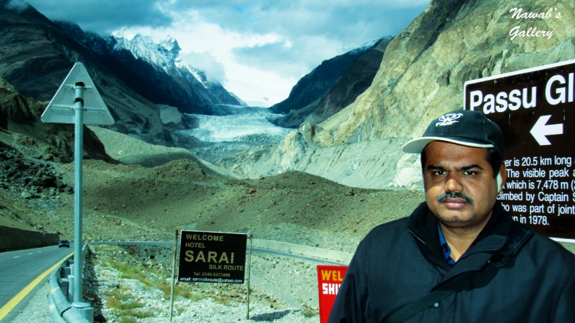
Our first halt was at Passu Peaks and Glacier viewpoint. This is a place from where one can understandably experience the view of Passu Peaks and its glacier. We had the plan to reach Passu Glacier but our driver told us that it will be hard for us to reach there, especially with the kids and instead of going to Passu Glacier it is better that we visit Borith Lake, and then we decided to take in some photograph at Passu View point and then go on our journey toward Borith.
After crossing Passu we stop at a spot where there were hotels and a very little population, I forget its name, but our driver told us that this population is constructed on a glacier and below this glacier the earth is continuously moving and slowly flowing like a river.
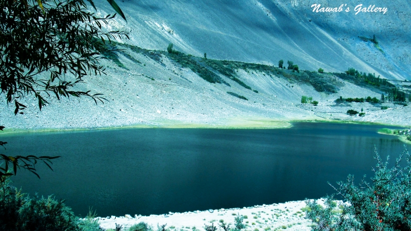
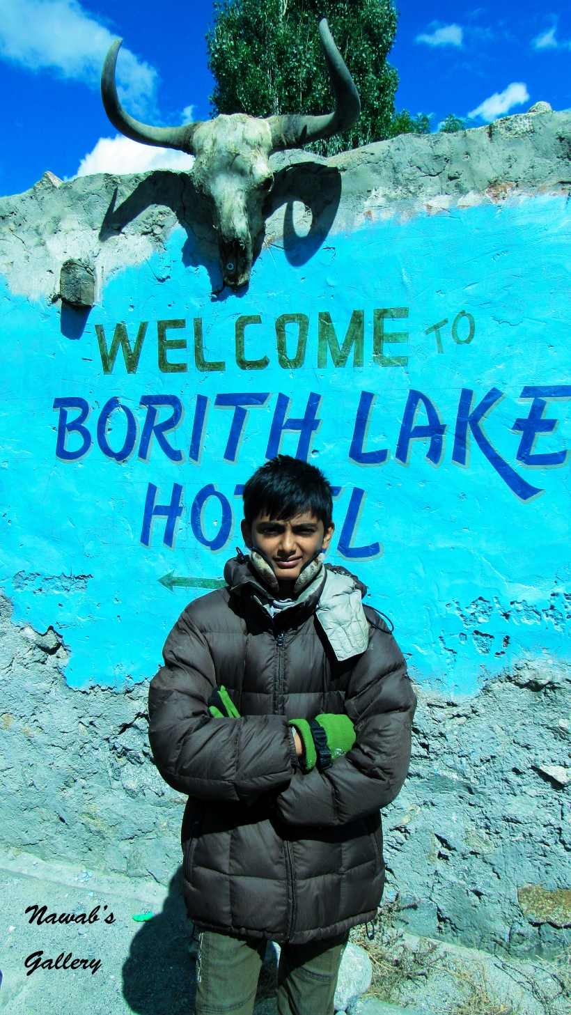
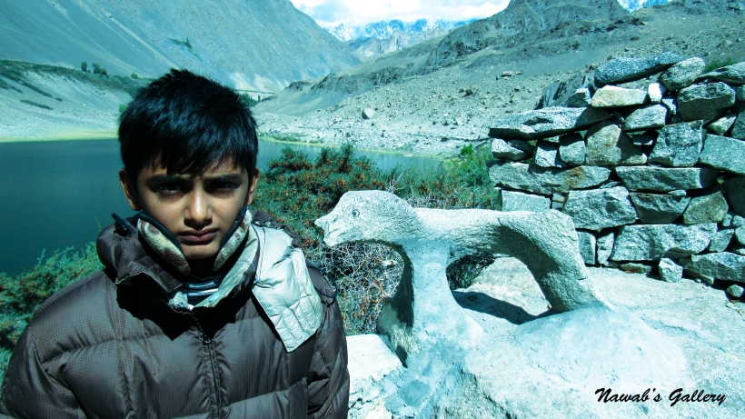
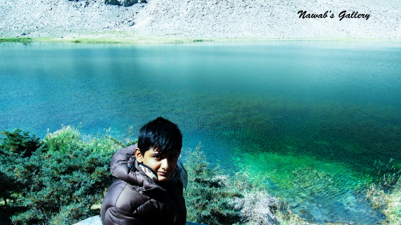
At Hussani a village near Gulmit, there is a rough & dirt road extending up on the mountain and heads to the Borith Lake. The lake is an important bird sanctuary for migrating wildfowl (ducks, geese and swans). The best time to see these migrating birds is between the months of March and June, when they make their way to the cooler climates of Central Asia and between September and November, as they return to the warmer parts of southern Pakistan. Once this lake was an important hunting ground for the Mir of Hunza during winters particularly for birds. On a nearby hill a small house was built for the Mir which is now converted to a hotel known as Borith Lake Hotel.
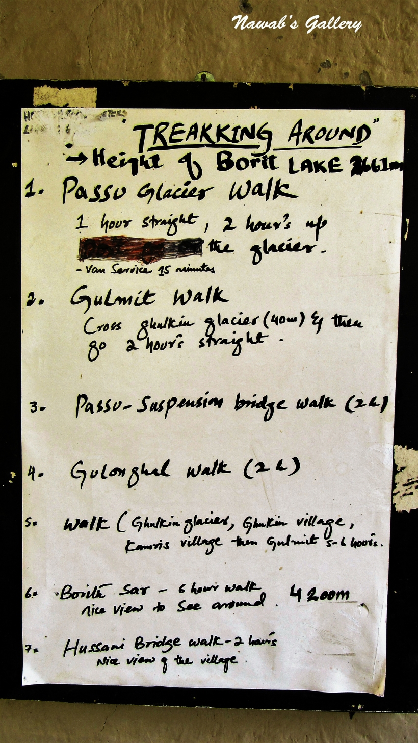
Going on an unpaved jeep route we reach Borith Lake at an elevation of 8,500 ft. (2,600 m) in nearly 30 minutes. Our jeep stopped near the Borith Lake Hotel and from there we have to trek down a little to get to the lake. The area was too peaceful and beautiful, we sit around the lake and adored the peace and calmness of the surroundings, and enjoyed a tasty cup of tea. The guy at the hotel told us that on that point are many treks starting from this lake, like the trek to the famous Passu glacier that is about 1 hour straight walk and then a 2 hour walk up to the glacier. The other walking trails lead to Ghulkin glacier, the famous Passu-Suspension Bridge, the Borigh Sar peak (4,200 m) and the most dangerous rope bridge in the world “Hussaini Hanging Bridge”.
Winding up the tea and enjoying the marvelous panorama we again embarked on our journey. Going along the same unpaved route we join the Karakoram Highway again. We bear to reach Attabad Tunnel before 1 PM as after 1 PM the tunnels will be closed for building work. Without breaking off at any place we reached Attabad Tunnel and stop at the Gulmit side of the Attabad Lake just for some photographs. And then after continuously traveling we reached Aliabad at noon. Agreeing to our plan, we have to spend a night at Aliabad before going to Gilgit but since we take in scads of time in our hand we mutually decided to proceed directly to Gilgit.
At Aliabad, our jeep driver helped us in arranging transport till Gilgit. Since it is Eid day, there is very less transport available in Aliabad. Only after some searching we were able to find a coaster how agreed to take us to Gilgit. We shifted all our luggage into the coaster and our journey toward Gilgit is started.
All of us are sad as we leave the Heaven on Earth, the most beautiful place we have seen in our life, The Hunza Valley. Our journey toward Gilgit started on Karakoram Highway with the stunning scenic view of the valley in front and the mighty snow covered mountains on both sides.
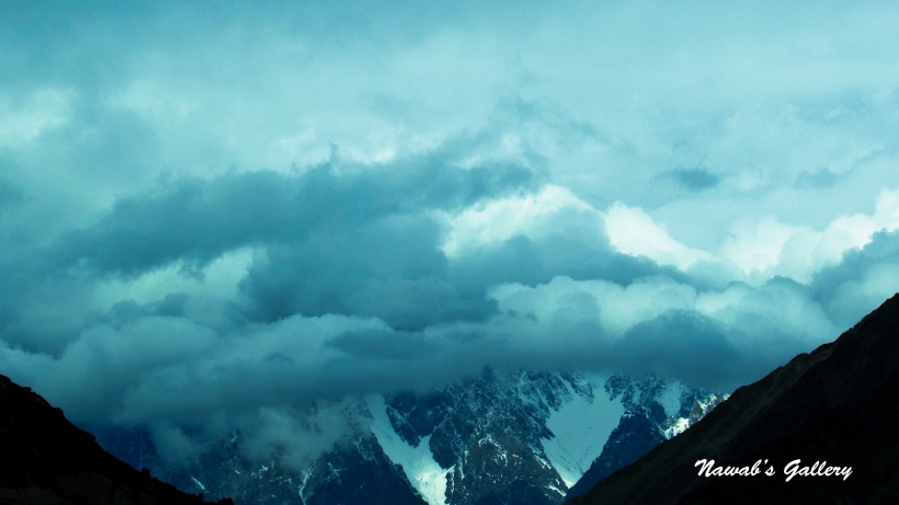
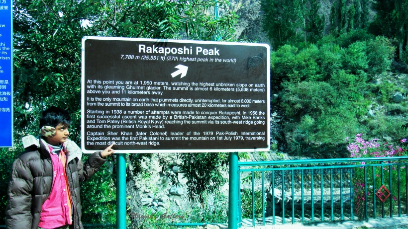
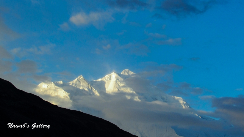
Traveling toward Gilgit we stop at Rakaposhi view point. Rakaposhi also known as the crown of Hunza & Nagar Valleys is the 12th highest peak in Pakistan and the 27th in the world with a height of 7788 meters. It is the highest unbroken slope on earth with its gleaming Gulmet glacier. The summit is almost 6 kilometers (5,838 meters) from Karakorum Highway. It is the only mountain on earth that plummets directly, uninterrupted, for almost 6,000 meters from the summit to its broad base which measures almost 20 kilometers east to west.
From this spot the complete aspect of the mountain, along with its peak is clearly visible. Thither is a restaurant, some tuck shops and a gems & handicraft shop too. Cold and clear water is flowing from the glacier, we sit along the stream to enjoy this marvelous place. We have put an order for the tea and decided to hold it in the sitting area adjacent to the cold water stream.
After finishing the tea our journey toward Gilgit again started. Crossing many small cities, beautiful valleys and mountains we reached Gilgit city in the evening. Gilgit city is situated at an elevation of about 4,800 ft. (1500 meters) and is the administrative and commercial capital of Northern Areas. Fenced in by the massive mountains of the Karakorum ranges this city has been an important city in earlier history too, as being along the important Silk Route which passed through this urban center. This city also serves as a main hub for the tourist visiting Northern Areas, as everyone has to first reach this city before heading toward different directions including Skardu, Hunza, Astore, Diamer and even China. Gilgit is served by the Gilgit airport with a flying time of about 55 minutes from Islamabad.
This is our 2nd visit to Gilgit city as we have already spend a night in Gilgit while traveling toward Hunza. We choose to stay at Taj hotel which is located near the famous N.L.I market in Gilgit. It is a really decent hotel with courteous staff. The location is great too with the famous N.L.I market, Gilgit River and the historic Konodas Bridge at a walking distance from the hotel. With neat and comfortable rooms this is a very good hotel to stay in Gilgit. The airport is at an easy access too. In that respect is also a decent restaurant with a fine dining area within the hotel, where one can sit and savor the food while discussing the plan or merely viewing the television. There was free Wi-Fi and also a tv in every room and it was really interesting watching the local Gilgit-Baltistan channels, which offer us lots of info regarding this area. Hot water was also available 24 hours. We stay there for two days and found it very comfortable. After putting our luggage in our room we went out and just walked on the road before coming back to our hotel for dinner and the night’s slumber.
We wake up after a comfortable sleep at Taj Hotel in Gilgit where we arrived yesterday from Sust the last town of Pakistan before china. We are all so excited and frequently keep on discussing our marvelous trip to Khunjerab that we have completed but at the same time, we are sad too, as we have left the “Heaven on Earth”, Hunza Valley. Children are insisting that they do not desire to move back to Karachi and reside at Hunza instead.
Gilgit is the capital of Gilgit-Baltistan and a tourist hub. The city is at an elevation of 4,800 ft. (1500 meters) and is fenced by the massive snow covered Karakorum ranges. Today is the 2nd day of Eid in Pakistan, hence all the markets and stores are still shut and there is very limited transport available in the city. We decided to have breakfast at an outside restaurant so we went out on the road. First, we travelled toward Sadar Bazaar and find out that there are no shops open neither any restaurant along that street, we walked till the Gilgit River and rest at that place for a while. Gilgit River is a tributary of the Indus River and starts from Shandur Lake. The total course is nearly 240KM (150 miles) and flows past the town of Gilgit before joining the Indus River.
We were starving as we didn’t have our breakfast yet, so now we travel on Col. Hasan Road toward Airport road in search of a restaurant. There were many restaurants on the road, but all of them are closed. Reverting back to our hotel where we are staying we were glad to find a Sweets & Bakery shop, from that shop we bought some snack and instant noodles for the kids. At our hotel, we ask the hotel staff for the tea and at last had our breakfast after such a long search.
After breakfast we stay in our room watching TV and talking about our tour. It was really interesting watching the local Gilgit-Baltistan channels, which offer us lots of info regarding this area. There were many different channels broadcasting local shows and programs and one channel is continuously broadcasting programs related to different tourist sites and beautiful surrounding of Gilgit-Baltistan region.
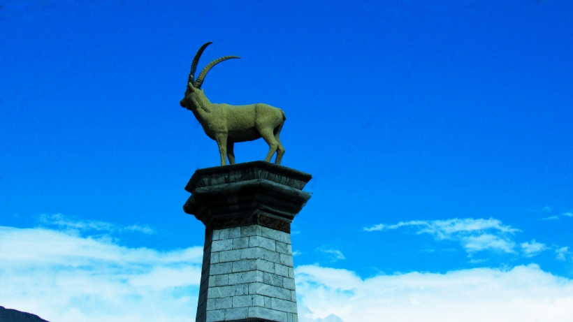
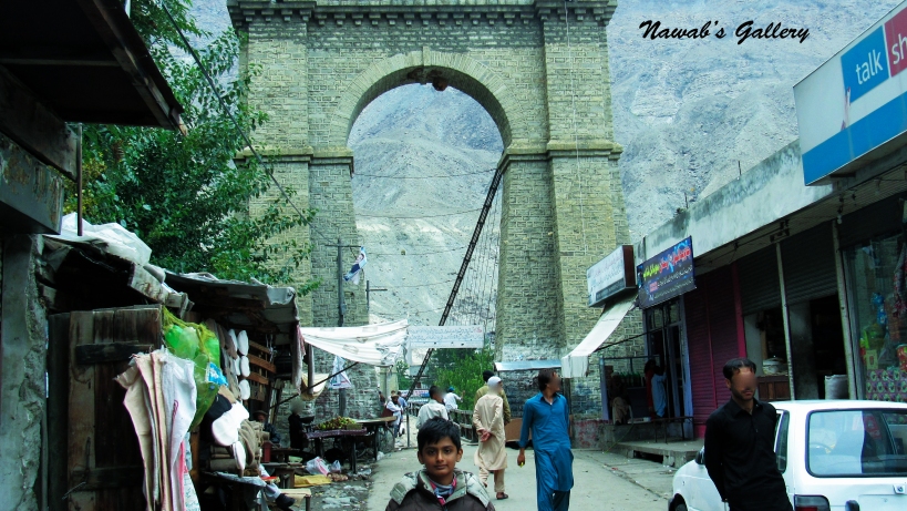
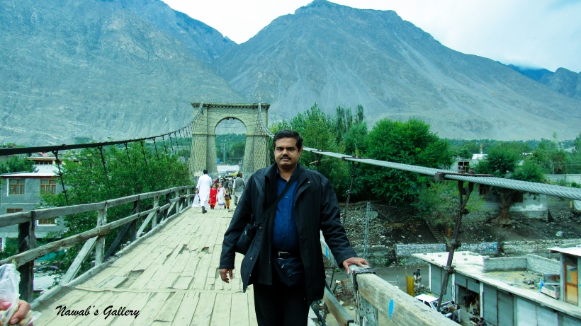
After passing sometimes we again settled to go out, but this time our intention is to travel to the surrounding areas. The weather outside was cold and it was also drizzling. First, we walk toward Gari Bagh Chowk, this chowk is identified by a statue of an Ibex built on a pillar. We walked toward the Gilgit River and reached the bridge, the concrete bridge is connecting two sides of the river for the traffic to cross the river. At a walking distance from this bridge we spotted an ancient bridge that was built on the Gilgit River, it is known as Konodas Bridge. This bridge is located in the Kashmiri Bazar area of Gilgit city, linking the main city with Konodas, across the Gilgit River.
We went travelling on Sadar Bazar road the path leading to Konodas Bridge, and at the middle of the route is a park by the name “Gari Bagh”. This park also has some historic importance and government has also constructed a monument at the center of this park. Crossing the market, we took a right turn and hit the famous Konodas Bridge, this is a hanging bridge and made with iron rods, sand and stone bricks and the floor is made of wood. The bride is nearly 100 years old and deteriorating because of ignorance by the government. People are still using this bridge to traverse the river, we also walk on the bridge to view the river flowing below, and while standing on the bridge we feel that bridge continuously jerks as the people walk on the bridge. It feels a little scary, but after getting some photographs we more toward Konodas. Konodas is a residential area with small shops of daily usage items. While walking along the road we discovered a track going downward to the river, we considered that track and extended to the bank of the River Gilgit, the water was cold and flowing with high pressure.
Passing some time at the bank, we return back to the main Gilgit area using the same Konodas Bridge. Now we use a different road parallel to the river in the direction of our hotel, on the route there was a small tea shop, the weather is awesome and it was still drizzling so we asked the shopkeeper to serve us the tea at the river bank. We were enjoying sitting and having some snacks and tea along the river bank, but suddenly it started raining and we have to move inside the shop.
Finishing the tea we again walked to our hotel, we cross the famous N.L.I Market but it is still closed. By asking people along the road they informed us that due to Eid holidays these shops are shut, but some stores might open in the eventide. Then we revert back to our hotel room and enjoyed viewing the TV again.
In the evening, we again went out and this time, some are shops open, we also visited the famous N.L.I Market and bought some souvenir for our friends and relatives. N.L.I is a large market and there are many different types of shops, but more interesting are those with handicrafts and local dresses. Wandering around in the market and doing some shopping we return back to our room.
Tomorrow we have to travel back to Rawalpindi and then finally back to our home in Karachi, so we pack your luggage and after dinner we went to sleep.


 While waiting for the rain to stop, we roamed around the hotel hall and visited different rooms. Adjacent to the reception in the lobby is also store that sells different decoration items, handicraft products, and precious gemstones. We were experiencing a good time, then a staff boy handed us two umbrellas and ask us if we like to go into our room so that our luggage can be shifted. Unfortunately, they only have two umbrellas, but we have coped with it, so if anyone is traveling in a rainy season remember to carry an umbrella with them. We decided to go to the room and freshen up and get changed. The rooms we have booked are on Rakaposhi block, this block is in a marvelous location it is near the edge and there is a beautiful garden in front of the block from where the whole Hunza valley can be sighted below and the mighty mountains surrounding us.